Download
1 / 17
170 likes | 188 Vues
Develop a plan to reforest vulnerable areas in Haiti and address erosion, human health, and safety risks. This decision-making tool uses a defensible logic and effective framework to identify and rank the vulnerability of Haiti's watersheds.

E N D
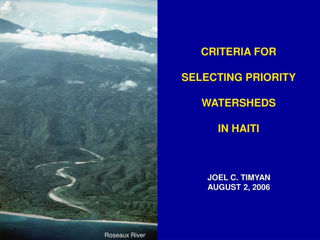
CRITERIA FOR SELECTING PRIORITY WATERSHEDS IN HAITI JOEL C. TIMYAN AUGUST 2, 2006 Roseaux River
Develop a plan to reforest areas in Haiti that are vulnerable to erosion and pose significant danger to human health and safety GOAL SOILS INFRASTRUCTURE POPULATION
WATERSHED VULNERABILITY ANALYSIS OBJECTIVE Identify and rank the vulnerability of Haiti’s watersheds • Decision-making Tool • Rapid Appraisal • Defensible Logic • Effective Framework • Reference Database ADVANTAGES APPROACH Identify the key factors of vulnerability Weight the factors Score the watersheds, determine Vulnerability Index Rank the watersheds
20.33 N Ross Wagenseil for CDMP January 2000 71.25 W 75 W CDMP 17.5 N HURRICANES 50-YR RETURN TIME 1. Cap Haïtien: 34 m/s (I) 2. Gonaïves: 35 m/s (I) 3. Port-au-Prince: 40 m/s (I) 4. Les Cayes: 48 m/s (II) N WIND SPEEDS 0 1 2 3 4 5 Cat. Storm knots 25 50 75 100 125 mph 25 50 75 100 150 125 kph 50 100 150 200 250 m/s 20 60 10 30 40 50 70
FLOODS FLOOD FREQUENCIES (1968-97)
KEY VULNERABILITY FACTORS HABITAT DENSITY RISK OF SOIL EROSION INFRASTRUCTURE (R, M, IP) FLOOD PRONE ZONES
HIGH EROSION RISK INDEX GRAND ANSE, RIV. JACMEL, FOND VERRETTES, PETIT GOAVE • Southern Peninsula • Highest Hurricane Risk • Important Protected Areas • · Macaya National Park • · La Visite National Park • · Pine Forest Reserve Average Watershed Index: 57
HIGH EROSION RISK + HIGH HURRICANE RISK + NATIONAL PARKS & PINE FOREST RESERVE PRIORITY WATERSHEDS
INFRASTRUCTURE VULNERABILITY INDEX VERY HIGHCAYES, LA QUINTE, CUL DE SAC HIGH CAP HAITIEN, TROU DU NORD, MONTROUIS • HIGH COASTAL POP. DENSITY • ELEVATED FLOOD RISK • HIGH INFRASTR. VULN. INDEX Average Watershed Index: 15
HIGH POPULATION DENSITY + HIGH FLOOD RISK + HIGH INFRASTRUCTURE VULNERABILITY PRIORITY WATERSHED
POPULATION VULNERABILITY INDEX HIGHESTCUL DE SAC (PORT-AU-PRINCE) HIGH LES CAYES, MOMANCE (LEOGANE), CAP HAITIEN, LA QUINTE (GONAIVES) • HIGH COASTAL POP. DENSITY • HIGH FLOOD RISK • HIGH SOIL QUALITY INDEX Average Watershed Index: 7
HIGH COASTAL POPULATION DENSITY + HIGH FLOOD RISK + HIGH SOIL QUALITY PRIORITY WATERSHEDS
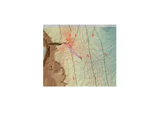
CUL-DE-SAC WATERSHED GRISE RIVER FLOOD RISK MAP • CONCENTRATIONS OF VULNERABILITY • UPSTREAM / DOWNSTREAM CONUNDRUM • URBAN VS RURAL INTERVENTIONS • “WE ALL LIVE DOWNSTREAM”
CUL-DE-SAC WATERSHED GRISE RIVER FLOOD RISK MAP L’Etang Saumâtre Port-au-Prince Bay
RECOMMENDATIONS • GROUP 1: CUL-DE-SAC (PORT-AU-PRINCE) • Watershed that serves the most vulnerable population • Develop a multi-donor strategy to capture synergies and engage municipal government • Assist the development of client-oriented neighborhood groups to provide essential services • Establish a task force to create a flood map of high risk areas of the metro area • Develop NRM strategies to meet upland conservation and economic goals • GROUP 2 CAYES, CAP HAITIEN, TROU DU NORD, LA QUINTE • Watersheds with high densities of coastal population, high vulnerability indices and high soil quality index • Support government ministries to improve strategies in disaster preparedness • Develop partnerships to improve risk management design of priority infrastructure • Increase economic productivity of rich soil base • Engage municipal governments to develop essential policy: e.g., flood zones, building codes • GROUP 3 SOUTHERN PENINSULA: GRAND ANSE, RIVIÈRE JACMEL, FOND VERRETTES Watersheds of high priority value as protected areas and low impact development • Develop a national heritage strategy with Ministry of Environment and international NGOs • Develop approaches to co-management of public lands • Develop tourist potential and supporting infrastructure • Expand NRM interventions favoring perennial polycultures, producer & water user groups