Raster GIS
Raster GIS. Introduction. Programme. Day 1: Introduction to raster modelling in ArcGIS Practical exercise #1: comparing raster and vector data models Point-surface interpolation Practical extercise #2: interpolating point data in ArcGIS Cartographic modelling

Raster GIS
E N D
Presentation Transcript
Programme • Day 1: • Introduction to raster modelling in ArcGIS • Practical exercise #1: comparing raster and vector data models • Point-surface interpolation • Practical extercise #2: interpolating point data in ArcGIS • Cartographic modelling • Practical exercise #3: modelling in ArcGIS and Grid • Day 2: • Digital elevation models • Practical exercise #4: terrain analysis in ArcGIS and grid
Safety, etc. • Fire alarm and exits • Toilets • Tea and coffee • Lunch
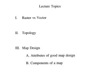
Day 1: Introduction to raster • Prior experience with raster and vector data models? • Basics of raster model • Grids and cells, rows and columns • Points, lines, areas, surfaces and images • Binary, categorical and continuous data types • Resolution and orientation (generalisation) • Topology • Typical data sources • Vector to raster conversion • Satellite and aerial imagery • DEMs by direct measurement • Point-surface interpolation
Prior experience? • Vector GIS in ArcGIS and MapInfo? • Familiarity with basic GIS concepts • Familiarity with ArcGIS and ArcMap interface • Raster GIS? • ArcGIS, ArcView, MapInfo Vertical Mapper, Idrisi, GRASS, etc. • Image processing software (e.g. ERDAS Imagine, PCI, etc.) • Microsoft Excel (or any other spreadsheet software) • Digital photography and image management/editing software
Basics of raster data model • Grids and cells, rows and columns...
Basics of raster data model • Feature types: • Points, lines and areas
Basics of raster data model • Feature types: • Networks and surfaces
Basics of raster data model • Feature types: • Images
Basics of raster data model • Data types: • Continuous (a), categorical (b), image (c)
Basics of raster data model • Data types: • Binary (demonstration of raster file structures)
Basics of raster data model • Resolution and orientation (generalisation)
Basics of raster data model • Topology
Data sources • Vector to raster conversion
Data sources • Vector to raster conversion – topological mismatch
Data sources • Satellite and aerial imagery
Data sources • DEMs (Digital Elevation Models) by direct measurement
Data sources • Point-surface interpolation Points Surface
Querying in ArcMap • Hands-on Exercise #1 • Comparing raster and vector data models