GIS Data Collection with Consumer-Grade Mobile Devices
280 likes | 329 Vues
Explore how Consumer-Grade mobile devices can revolutionize geospatial data collection for decision-making. Discover and adopt affordable GIS applications for efficient mapping processes.

GIS Data Collection with Consumer-Grade Mobile Devices
E N D
Presentation Transcript
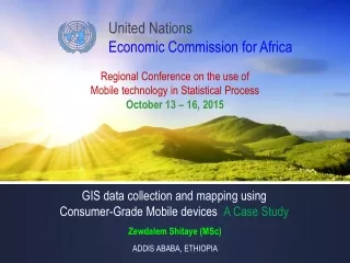
United Nations Economic Commission for Africa Regional Conference on the use of Mobile technology in Statistical Process October 13 – 16, 2015 GIS data collection and mapping using Consumer-Grade Mobile devices:A Case Study Zewdalem Shitaye (MSc) ADDIS ABABA, ETHIOPIA
Presentation Topics Introduction Background Motivation Problem and Objectives Scope Framework and Methodology Study Site, Type and Purpose Research Design and Methodology Data Source and Representation General Consideration Application of Results Short-term and Long-term Related Works Solution Design Experimentations, prototype and Results Summary Conclusion Research Limitation and Problem Experienced Recommendations Questionand Answer GIS Data Collection using Consumer-Grade Mobile Devices
IntroductionBackground • The Use of GISgrewrapidly and is now common place for business, government and academic for many diverse applications. • GIS supports the daily activities of automated mapping and facilities management with the applications for electricity, water, gas, telecommunications, and cable television and other utilities. • GIScapture, edit, store, manipulate, and analyze a variety of geospatial data that are used to create a display such as Internet mapping sites. • GIS professionals are responsible for compiling the data and presenting it in an understandable, visual form like a map or text directions. • In the history of GIS in the olden timesgeospatial data were collected using manual measurement then Aerial Photography,Satellite imagery and professional grade GIS mapping devices are in use. GIS Data Collection using Consumer-Grade Mobile Devices
Introduction Motivation • Technological development improve the quality of our lives by introducing new tools & methods daily in our every walks of life. • Mapping in GIShoped bring a great improvement in human being daily life and national development. With the work we can open the eyes of the community that can help us all. • Smartphone device adoption is increasing rapidly and contain highly capable sensing improvements. • The “GIS data collection and mapping using Smartphone” is hoped to contribute and add value to speed up community development. • The ability to solve spatial problems using geographic analysis is one of the most interesting and remarkable aspects of GIS. • GIS helps us integrate all kinds of information about our world and apply sophisticated analytical methods to the data. • GIS also lets us convey our results in beautiful maps and graphics to effectively communicate the stories we want to tell. • Location • Multimedia • Biometrics • Tools & Software's GIS Data Collection using Consumer-Grade Mobile Devices
IntroductionProblem Statement • The professional-grade GIS mapping devices are too Expensive to be used Frequently andthey entail a slowapproach to collect geospatial data of our surroundings. • Because of this factors, many local as well as global organizations & countries are forced to make decision based on 4or 5 year’s old geospatial data. Can we use simple applications to collect geospatial data that can be useful for decision makings? GIS Data Collection using Consumer-Grade Mobile Devices
IntroductionProblem Statement Can we use a mobile device, simple applications and workflow to collect geospatial data by involving ordinary citizen and community at large that can be useful for decision makings? So, this leads to the research questions: RQ1. To what extent is it possible to use Consumer-Grade mobile devices with free mobile apps and easy to follow methodology in collection of geospatial data? RQ2. Is it possible to collect geospatial data at a Woreda / district administration level using consumer grade mobile devices? RQ3 How Can we develop simple, user-friendly methodologies for municipal administrators to use such tools for their work? RQ4 Can UNECA use this options for sub regional offices and countries in Africa for its economic and social development programs ? Yes, Using simple and affordable GIS application in our Smartphones and Tablet device can create & update nearest to real time GIS data in the field. [Discover Open Explore Maps = GIS online /Corporate GIS Server ] GIS Data Collection using Consumer-Grade Mobile Devices
IntroductionObjectives General Objective • The objective of this research project is proof of concept that Consumer-Grade mobile devices with simple free apps can be used for collecting geospatial data for certain types of municipal administration. Specific Objective • To demonstrate that simple handheld devices can be used to collect geospatial data suitable for some decisions. and also to test and propose best design model or approach to collected geospatial data. • To accomplish this by exploring, comparing and selecting, • The Consumer-Grade smartphones and • Afree mobile GIS apps currently available, • To be usable, affordable, and accessibleby ordinary citizens and empower community at large. • To prepare a prototype, on selected study location in one of the Woreda in Addis Ababa and ECA compound, based on the defined and select model, using a smartphone and free mobile Apps, and recommend the methodology to be used widely by woredafor fast and efficient data collections and decision making. GIS Data Collection using Consumer-Grade Mobile Devices
Framework and MethodologyStudy Site, Type and Purpose • The study area included in this research is in Addis Ababa specifically one office location (workplace) and a Woreda (Residence). • Workplace: The UNECA Head office in Addis Ababa, located Node on Longitude (38°45'57.94"E) and Latitude (9° 0'52.62"N) estimated total Area covered is 0.7 Km2. • Residence Area: North West of Addis Ababa, Woreda 15 located Node on Longitude (9° 3'44.05"N) and Latitude (38°42'25.28"E) named known as Asko Area the estimated total area covered in 1.25 KM2. • The case study investigate and evaluate the use of Consumer-Grade mobile technology and location-based services using affordable, accessible and free mobile apps in the field • This study is hoped to be particularly useful to explore and contribute a practical approach using modern technology in the area geospatial data collection approach and impact of new technology used in the study. • The research is to enable ordinary citizen to collect geospatial data using simple devices and Apps with easy instruction to be followed. • The study will be supported by a Model and Prototype. GIS Data Collection using Consumer-Grade Mobile Devices
Framework and MethodologyData Sources & Representation • The research did not need external data sourcessince most of the data is being collected by the selected smartphone, mobile Appsand Frameworkon the targeted field study site. • The stated goal of this research was to make the data collection process easierfor the user to conduct in the field. • GIS data represents real objects (such as roads, land use, elevation, trees, waterways, etc.) with digital data determining the mix. Real objects can be divided into two abstractions: discrete objects (e.g., a house) and continuous fields(such as rainfall amount, or elevations). • There are two broad methods used to store data in a GIS for both kinds of abstractions mapping references: raster imagesand vector. Points, lines, and polygons are the stuff of mapped location attribute references. • Data can be collected offline in different standard GIS format, such as shp, kmz, kml, csv, excel sheetformat depending on the device and application used. GIS Data Collection using Consumer-Grade Mobile Devices
Framework and MethodologyDesign and Methodology The two types of design and methodology evaluated depends on Deviceand Platformdependency • Deviceand Platform Dependent • Cross Devices & Cross Platform - (Device & Platform independents) • Workflow which will work in all • Devices: Smartphones, Tablets & Phablets • Environment: Android, IOS, & Microsoft • Programming: Android Developer Tools (ADT), Objective-C and Swift (IOS), C# , Java (windows) GIS Data Collection using Consumer-Grade Mobile Devices
Framework and MethodologyGeneral Consideration • If accuracy within a 2 - 5 meter range is sufficientfor a given project, the next step is to choose an application to meet particular needs. • Geospatial data can be collected on the field offlineor online and geospatial data importing and mapping can be web-based using company server or cloud based. • Important considerations are the general purposeof the applications, platform of the device, if the app will work without a cell signal (working offline) the cost, and the file formats we wish to import or export. GIS Data Collection using Consumer-Grade Mobile Devices
Application of ResultsExpected Output(s) Short-term results • Empower the Woreda administration in collecting geospatial data by volunteer individual using Consumer-Grade mobile devices, free apps and easy to follow step-by-step-guide. • Enable the Woreda administration to use geospatial data collected in the day-to-day community services by using simple applications and follow up services such as waste collection, tax collections, rents...etc by locating Residential house, shops, health centres, schools, police stations, banks… etc. at Woreda level. Impact (long-term results) • Geospatial databases, incrementally updated and accrued are available to support Woreda administration and City Admin in development initiatives. • To create a well-informed society about changes in the environment as a result of regular tracking geospatial data for better decision making of changes in community’s surroundings. GIS Data Collection using Consumer-Grade Mobile Devices
Application of ResultsSolution Design Criteria for Selection Consumer-Grade Mobile Devices • The Mobile devices should be cheaper, affordable and accessible by ordinary citizen in Ethiopia Market. • The cost of mobile is ranges 1000to 3000Ethiopian Birr (ETB). • The Mobile devices Operating System (OS) can be IOS, Androidand Windows based phones. Some IPhone and Android phones are out of this scope because of the cost implication. • The memory can be from 1GB to8GM which also take SD card for more storage is preferable. • Which can be easily availablein Addis Ababa market if possible to be assembled in Ethiopia • The screen size can be from 4” to7” for more data and graphics display. • Camera with 2 MP and above is preferable GIS Data Collection using Consumer-Grade Mobile Devices
Application of ResultsSolution Design Criteria for Selection Smart Phone GIS Apps • Smart phone for light-weight field GIS so long as the app does not expect too much of user. • Provides us with imagery or other managed background data; • Stores the GIS data on our smart phone itself – not in the cloud; • Allows user to easily export data off our phone and into a GIS-ready format or some format that doesn’t require too much finagling to make it GIS-ready. • Focuses on being disconnected in the field to minimize cost. • Many of today’s mobile GIS applications refer to connectivity. It’s a somewhat obscure way of saying whether or not we have the ability to connect to the internet from the field. GIS Data Collection using Consumer-Grade Mobile Devices
Application of ResultsExperimentation GIS Data Collection using Consumer-Grade Mobile Devices
Application of ResultsTo start with GIS • GIS software needs of an organization depends on use case, its goals and workflow processes requirement which is based on the understandingof the problem which is half-way to the solution. Specially using spatial problem approach. • GIS people will always suggest the most appropriate, fit-for-purposes options GIS Data Collection using Consumer-Grade Mobile Devices
Application of ResultsFindings (1/4) • Identifying, comparing and evaluating the available Free and open source software’s (FOSS) mobile GIS application currently available. • Identifying the consumer grade mobile devices which is accessible, affordable and available in Ethiopia especially in Addis Ababa. • Comparing and contrasting different makes, OS and brand in terms of values and performance for specific selected GIS mobile applications. • Selection of the test site I and identified the Geospatial references in test site one UNECA compound. • Data collection and testing is done on certain selected smartphones and tables. • Evaluating and selecting a suitable workflow approaches based on the preferred Mobile devices and GIS applications to collected data. Both platform dependent and platform independent. • Identification of Geospatial references in Woreda 15 in study site II, which will be used for the required day to day Woreda administration activities. • Identification and prioritizing the real application at the UNECA compound (study site I) & Woreda administration level (study site II) • Preparationof a prototype based on the selected platform independent framework approaches and methodology. GIS Data Collection using Consumer-Grade Mobile Devices
Application of ResultsFindings (2/4) Platform & Device Dependent GIS Data Collection using Consumer-Grade Mobile Devices
Application of ResultsFindings (3/4) Cross platform and cross devices Solutions Conceptual diagram based on cross platform and devices solutions GIS Data Collection using Consumer-Grade Mobile Devices
Application of ResultsFindings (4/4) Cross platform and cross devices Solutions • Option 1: • ArcGIS • Option 2: • SuperSurv GIS Data Collection using Consumer-Grade Mobile Devices
Application of ResultsPrototypeGeospatial Data Collection http://hilcoe.maps.arcgis.com/home/organization.html GIS Data Collection using Consumer-Grade Mobile Devices
SummaryConclusion • No doubt, the Smart Phone GIS trend will continue to evolve. • The attraction of using a smart phone – a device most of us carry around with us all the time - to perform GIS field work is tempting. • These trend is removing some of the dependency on expensive GPS units that require even more expensive field GIS software. • Disconnected mobile GIS. It still provides a much-needed and reliable service. The other hand is on the new trapeze - connected mobile GIS. • Connected GIS is ready to use now though not for all situations or users. Until connected mobile GIS truly matures, mobile GIS users will be suspended between the two workflows. GIS Data Collection using Consumer-Grade Mobile Devices
SummaryConclusion After reviewing related empirical studies in the area of mobile technology and GIS applications and community practice in different countries and also considering the technology advancement in Mobile GIS, this research has arrived at the following conclusions: • Proof the Concept: It is possible to use Consumer-Grade Mobile devices which is available and affordable by most of the mobile users in our location to collect GIS data for local community development activities at the Woreda level and that can be used by individual and local community without prior basic GIS knowledge. • Based on the minimum requirement and functionality for GIS data collections among more than 250 Mobile application on each platform (IOS, Android and Windows ) cross platform and cross devices applications is selected and tested • The present study identified some preferred mobile devices which are cheaper, usable, and affordable by most of the local citizen. These devices include Techno Mobile, Semadele, Tana and Oking mobile. Brands like Huawei, IPhone and Samsung Smartphones and Tablets can also be used if it is older models and cheaper in prices. • The present study demonstrate and test the result based on selected framework and workflow options in selected research Site I and Site II in coordination with available applications in both sites. GIS Data Collection using Consumer-Grade Mobile Devices
SummaryLimitation & Problem Experienced For ‘Serious’ data collection using a smart phone has some problems at this time such as: • The internal GPS chip is capable of neither high nor consistent accuracy. • The phone’s battery will drain very quickly with the GPS engaged. • Field work often occurs outside of cellular & Wi-Fi range which may disrupt the app. • Also, most applications are limited to specific devices and platform If these issues are not a concern for us then smart phone apps can be a much more affordable way to outfit our field data collection than the traditional ruggedized GPS unit outfitted with field GIS software. GIS Data Collection using Consumer-Grade Mobile Devices
SummaryRecommendation Since the future is Cloud Computing and web based solutions, most of the applications development tend to this directions. The research couldn’t conduct exhaustive study due to the predefined scope, time and resource limitations. Therefore, it is suggests to do more research in the area of: • The research can be extended further by other researcher in Science, Location and Resource-Based GIS data collection approach using the mobile technology framework. • Further research could be done to determine if new software’s and smartphones can be used easily to collect GIS data on the field by the ordinary citizens which will assist for organized community based GIS geospatial data collection. • Based on this initial study objective, community practices can be developed locally. • Considering that hardware and software are getting smaller and less expensive respectively as time passes, there is a possibility for carrying out a better research and test. • Further research is also needed to look into the effectiveness of the actual application used in community development programs at the Woreda administration level based on the geospatial data collected. • The future in this direction is a cloud based GIS data collections. GIS Cloud is a next generation platform for apps that manage location information (SaaS, PaaS and DaaS) that will be affordable and available. GIS Data Collection using Consumer-Grade Mobile Devices
References [1] Otto Huisman and Rolf A. de, Principles of geographical information systems: An introductory textbook, 4th Ed. ISBN978–90–6164–269–5ITC, Enschede, the Netherlands, 2009, [2] Burrough, P. And McDonnell, R. (1998) “Principles of geographical information systems” New York, NY: Oxford University Press, 333 p. [3] Miroslav Rusko, Roman Chovanec, Dana Rošková , “An overview of geographic information system and its role and applicability in environmental monitoring and process modelling”, Slovak University of Technology. Volume 18, Issue 29, Pages 91–96, ISSN (Online) 1338-0532, ISSN (Print) 1336-1589, March 2011 [4] Chen Feixiang, Zhao Ming, Qi Jiandong, Jiang Xiaoru, "Research on Mobile GIS Based for Information Collection", IFITA, 2009, Information Technology and Applications, International Forum on, Information Technology and Applications, International Forum on 2009, pp. 8-11, doi:10.1109/IFITA.2009.376 [5] C. E. de Abreu Freire, Marco Painho, “Development of a Mobile Mapping Solution for Spatial Data Collection using Open-Source Technologies”, ISEGI, Universidad Nova de Lisboa, Elsevier Ltd. 2014, pp. 482-488 [6] Paul A. Longley, et al, Geographic Information Systems and Science, https://books.google.com/books?isbn=0470721448, 2010, pp.76 88 [7] Eric Mensah-Okantey, “Designing a prototype Mobile GIS for Cadastral Data Collection in Ghana” Geospatial Crossroads @ GI Forum ’08, pages 199–204, 2007. [8] KO KO Lwin, Misao Hashimoto, Yuji Murayama, “Real-Time Geospatial Data Collection and Visualization with Smartphone” Journal of Geographic Information System Vol.6 No.2, Pub. Date: April 4, 2014, pp. 382-389 [9] Jane Drummond, Roland Billen, Elsa Joa˜o and David Forrest, “Current and Future Trends in Dynamic and Mobile GIS’, Journal of Location Based Services CRC Press, Boca Raton, FL, USA, 2007, Vol. 2, No. 4, December 2008, ISBN 0-8493-9092-3 pp. 303–307, [10] Michael K. McCall and Peter A. Minang, “Assessing participatory GIS for community-based natural resource management claiming community forests in Cameroon”, The Geographical Journal, Vol. 171, No. 4 (Dec., 2005), pp. 340-356 [11] Fatih Orhan, “A multimodal sensor analysis framework for vehicular mobile applications” The Middle East technical University, September 2013 GIS Data Collection using Consumer-Grade Mobile Devices