Historical Leveling in the U. S.
This overview details the development of leveling and gravity measurement techniques by the U.S. Corps of Engineers and the Coast & Geodetic Survey from 1876 through 2006. It highlights key milestones, including the establishment of the Sea Level Datum of 1929, various adjustments over the decades, and the impact of major floods in Louisiana. Notable measurements in New Orleans demonstrate gravity variations and reflect significant geophysical changes in the region. This historical record underscores the importance of these adjustments for understanding sea level changes and their implications for coastal management.

Historical Leveling in the U. S.
E N D
Presentation Transcript
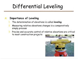
Historical Leveling in the U. S. • Corps of Engineers: General Survey of the Mississippi River in 1876 • Coast & Geodetic Survey Tide Gauges for Atlantic, Pacific, & Gulf Coasts • Sea Level Datum of 1929 - First continental VERTICAL datum in the world • 26 Tide Gauges for U.S.; Pensacola & Galveston based on full Metonic Cycles
History of Levels in New Orleans • 1935 – WPA local adjustment to SLD 1929 • 1951 - adjusted forward in time to 1955 • 1955 - tied to Morgan City & Mobile (‘29) • 1963 - tied to Norco well (‘29 value) • 1969 - tied to ‘63 lines • 1973 Federal Register: SLD’29 changed to NGVD 1929 • 1976 - tied to Index, AR & Logtown, MS
1982-83 NGS Regional Adjustment of South Louisiana Catastrophic Floods of : May 3, 1979; April 12-13, 1980 • Orleans, Jefferson, and Plaquemines Parishes funded NGS to re-observe BMs. • Corps of Engineers concerned with the “NGS FREE ADJUSTMENT” • Deep casement marks introduced
North American Vertical Datum of 1988 Actual published data available starting in 1990 No data available for South Louisiana (Crustal Motion Area)
The acceleration due to gravity at the Earth's surface is 976 to 983 gal, depending on the latitude and the ellipsoid height • A μgal is one-millionth of a gal! • (That’s nine significant figures.)
Absolute Gravity Observed in New Orleans: March, 1989 979,316,847.7 mgals Sept., 1991 979,316,854.2 mgals (-0.91 centimeters per year)
Absolute Gravity Observed in New Orleans: Nov., 1993 979,316,856.3 mgals Aug., 1994 979,316,860.6 mgals (-0.91 centimeters per year)
In 2002: UNO (5th time) Stennis Space Center (2nd) Loyola University Southeastern Louisiana Univ. LSU McNeese State Univ. Venice-Boothville H.S. LUMCON @ Cocodrie Oakdale H.S. LSU Alexandria Old River Aux. Control Structure Nicholls State Univ. Univ. of Louisiana in Lafayette Northwestern State Univ. Sicily Island H.S. LSU Shreveport Louisiana Tech Univ. In 2006: UNO (6th time) Stennis Space Center (3rd) Loyola University (2nd) Southeastern Louisiana Univ. (2nd) LSU (2nd) McNeese State Univ. (2nd) Venice-Boothville H.S. (2nd) LUMCON @ Cocodrie (2nd) Oakdale H.S. (2nd) LSU Alexandria (2nd) Old River Aux. Control Structure (2nd) Nicholls State Univ. (2nd) Univ. of Louisiana in Lafayette (2nd) Grand Isle U.S.C.G. Station Lamar Univ. in Beaumont Univ. of Mississippi in Hattiesburg Absolute Gravity Observations