Download
1 / 12
120 likes | 216 Vues
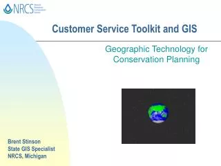
Learn about GIS and its importance in conservation planning. Discover how to combine spatial and tabular data to optimize land use.

E N D
Customer Service Toolkit and GIS Geographic Technology for Conservation Planning Brent Stinson State GIS Specialist NRCS, Michigan
What Is GIS? The term “GIS” stands for... Geographic Information System
Geographic refers to the process of locating points on the face of the Earth by way of x and y coordinates. Georeferencing What isGeographic??? North y x West East South
North y Georeferencing x West East South Since GIS data is georeferenced, multiple data layers may be overlaid simultaneously. Land Use Local Bounds Highways Streams
What is Geographic Information??? Geographic information is any data that can be referenced to a known point on the face of the Earth. There are two main types of geographic information...
What is Geographic Information??? Geographic information is any data that can be referenced to a known point on the face of the Earth. Spatial Data: Graphically represents specific spaces on the face of the earth. WHERE ??
What is Geographic Information??? Geographic information is any data that can be referenced to a known point on the face of the Earth. Tabular Data: Text-based information about conditions at specific places on Earth. WHAT ??
CountyPopulation ---------- --------------- Alcona 10,889 Alger 10,009 Allegan 100,094 Alpena 30,752 Antrim 20,901 Arenac 16,398 Baraga 8,494 Barry 53,518 Bay 110,570 Benzie 14,286 Berrien 161,421 Branch 43,189 Related What is a Geographic Information System??? A GIS is a computer-based system for the storage, management, analysis, and display of spatial and associated tabular data. Spatial Data Tabular Data
Population Theme w a n e e w e K H o u g h t o n O n t o n a g o n B a r a g a L u c e G o g e b i c M a r q u e t t e A l g e r C h i p p e w a I r o n S c h o o l c r a f t M a c k i n a c D i c k i n s o n D e l t a e e n i m GIS n o n E m m e t a e g y M o b e h C P r e s q u e I s l e C h a r l e v o i x y c n e r P o p u l a t i o n o f o m A l p e n a O t s e g o t n A n t r i m o M L e e l a n a u M i c h i g a n C o u n t i e s G r a n d A l c o n a K a l k a s k a O s c o d a C r a w f o r d B e n z i e T r a v e r s e n o m m I o s c o W e x f o r d o O g e m a w M i s s a u k e e M a n i s t e e c s o R A r e n a c M a s o n G l a d w i n O s c e o l a C l a r e L a k e H u r o n B a y M i d l a n d M e c o s t a I s a b e l l a O c e a n a N e w a y g o 1 - 1 0 0 , 0 0 0 T u s c o l a S a n i l a c M o n t c a l m S a g i n a w G r a t i o t 1 0 0 , 0 0 0 - 5 0 0 , 0 0 0 M u s k e g o n e L a p e e r e s s K e n t S t . C l a i r e s e e 5 0 0 , 0 0 0 - 1 , 0 0 0 , 0 0 0 G e n a w C l i n t o n I o n i a a O t t a w a i h S b m 1 , 0 0 0 , 0 0 0 - 2 , 0 0 0 , 0 0 0 o c a M O a k l a n d I n g h a m E a t o n A l l e g a n B a r r y L i v i n g s t o n o o z W a y n e V a n B u r e n a W a s h t e n a w J a c k s o n C a l h o u n m a l a K M o n r o e L e n a w e e B e r r i e n C a s s B r a n c h S t . J o s e p h H i l l s d a l e Combining spatial and tabular data
Soils Theme Musym Calcacres HEL Hydric MaB 43.56 NHEL N MaD 1.90 HEL N Pr 37.01 NHEL Y MaD 1.590 HEL N MaB 4.93 NHEL N MaB 5.58 NHEL N Pr 66.61 NHEL Y MaD 3.42 HEL N CaA 62.17 NHEL N MaB 7.41 NHEL N Combining spatial and tabular data Spatial Data Geographic Locations of Soil Shapes Where is it ? Tabular Data Soil Characteristics What is it ?
Hydric Soils Theme Musym Calcacres HEL Hydric MaB 43.56 NHEL N MaD 1.90 HEL N Pr 37.01 NHEL Y MaD 1.590 HEL N MaB 4.93 NHEL N MaB 5.58 NHEL N Pr 66.61 NHEL Y MaD 3.42 HEL N CaA 62.17 NHEL N MaB 7.41 NHEL N