Download
1 / 30
300 likes | 461 Vues
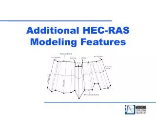
Other Features of HEC-RAS- part 2. Cross Section Interpolation Multiple Plans Supporting Pictures. Cross-Section Interpolation. Cross Section Interpolation. Sometimes it is necessary to supplement surveyed cross section data by interpolating new sections between two surveyed sections

E N D
Other Features of HEC-RAS- part 2 • Cross Section Interpolation • Multiple Plans • Supporting Pictures HEC-RAS Version 3.1
Cross-Section Interpolation HEC-RAS Version 3.1
Cross Section Interpolation • Sometimes it is necessary to supplement surveyed cross section data by interpolating new sections between two surveyed sections • Typically needed when the change in velocity head is large. HECRAS detects this by comparing conveyance values between two sections. HEC-RAS Version 3.1
Cross Section Interpolation Geometric interpolation is accomplished by linearly interpolating between elevations and stations along “cords” • 2 Options - • Interpolate a reach (more than 2 cross-sections) • Between 2 cross-sections HEC-RAS Version 3.1
Cross Section Interpolation HEC-RAS Version 3.1
Cross Section InterpolationMaster Cords - 5 Defaults • First coordinate of cross section • Left bank (required) • Minimum elevation point in main channel • Right bank (required) • Last coordinate of cross section HEC-RAS Version 3.1
Cross Section InterpolationMaster Cords HEC-RAS Version 3.1
Be Aware Of What The “Default” Is Doing • User can establish more Master Chords to prevent mis-interpolations HEC-RAS Version 3.1
Adding Master Chords to Interpolation HEC-RAS Version 3.1
Cross Section InterpolationMinor Cords HEC-RAS Version 3.1
Cross Section InterpolationMinor Cords • Automatically generated by program • Stations are determined using proportional distances between master cords • Number of minor cords = sum of coordinates in bounding cross sections minus number of master cords HEC-RAS Version 3.1
Cross Section InterpolationRoughness Coefficients • 4 default master cords (same as geometric minus the minimum channel elevation) • Minor cords added at other locations if more than 3 ‘n’ values at either cross sect. • Otherwise same as geometric interpolation HEC-RAS Version 3.1
Cross Section InterpolationOther • Other features which are interpolated: downstream reach lengths, main channel bank stations, contraction and expansion coefficients, normal ineffective flow areas, levees, and normal blocked obstructions • Normal ineffective flow areas, levees, and normal blocked obstructions are interpolated only if both bounding cross sections have them. • Can interpolate between 2 cross sections or entire reach HEC-RAS Version 3.1
Multiple Plans HEC-RAS Version 3.1
HEC-RAS - Multiple Plans Suggested Reading: Chapter 5 of HEC-RAS User’s Manual HEC-RAS Version 3.1
HEC-RAS - Multiple Plans Able to compare plans in tables: HEC-RAS Version 3.1
HEC-RAS - Multiple Plans Able to compare plans in tables: HEC-RAS Version 3.1
HEC-RAS - Multiple Plans Able to compare plans in tables: HEC-RAS Version 3.1
HEC-RAS - Multiple Plans As well as in profiles, cross-sections, etc.: HEC-RAS Version 3.1
Supporting Pictures HEC-RAS Version 3.1
Supporting Pictures • A picture can be “attached” to a cross section to help in documentation of the data. • A picture can also be “attached” to the river schematic to assist in documentation. HEC-RAS Version 3.1
Example - Cross-Section HEC-RAS Version 3.1
Example - Cross-Section HEC-RAS Version 3.1
Example - River Schematic HEC-RAS Version 3.1
Example - River Schematic HEC-RAS Version 3.1
Example - River Schematic HEC-RAS Version 3.1
Example - River Schematic HEC-RAS Version 3.1
Log Files • Program will write notes to a file as it performs the computations. • 10 different levels of output. • Files can get extremely large if higher levels are selected. • Generally not necessary unless unusual answers are given by the program. HEC-RAS Version 3.1
Other Options There are other options not discussed in this presentation: • Scour at bridges • Lateral weirs • Ice-covered rivers • Cross-Section points filter • Fixed sediment elevations • Pilot channels • Setting ineffective flow areas to permanent HEC-RAS Version 3.1
Any Questions? HEC-RAS Version 3.1