ArcGIS Workshop
ArcGIS Workshop. Fernan Lake Watershed Pilot Project Bruce Godfrey January 31, 2014. Outline. Background Esri license ArcGIS System ArcGIS Server ArcGIS Online Discussion Next steps. Esri Educational Site License.

ArcGIS Workshop
E N D
Presentation Transcript
ArcGIS Workshop Fernan Lake Watershed Pilot Project Bruce Godfrey January 31, 2014
Outline • Background • Esri license • ArcGIS System • ArcGIS Server • ArcGIS Online • Discussion • Next steps
Esri Educational Site License GIS Software Site License Agreement for Idaho Higher Education Insitutions Site License Overview
What is ArcGIS? • System to collect, organize, manage, analyze, communicate, and distribute geographic information • Long-time users: series of software programs and tools (primarily desktop) that you use to get GIS work done. • Expanded vision: system that enables geographic information to be easily leveraged by anyone who wants to use it (and with whom you choose to share it).
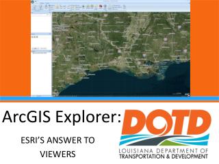
Approaches to Sharing • Three approaches* • ArcGIS for Server • offers your GIS work as services • ArcGIS Online • an Esri-administered cloud-based mapping platform to use and create interactive maps and applications and share them • Portal for ArcGIS • ArcGIS Online deployed on your network infrastructure *Web services allow server computers to receive and process requests for information sent by other devices.
Working with ArcGIS Server Services • Types of services you can publish • Map service • Geoprocessing services • Image services • Others • Service capabilities • KML (enabled by default) • Mobile data access • Open Geospatial Consortium (OGC) • Others
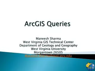
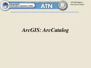
Connecting to the ArcGIS Server Site • Web browser • Manager • https://miles-gis-sandbox.northwestknowledge.net/arcgis/manager • Services directory • https://miles-gis-sandbox.northwestknowledge.net/arcgis/rest/services • ArcGIS for Desktop • Three connection types • Use • Publish • Administer
Making a Publisher Connection Demo – open ArcCatalog
Restricting Access to Services • Role types • User • Publisher • Administrator When a role has its role type set to Administrator or Publisher, members of that role will have implicit permission to access all services hosted on an ArcGIS Server site. This implicit permission cannot be overridden by changing the permissions on a service or folder.
Features Available to Publishers Create and delete folders View, publish, and delete services Start, stop, and edit services Set permissions rules about who can view services Deploy and undeploy server object extensions (SOEs) View security configuration settings (for example, which type of role store is being used) View available users and the roles to which each user belongs View available roles, the users who belong to each role, and the privileges assigned to each role View and query logs Create KML network links View software authorization information Register databases and data directories with the server
Editing Permissions in Manager • Demo – Open manager web application • https://miles-gis-sandbox.northwestknowledge.net/arcgis/manager
Registering Data with ArcGIS Server Automatic data copying
Registering Data with ArcGIS Server Network directory data access
Registering Data with ArcGIS Server Database directory access
Publishing a Map • Publish a map document from ArcGIS for Desktop to ArcGIS for Server • Demo – open ArcMap • Documentation • Performance
ArcGIS Online • An Esri-administered cloud-based mapping platform to use and create interactive maps and applications and share them • You can manage, create, store, and access data as published web layers • Feature layers • Tiled layers • Part of ArcGIS System • Can extend capabilities of Desktop, Server etc.
What You Can Do with ArcGIS Online • Explore data through maps • Create maps and apps • Collaborate and share • Share content with others – they share with you • Publish data as web layers • Administer your ArcGIS Online organization • Take advantage of ready-to-use apps • Collect and share maps in the field with Collector for ArcGIS • Create interactive maps of your spreadsheet data with Esri Maps for Office • Build custom apps
Supported Files Image file (.jpg, .jpeg, .png, .tif, .tiff) Image service (URL) Keyhole markup language (KML) collection (.zip) Keyhole markup language (KML) file (.kml, .kmz) Layer file (.lyr) Layer package (.lpk) Locator package (.gcpk) Map package (.mpk) Map service (URL) Map service definition (MSD) file (.msd) Map template (.zip) Microsoft Excel document (.xls, .xlsx) Microsoft PowerPoint document (.ppt, .pptx) Microsoft Visio document (.vsd) Microsoft Word document (.doc, .docx) Mobile application (URL) Network analysis service (URL) Open Geospatial Consortium (OGC) Web Map Service (WMS) (URL) Operation View (URL) Operations Dashboard Add-In (.opdashboardaddin) Portable Document Format (PDF) file (.pdf) Rule package (.rpk) Service definition (SD) file (.sd) Shapefile (.zip) Tile package (.tpk) Web application (URL) Workflow package (.wpk) Image file (.jpg, .jpeg, .png, .tif, .tiff) Image service (URL) Keyhole markup language (KML) collection (.zip) Keyhole markup language (KML) file (.kml, .kmz) Layer file (.lyr) Layer package (.lpk) Locator package (.gcpk) Map package (.mpk) Map service (URL) Map service definition (MSD) file (.msd) Map template (.zip) Microsoft Excel document (.xls, .xlsx) Microsoft PowerPoint document (.ppt, .pptx) Microsoft Visio document (.vsd) Microsoft Word document (.doc, .docx) Mobile application (URL) Network analysis service (URL) Open Geospatial Consortium (OGC) Web Map Service (WMS) (URL) Operation View (URL) Operations Dashboard Add-In (.opdashboardaddin) Portable Document Format (PDF) file (.pdf) Rule package (.rpk) Service definition (SD) file (.sd) Shapefile (.zip) Tile package (.tpk) Web application (URL) Workflow package (.wpk)
Accessing ArcGIS Online • University of Idaho Organizational Account • http://uidaho.maps.arcgis.com/home/ • 100 users/2,500 credits • Storage varies by type of content. About 860 MB of feature services or about 170 GB of tiles/layer packages/etc. • EPSCoR MILES Organizational Account? • $250/yr for a subscription with 50 user/2,500 credits • $500/yr for a subscription with 100 users/2,500 credits
Accessing ArcGIS Online • Navigate to: http://arcgis.com • Search Gallery for public content • Create account • 30-day free trial • Public account (limited functionality) • Subscription account
ArcGIS Online • UI organization demo • http://uidaho.maps.arcgis.com/home/index.html • Overview • Esri Maps for Office demo • ArcGIS for Desktop demo • Publishing to ArcGIS Server and sharing through ArcGIS Online • Publishing directly to ArcGIS Online
Breaking Down Barriers to Discovery & Sharing? • Kootenai County • http://cloud.insideidaho.org/webapps/search/publisher_browse.aspx?filter=Kootenai%20County • Extract, Transform, Load • Gathers shapefiles from participants • Runs each weekend • Structures • Road centerlines • ArcGISOnline • Federal, state, local entities • Groups • Inviting organizations to share content
Discussion • How does this all fit together? • Fit with web site case study [sketch] • Next steps?