Download
1 / 16
160 likes | 319 Vues
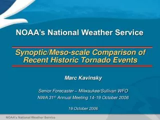
Synoptic/Meso-scale Comparison of Recent Historic Tornado Events. Marc Kavinsky Senior Forecaster – Milwaukee/Sullivan WFO NWA 31 st Annual Meeting 14-19 October 2006 19 October 2006. NOAA’s National Weather Service. NOAA’s National Weather Service. Recent Historic Wisconsin Tornado Events.

E N D
Synoptic/Meso-scale Comparison of Recent Historic Tornado Events Marc Kavinsky Senior Forecaster – Milwaukee/Sullivan WFO NWA 31st Annual Meeting 14-19 October 2006 19 October 2006 NOAA’s National Weather Service NOAA’s National Weather Service
Recent Historic Wisconsin Tornado Events • 23 June 2004 • 5th Largest Tornado Outbreak in Wisconsin History • 17 Tornadoes - 3 F3’s, 2 F2’s • 1 death • 28.8 million damage • 18 August 2005 • Worst Tornado Outbreak in Wisconsin History • 27 Tornadoes – 1 F3, 2 F2’s • New daily, monthly (27) • New yearly record (62) • Previous yearly record was 43 -1980 • 43 million damage • 1 death, 27 injuries
Supercell/Severe Wx Forecasting Moderate to Strong Potential
F2-F5 Tornadic Supercell Forecasting Moderate to Strong Potential
0-3 km SRH ML Cape 0-6 km Bulk Shear Surface Boundary 150 200 2000 60 55 50 250 40 1500 1000 23 June 2004 Supercell Forecast 00z/24
0-1 km Bulk Shear 0-3 km Cape 0.2 MLCIN MLLCL 0-3 kmVGP 15 0.3 1500 20 125 0.35 1000 2000 2500 25 100 >-50 75 0.2 50 <-50 23 June 2004 F2-F5 Tornado Forecast 00z/24
23 June 2004 - Tornadoes F0-F1 F2 F3
0-6 km Bulk Shear 0-3 km SRH MLCape 45 L 150 1003 200 50 1000 250 300 40 400 1500 2500 2000 18 August 2005 Supercell Forecast 23z/18
0-1km Bulk Shear 0-3 km Cape MLCIN MLLCL All CIN greater than -50 0-3km VGP 0.1 15 2000 20 0.2 200 2600 3300 0.5 30 0.3 150 0.4 100 18 August 2005 F2-F5 Tornado Forecast 23z/18
18 August 2005 - Tornadoes F0-F1 F2 F3
Conclusions… • Remain aware of Near Storm Environment parameters and if time allows, perform hourly mesoscale analysis using mesonet, RUC, TAMDAR, BUFkit, SPC Mesoanalysis • Look for low level boundary interaction with axis of severe weather and strong tornado parameters
Acknowledgements • Mark Gehring – Forecaster MKX • SPC/OAX – MesoAnalysis/Archive • Bill Borghoff – graphics • Jeff Craven – Science Operations Officer MKX