Map Scale and Generalization Concepts
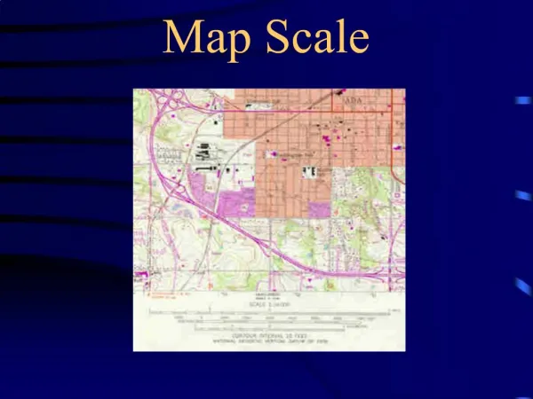
Chapter 5 Map Scale and Generalization Concepts Scale Scale is the relationship between distance on the map and distance on the ground. Selecting the appropriate scale depends on the size of the sheet of paper and the accurate placement of features.

Map Scale and Generalization Concepts
E N D
Presentation Transcript
Chapter 5 Map Scale and Generalization Concepts
Scale • Scale is the relationship between distance on the map and distance on the ground. • Selecting the appropriate scale depends on the size of the sheet of paper and the accurate placement of features. • http://www.beg.utexas.edu/GIS/tools/scale2.htm
Type of Map Scale • Word Statement • Representative Fraction • Graphic Scale
Word Statement • A word statement gives a written description of scale, such as "One centimeter equals one kilometer" or "One centimeter equals ten kilometers." • Ineffective if the map is reproduced by a method such as photocopying and the size of the map is modified (Enlarge or Reduce)
Representative Fraction • A ratio or representative fraction (RF) indicates how many units on the earth's surface is equal to one unit on the map. It can be expressed as 1/100,000 or 1:100,000. • Good when Enlarge and Reduce complete map
Graphic Scale • It is simply a line marked with distance on the ground which the map user can use along with a ruler to determine scale on the map. • Good when Enlarge and Reduce complete map • In the U.S., a graphic scale often includes both metric and U.S. common units.
How to Measure Distances on a Map? • Find the scale for the map you're going to use - it might be a ruler-looking bar scale or a written scale, in words or numbers. • Use a ruler to measure the distance between the two places. If the line is quite curved, use a string to determine the distance and then measure the string. • If the scale is a representative fraction (and looks like 1/100,000 or 1:100,000), multiply the distance of the ruler by the denominator, giving distance in the ruler units. • If the scale is a word statement (i.e. "One centimeter equals one kilometer") then determine the distance. • For a graphic scale, you'll need to measure the graphic and divide the scale into the measured units on the ruler. • Convert your units of measurement into the most convenient units for you (i.e. convert 63,360 inches to one mile) Tips: Watch out for maps that have been reproduced and have had their scale changed. A graphic scale will change with the reduction or enlargement but the other scales become wrong.
Large Scale & Small Scale • Large scale:Large representative fraction (1:50,000 or Larger) • More detail • Covers smaller spatial area of Earth’s surface • Intermediate Scale:1:50,000 to 1:250,000 • Small Scale:1:250,000 to 1:7,500,000 • Less detail • Covers larger spatial area of the Earth’s surface
Scale Determination When map don’t have scale on map, then: • Use of known features • Reference features as Football ground, tennis court, Baseball diamond • Use of line of Latitude and Longitude • Distance of 10 line of latitude is 111.133 km (average) can be useful to determine scale on ATLAS maps. • Use of Map Comparison • Another map from same area, having similar features can be helpful to determine scale.
Scale Conversion Map scales can be converted from one form to another • RF to word-statement conversion • Puts map scale in a form that is more easily understood verbally • 1:63,360 is that same as saying 1 inch is 1 mile • Word statement to RF • 2 inches per mile is the same as 1:31,680 • RF to graphic conversions • Graphic conversions to RF
Generalization • Selection • Selection and retention of more important area & eliminating less important area. • Simplification • Simplify the Shape of feature retain on maps with changes in scale • Combination • Combine similar Two or more features in one symbol • Locational Shift • Road or rail road or river crowded in to each other, need shifting (not all features are shown at their exact location) • Size Exaggeration • Exaggerate the size of the objects to improve their visibility (Highway width on US map, to see clear need exaggeration) "The process of generalization requires the selection of those features that are essential to the map's purpose and the representation of them in a way which is clear and informative".
Simplification • Simplify the Shape of feature retain on maps
Exaggeration • On small scale maps most of the objects that are important enough to be shown on the map but are small in size in real life.e.g.: highway shown on a US map with scale 1 : 10,000,000 with line 0.5 mm would have to be 5,000 m wide in real life to meet the proportional scaling criterion.