Download
1 / 36
360 likes | 384 Vues
Learn about the powerful features and capabilities of Explorer for ArcGIS, a native app that allows you to explore, share, and collaborate on maps anytime, anywhere. Discover how you can communicate, access, and use maps in the field with ease. Find out how to leverage this app for public access maps and engage a wider audience. Explore the possibilities of this tool and how it can benefit your organization's workflow and efficiency.

E N D
Explorer for ArcGIS: Take Your Maps With You Chris LeSueur Mabel Ney
Agenda What is Explorer for ArcGIS Using Explorer: Communicating with Maps Using Explorer: Maps in the Field Using Explorer: Public Access Maps Q & A
TheAppRevolution Is Making Web GIS Available Everywhere Anytime Anywhere Any Device
Apps We build Apps You build Apps Apps for Everyone a suite of easy to use apps that work on any device, anywhere, anytime
Making mapping and location aware apps available across your organization ArcGIS is a Platform WorkAnywhere Knowledge Workers Executive Access Public Engagement Enterprise Integration Web GIS ArcGIS
Employing the agile methodology will deliver immediate value to your business today and into the future Key Principle Empower People 1st Configure 2nd Customize
What is Explorer for ArcGIS?Powered by web maps A native app • Discover maps in your organization • View information about your assets • Collaborate with others • Share maps
Why build a native app? Performance Better user experience Access device features GPS/Compass Camera Contacts Sharing Explorer offers a native app experience to your maps Facebook Twitter YouTube Explorer for ArcGIS
Multiple platforms iOS(iPhone and iPad) Android(phones and tablets)
With your organization log in • Use the maps you work with every day • Favorites • My Maps • My Groups • Recently used • Search for Maps within your organization • Featured and newest maps
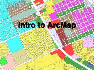
Use and Search the Map • Key features for using maps • Measure Distances and Areas • View Feature Details • Change basemaps • Bookmarks, My Places • Search the map for • Places • Features • Locations by coordinate notation • Search suggestions
Share maps • Within your organization (groups, everyone) • Directly with others (Email, Text Message, AirDrop) Collaborate • Sketch on the map • View presentations Share and Collaborate
Anyone who can benefit from viewing data on a map Everyone in the organization Executives and managers Policy makers Knowledge workers Field staff Who will use Explorer for ArcGIS?
Search for assets Get information about your data Current location Measure What can you do in the field
Use Case Loudon Water • Need to take maps in the field • They went from: Paper Maps Explorer for ArcGIS ArcReader
Explorer for ArcGIS can be used by anyone • No login required to search, open, and view public maps from ArcGIS • The best native ArcGIS app for sharing maps • Support for: • Bookmarks • Legends • Popups
Create a Custom URL to Open Explorer for ArcGIS • Create a URL to open your map in Explorer for ArcGIS on an iOS or Android device. • If the recipient does not have either of those installed the map will open in a browser. • Post the URL on your website or send via email • How To: Use this URL as a template and insert your Web map ID. http://www.arcgis.com/home/mobileviewer/appsharer.html?id=YourMapIdHere • Here is an example:http://www.arcgis.com/home/mobileviewer/appsharer.html?id=ac7e0840c3444ccbb69082ad99d18eeb
Horry County – Bike Fest http://www.horrycounty.org/BikeWeeks.aspx
What we’re working on • Move to Quartz runtime • Vector Tiles • Smart Mapping renderers • Offline Maps • Enhanced Map Sketching/Markup • Markup and annotations are persistent • ArcGIS Org users can share with a group • Supports redlining workflows
Learn more Come to the Apps booth esri.com/explorer-for-arcgis
Thank you! Questions?
Thank you… • Please fill out the session survey in your mobile app • Select ArcGIS Apps • Use the Search Feature to quickly find this title • Click “Technical Workshop Survey” • Answer a few short questions and enter any comments
Want to learn more? • Documentation • Collector • Explorer • Navigator • Operations Dashboard • Survey123 - Workforce • Additional Resources • GeoNet