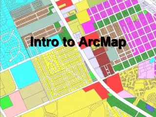
Intro to ArcMap
Intro to ArcMap. Intro to ArcMap. What is ArcMap? Accessing ArcMap Data used by ArcMap Symbology Labels Graphics Printing/Exporting maps. What is ArcMap?. Part of the ArcGIS Desktop suite of applications ArcMap ArcCatalog ArcCatalog is the “file explorer of GIS”


Intro to ArcMap
E N D
Presentation Transcript
Intro to ArcMap • What is ArcMap? • Accessing ArcMap • Data used by ArcMap • Symbology • Labels • Graphics • Printing/Exporting maps
What is ArcMap? • Part of the ArcGIS Desktop suite of applications • ArcMap • ArcCatalog • ArcCatalog is the “file explorer of GIS” • ArcMap is the “map display of GIS”
What is ArcMap? • Licensing • ArcInfo • ArcEditor • ArcView
Data used by ArcMap Spatial Data (Feature Class) Tables Database Tables Oracle SQL Server DBF Excel Sometimes CSV • Geodatabase • Single User • Personal Geodatabase • File Geodatabase • Enterprise • ArSDE • Shape files • Coverages • CAD files • DWG • DXF • ArcIMS • Other Web servers • KML (Future)
Data used by ArcMap • Layer Files • Only used once • Point at GIS data • Symbology • Symbology • Labels • Scale Range • Transparency • Definition Query • Joins/Relates GIS DATA
Connecting to ArcSDE • Open ArcCatalog • Bottom left side • Database Connections • Double Click “Add Spatial Database Connection”
Connecting to ArcSDE • Server “ms1server” • Service “5151” • Database “” (blank) • User “arc” • Password “mcgis” • Test Connection • OK
Connecting to ArcSDE • Demo
Adding Data to ArcMap • Adding Data • Add Data button • Drag and drop from ArcCatalog • Layer Files
Symbology • Point • Color • Size • Shape • Line • Color • Width • Dashed • Polygon • Outline (see line) • Fill color • Fill Pattern • Solid • Picture • Marker • Line • Annotation • Color only
Symbology • Database Driven • Single Feature • Categories • Unique values • Unique values, many fields • Quantities (number fields only) • Graduated colors • Graduated symbols • Proportional symbols • Dot density
Symbology • Charts • Pie • Bar/Column • Stacked • Multiple Attributes • Quantity by Quality
Symbology • Demo
Labels • Database Driven Text • Semi-automatic • Not perfect!
Labels • Database field • Road name • Owner Name • Font • Color • Bold, Italic, Size • Background • Halos • Position • Angle • Duplicates • Conflict detection • Label • Other feature classes
Labels • Demo
Graphics • Simple • Square • Polygon • Line • Curve • Circle • Oval • Point • Freehand line • Text • Callout Labels (Cartoon) • Layout or Data View?
Graphics • Demo
Search • Find • Feature Search • PCN • Owner Name • Street Name
Search • Find • Address Search • Simple address search
Search • Demo
Bookmarks • Save your place • Name it • Share it (new at version 9.3)
Bookmarks • Demo
Layout View / Data View Layout View Data View Data Layer Setup Label features Roads Site Location • Paper Printing • Map Surrounds • Legend • Map Title • Scale bar • Scale Text • North Arrow • Logo graphic • Disclaimer
Layout View / Data View • Demo
Printing/Exporting • Layout View • Small maps • Large maps • More difficult due to printer and computer memory problems • Paper printing • Exporting to PDF • Follow these simple steps for consistent results
Printing/Exporting • Choose Printer/Plotter • Choose paper • Size • Portrait/Landscape • Use Printer Page Settings • Show Printer Margins on Layout • Scale Map Elements proportionally to changes in page size
Printing/Exporting • Export to PDF • Where to save? • Resolution? • 600 max • Output Quality? • Normal • Embed all document fonts • YES!!! • Save • Test your files!
Printing/Exporting • Demo
Help • ArcGIS Desktop Help • Employee Central • ESRI Digital Books • How To’s • Service Desk x4800