Download
1 / 41
460 likes | 870 Vues
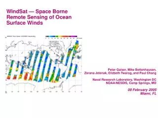
WindSat — Space Borne Remote Sensing of Ocean Surface Winds. Peter Gaiser, Mike Bettenhausen, Zorana Jelenak, Elizbeth Twarog, and Paul Chang Naval Research Laboratory, Washington DC NOAA/NESDIS, Camp Springs, MD 08 February 2005 Miami, FL. WindSat - Mission Description. Overview :

E N D
WindSat — Space Borne Remote Sensing of Ocean Surface Winds Peter Gaiser, Mike Bettenhausen, Zorana Jelenak, Elizbeth Twarog, and Paul Chang Naval Research Laboratory, Washington DC NOAA/NESDIS, Camp Springs, MD 08 February 2005 Miami, FL
WindSat - Mission Description Overview: • Demonstrate Ocean Surface Wind Speed and Direction Measurement Capability with Polarimetric Microwave Radiometry • Launched 06 January 2003 on STP’s Coriolis Satellite Bus Into a Sun-Synchronous Orbit (830 km; 98.7 deg; 1759 LTAN) • 3 Year Design Life; Current plan calls for continued operation throughout useful life of Coriolis/WindSat • Wind Vector Remains High Priority EDR for the Navy • Risk Reduction for NPOESS CMIS • WindSat Brightness Temperature and Environmental Data Now Available to Science and User Community
Available from “Dual Polarization” Systems (SSM/I, SSMIS) New Capability Available from “Polarimetric” Systems (WindSat) Polarimetric Radiometry • Ocean Surface Emission and Scattering Vary With Wind Vector • Wind Direction Dependence Arises From Anisotropic Distribution and Orientation of Wind Driven Waves • Polarimetric Radiometry Measures Stokes Vector • Polarization Properties of Emitted/scattered Radiation • Contains Directional Information • Wind Direction Signal Is Two Orders of Magnitude Smaller Than Background Signal • Two Means of Measuring • Correlation of Primary Polarizations • Direct Measure of 45, LHC, RHC Polarizations 37 GHz, Wind Speed = 9 m/s DTu, K
WindSat Payload Configuration Main Reflector GPS Antenna Reflector Support Structure Height 10.5 ft. Width 8.25 ft. Weight 675 lbs. Power 295 Watts Warm Load Spin Rate (Nom) 31.6 rpm 22 Channels 5 Frequencies RF Canister Top Deck and Electronics (Rotating) Cold Load Feed Bench Launch Locks (4 Places) Feed Array Bearing and Power Transfer Assembly (BAPTA) Stationary Deck Spacecraft Interface
WindSat Description (1) NEDT for IFOV, WindSat at 25°C, Warmload=281 K • Uses 11 Feeds Horns and a 6-foot Spinning Offset Parabolic Reflector • Calibration Is Performed Once Per Scan As Feeds Pass Below Stationary Targets • Design Minimizes “New Technologies” and Uses Heritage On-board Calibration — Must Be Able to Separate Phenomenology and Sensor Behavior
WindSat Flight Build WindSat in TVAC Chamber Coriolis Satellite at Launch Site WindSat Feed Horn Array
WindSat operating as designed System noise is low; receivers are stable Geolocation accuracy is much better than 5 km Two significant performance anomalies RFI and lunar interference in cold sky data calibration (corrected) Thermal gradients on warmload; Seasonal and orbit location dependent Continue WindSat sensor calibration Incorporate feedback from wind vector validation Warm load anomaly mitigation Tuning antenna pattern correction Ground Processing Upgrades Incorporate more automated screening for anomalous conditions RFI, Rain, Sea Ice flags Faraday rotation improvements Calibration/Validation
WindSat Wind Direction Sensitivity 18.7GHZ 3rd Stokes directional dependence wspd= [5,15]m/s and wv=[5,45] mm^2
WindSat Wind Direction Sensitivity 18.7GHZ 4th Stokes directional dependence wspd= [5,15]m/s and wv=[5,45]mm^2
WindSat View of Hurricane Isabel - Wind direction signature is clearly evident in WindSat data
Wind Retrievals • Physically-based algorithm using nonlinear optimization (NRL) • Uses physical forward model • Solves for all EDRs simultaneously • Empirical regression technique (NRL) • Two-stage regression for wind vector components • Maximum likelihood estimator (MLE) for final wind direction • Maximum Likelihood Estimator (NOAA) • Uses empirical forward model for wind vector retrievals • Regression retrievals for other EDRs • Solves for each EDR separately • Other retrieved EDRs are columnar water vapor, cloud liquid water and SST
Physically-based Retrieval Algorithm Outline • Uses a parameterized forward model • Simultaneous retrieval of 5 EDR's: TS , W, V, L, and wind direction (R); • Retrieval technique is Optimal Estimation: • C.D. Rodgers, Rev. Geophys. & Space Phys., 14, Nov. 1976; • Two-stage retrieval followed by a median filter for ambiguity selection: • Stage 1: solve for TS , W, V, L using the V-pol and H-pol channels only to obtain a priori values for stage 2; • Stage 2: solve for all 5 EDR's using all available channels. • Currently the 6.8 GHz H-pol and the 37 GHz 4th Stokes are not used
Atmospheric Parameterizations,Part 1 • One-layer (isotropic) atmosphere • = exp[-sec θ (AO + AV + AL)] • AO vertically integrated oxygen absorption • AV vertically integrated water vapor absorption • AL vertically integrated cloud liquid water absorption • Parameterize up- and down-welling atmospheric brightness temperatures in terms of effective temperatures • Tup = Teff, up (1 –) • Tdown = Teff, down (1 – )
Atmospheric Parameterizations,Part 2 Linear least squares fit at each frequency to results from our radiative transfer model V is vertical columnar water vapor L is vertical columnar cloud liquid water
Sea Emissivity Calculation • NRL two-scale model is used to generate a 3D lookup table (EIA, Ts, wind speed) for the emissivity • Correction term for contribution from non-specular reflected downwelling radiation, Ω (Wang et al, next talk) • Empirical corrections are made to account for foam and modeling errors: • Measured emissivity is calculated • measured brightness temperature (SDR) • cross-track biases applied • atmospheric contribution is removed • Isotropic terms only for V and H polarizations • Harmonics for 3rd and 4th Stokes • correction is applied as a scaling factor,emeasured / emodel
Quality Control • Retrievals are performed for all SDR's except • In the aft scan • Surface type other than ocean (no coast or near coast) • TBs out of physical bounds for no or light rain • EIAs out of expected range (>0.5o from nominal) • The following are flagged for the condition and also as“low confidence retrieval” in the EDR QC flag • Lakes or inland seas (geographic mask) • May contain rain (rain flagging based on cloud retrieval, about 6% flagged) • 10 GHz RFI (geographic mask) • Ice flag • Likely land contamination (geographic mask) • Beam averaging threshold • Calibration likely influenced by thermal gradients in warm load
Two-Stage Approach to Retrievals • Stage 1: Get a-priori data for stage 2: • A-priori data are constants • A-priori error covariance matrix terms set high • Only uses isotropic terms of the V-pol and H-pol channels • Stage 2: Final Retrieval: • A-priori data obtained from stage 1 retrieval; • Four a-priori wind directions for four retrievals: • R = Regression + 0o, 90o, 180o, 270o • Yields four solutions (“ambiguities”) for the entire state vector • Regression is the wind direction from the second stage regression • A-priori covariance matrix terms set lower; • Measurement error covariance matrix determined from model function – measurement differences
Wind Direction Ambiguity Removal • Circular Vector Median Filter • Based on S.J. Shaffer, et al., TGRS, 29, 1991 • Minimize cost function • 7x7 box size (h = 3) • Central pixel is included in cost function • Cost Function weighting (wmn) • Wind speed • Low confidence conditions: ice, RFI, land contamination, etc. • Nudging (optional) • Uses spatially interpolated NCEP GDAS 1o x1o analysis closest in time • Near-real-time system uses spatially interpolated NOGAPS .5o x.5o analysis • Initialize median filter with first or second rank wind vector closest to GDAS wind vector
Retrieval Comparison & Error Analysis • Uses collocated GDAS, SSM/I, TMI and Science QuikSCAT data: • 6 months (Sept ‘03 – Feb ‘04); • Alternating 2 days model function development, 1 day testing: • Filtered out GDAS, SSMI & QuikSCAT ice and non-ocean; • Filtered out GDAS, SSMI & QuikSCAT rain only for model development; • 25 km spatial collocation window; • 1 hour for GDAS and QuikSCAT, 35 minutes for SSM/I; • Spatially interpolated NCEP GDAS 1o x 1o analyses for SST; • SSM/I and TMI retrievals for V and L from Remote Sensing Systems; • Science QuikSCAT product for wind vectors: • Filtered out matchups where one or more of the expected beam combinations was missing.
Retrieval Performance • Comparison to Separate Matchup Datasets (“1-way”) • GDAS 1 hour for SST • QuikSCAT 1 hour for wind vectors (W, R) • SSM/I, TMI 35 min. for water vapor and cloud water • Excludes Low Confidence Retrievals
Wind Direction Performance (1-Way) Matchup with Science QuikSCAT No Low Confidence Retrievals FR = First Rank MF= Median Filtered NG= Nudged with closest GDAS analysis CL = Closest Ambiguity to true wind dir.
Wind Speed Histogram (old) • Wind speed histogram problem near 10 m/s wind speed. • Caused by transition in the form of the sea emissivity correction for the forward model
Wind Speed Histogram • Wind speed histogram corrected using a smooth transition between high and low wind speeds.
Ongoing Work • Improving performance of wind vector retrievals • Wind speeds below 7 m/s • Improving forward model performance across all conditions • Incorporate lessons learned from ocean wind science community and other data users • Improve ambiguity removal techniques • Higher spatial resolution • Train and test retrieval algorithms at higher spatial resolutions (smaller footprint but higher noise) • Demonstrate improvement with two-look retrieval technique
WindSat Data Availability • Data Release Data products available for the six-monthperiod from September 2003 – February 2004 (July’04 Processing) • Wind vector, SST, Columnar water vapor and cloud liquid water • Data products accessible via the NASA/JPL PhysicalOcean Data Active Archive Center (PO.DAAC) • Data set is being reprocessed with latest ground processing algorithms • NRL Optimal Estimation EDRs • NOAA/NESDIS EDRs • WindSat SDRs (Brightness Temperatures) • New Data to be Uploaded in March • Additional Months to Follow Immediately http://podaac.jpl.nasa.gov/windsat
WindSat Status and Summary • WindSat Successfully Launched on Coriolis on 06 January 2003 • WindSat Operation Initiated on 24 January 2003 • All Radiometers and Subsystems Are Performing As Expected • WindSat Version 0 Retrievals Demonstrate the Capability to Retrieve the Ocean Surface Wind Vector With Polarimetric Microwave Radiometry • Retrieval Performance and Calibration Continue to Improve
Parameter Accuracy Range Spatial Resolution CMISIORD CMISIORD Predicted Performance Predicted Performance CMISIORD System Goal Goal Goal Wind Speed 25 km < 2 m/s ± 2 m/s or 20% 3 – 25 m/s 20 km 3-5 m/s <25o 5-25 m/s <20o Wind Direction ±20° (3-25 m/s) 25 km 20 km 0 - 360° WindSat Mission Objectives • 1. To Demonstrate the Viability of Retrieving Ocean Surface Wind Vectors from Space Borne Polarimetric Microwave Radiometry • 2. Show Potential to Measure the Additional Environmental Data Types: Sea Surface Temperature, Integrated Atmospheric Water Vapor, Cloud Liquid Water, Rain Rate, Sea Ice, Snow Cover, Etc. • 3. Transition of Polarimetric Microwave Radiometer Science and Technology for Use in the Development and Production of the NPOESS Conical Microwave Imagery and Sounder (CMIS)
Earth Projected Beams • Multiple Feeds Results in 11 Sets of Dual-Polarized Antenna Beams • Beams within Frequency Bands Have Same EIA • Data Co-Located Within Bands by Time Shifting Data; Co-Location Across Bands Requires Interpolation
WindSat and NPOESS Risk Reduction • NPOESS Plans to Fulfill the Ocean Wind Speed and Directions Requirements Using Polarimetric Microwave Radiometry - Conically-scanned Microwave Imager and Sounder (CMIS) • WindSat Provides Risk Reduction to NPOESS and CMIS Is Several Ways • Space Borne Demonstration of Capability of Polarimetric Microwave Radiometry to Measure the Ocean Surface Wind Direction • Real Polarimetric Radiometer Data From Space for Model Function and Retrieval Algorithm Development • Windsat Lessons Learned • Hardware Development and Testing (Antenna Characterization, Receiver Design and Testing) • Calibration and Data Processing (Warm Load Target Design, On-orbit Anomalies, RFI Detection and Mitigation) • Post-Launch Calibration/Validation Techniques • Coriolis/Windsat Mission Uses NPOESS Ground Segment for Data Downlink and Distribution
Validation • Scatterometer data for wind speed and direction • Buoy matchups for wind speed and direction • Higher resolution NCEP GDAS analyses wind vectors, SST, water vapor and cloud liquid • Simulation of brightness temperatures with full forward model simulation • Training and testing of forward models and empirical regressions • SSMI, SSMIS • Continue using matchups for wind speed, water vapor and cloud liquid water • Will also use AMSR, TMI, radiosondes, other NWP models as appropriate
Ongoing and Future Work • Other Ocean EDRs • Wind vector algorithms require retrieval of sea surface temperature (SST) and columnar water vapor and cloud liquid water • Current retrievals of these EDRs only done in support of wind vector retrievals • Additional work will enable these to be quality products on their own • Current algorithms determine the presence of rain; We are confident that rain rate can be extracted from WindSat data over the ocean • However, these products have not been rigorously validated; evaluated to be good enough to support wind vector retrievals • Capability of WindSat and polarimetric radiometry in general has not been exploited over land
Continuing Cal/Val Tasks • Continue WindSat sensor calibration • Incorporate feedback from wind vector validation • Warm load anomaly mitigation • Upgrade antenna pattern correction • GDPS Upgrades • Incorporate more automated screening for anomalous conditions • RFI, Rain, Sea Ice flags • Faraday rotation improvements • Upgrade EDRP with latest retrieval algorithm • Need background fields to initialize median filter • Ongoing Maintenance Tasks • Data Processing and Distribution • GDPS Maintenance • Cal/Val Monitoring and Performance Tracking
Wind Retrievals • Developed multiple retrievals • Primary operational algorithm is physically based and uses optimal estimation (OE) • Uses physical forward model • Solves for all EDRs simultaneously • Empirical regression technique • Stage 1 solves for everything but wind direction • Stage 2 solves for wind direction based on Stage 1 results • Maximum Likelihood Estimator (MLE) • Uses empirical forward model • Solves for each EDR separately • Also retrieving other supporting parameters such as columnar water vapor, cloud liquid water and SST