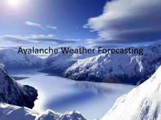
Avalanche Weather Forecasting
310 likes | 465 Vues
Avalanche Weather Forecasting . Why should we study this? .

Avalanche Weather Forecasting
E N D
Presentation Transcript
Why should we study this? On December 1st, 2000, a 28- year old snowboarder named Joel Roof planned to follow the Glory Bowl down the side of Mt. Glory. Little did he know that his journey down would trigger an avalnach that would bury him alive under feet of know for an hour and a half. Why did this happen? What led to the formation of the avalanche? How long had it been in the making? And could one person really set it off?
Glory Bowls Weather History • The avalanche had been in the making since the very first snow fell in early October and stuck to the surface of the mountain. • Throughout the month of October, multiple melt-freeze cycles had occurred. • The northeast facing slope had less than a foot of settled snow, the adjacent southeast slope was almost bare. *these are all important facts used to answer why the avalanche happened October • A warming up in early November created a new crust on the current surface • During the month, another 30 cm of snow fell, leaving about 60 cm of snow on the surface • The extremely cold temperatures cause the snow to have a low density • Around the 24th, another 60 cm of new snow fell, containing 38 mm of water, making it moderately dense • On the 27th, 18 cm more fell, containing 18 mm of water. November Throughout this time, winds were mostly out of the west loading much more snow on the leeward east- and northeast-facing aspects of Glory Bowl WIND
Avalanche Climate Avalanche climate refers to average winter weather patterns that cause certain kinds of snowpack conditions. The three mains types are maritime, continental, and intermountain. • They are differentiated by: • Average overall snowpack depth • Average winter temperatures • Frequency • Average density of new snowfall
Types of Avalanches Definition: “An avalanche is a mass of snow that moves rapidly down a steep mountain slope. There are two main types to be concerned about: loose snow and slab avalanches.” The first kind of avalanche is a loose snow avalanche which is also known as sluff. It is loose snow that originates at a single point on a slope and gathers loose, unconsolidated, individual snow crystals that are not bonded well together as it descends the mountain. These types often look like an inverted “V”. They are usually not large enough to cause significant property damage, bt can carry a person over a cliff or bury them.
Types of Avalanches Slab avalanches occur when a cohesive layer of snow, very well boded and consolidated patch of snow throughout and entire layer, slides down the slope of the mountain. Slab avalanches are also referred to as “wind slabs” because they are formed from new snow and wind. Slab avalanches cause the most fatalities and do the most property damage. • Parts of a slab: • Fracture line(crown): the upper limit on the slope • Flanks: continuations of the fracture lines down either side of the slab • Stauchwall: the bottom/lower limit of the slab • Bed surface: smooth and planer surface upon which the avalanche slides
The two types of slab avalanches S O F T Soft slabs form when winds are relatively light and the snow has relatively low density. They break up and become more powdery as they run downhill. Can consist of dry or wet snow. H A R D Hard slabs form when winds are relatively strong and the snow is of higher density. They do not become powdery, they break apart into large blocks of snow as they descend the mountain. Can consist of dry or wet snow.
Avalanche Paths The starting zone is the upper most part of the avalanches path. For loose snow avalanches it is where the first snow grain starts to move downhill, for the slab avalanche it is where the crown is located. The track is the path that the avalanche travels. It is usually downhill of the starting zone and has less or smaller vegetation than the surrounding area. The runoutzone is at the bottom of the track and is where the debris from the avalanche accumulates.
Avalanche Terrain 30 – 45 degrees is the typical window for avalanche occurrence. Slopes steeper than 45 degrees usually shed snow regularly through sluffing or shallow-depth avalanches. Since there is no build up of snow it prevents larger avalanches from occurring. The direction the tilted ground surface faces, or the aspect, affects how wind deposits snow on the slope and the intensity of solar radiation on that slope. The altitude or elevation affects the type of snow that an area will get along with the temperatures and wind regime.
Avalanche Triggers! Natural: A natural avalanche is triggered by something naturally produced: new snowfall overloading an existing snowpack, cornice breaking off, snowmelt, rockfall, or earthquake. A direct-action avalanche would occur during a storm or right after it ends while a delayed-action avalanche would take more than 24 hours. Artificial: An artificial avalanche is triggered by people or wildlife. Artificial avalanches are often triggered by avalanche hazard reduction personnel in order to avoid surprise avalanches and keep roads and ski areas safe.
Avalanche Sizes Avalanches are classified in ways similar to hurricanes, by their relative size and destructive force. The size is relative to its path. It takes into account the whole path of the avalanche. The destructive force measures an avalanche’s potential damage to things in it’s track or runout zone. The Glory Bowl avalanche would most likely have been given this rating
Slab Avalanche Development • A slab avalanche has three basic components. It is not necessary for all three to exist for an avalanche to occur, but each one increases the potential • The slab is a consolidated mass of snow that moves as a unit when the avalanche releases. Slabs are formed either from falling snow or snow that is already on the group. Wind breaks the snow into smaller pieces and deposits them on the leeward slope as a dense, cohesive layer of snow.
Slab Avalanche Development con’t • The weak layer is made up of poorly bonded snow that can easily collapse under stress,putting the slab above it in motion down a slope. There are several processes that result in weak layer formation, usually occurring between storm periods while there are clear skies and cold temperatures. • Surface hoar, the frozen winter equivalent of dew, isn’t a problem until it is buried by the next snowfall and can only form with winds less than 10mph. • Near-surface facets, or simply facets, aren’t a problem until the layer is buried by the next snowfall and can form regardless of wind speed. • Depth hoar, develops near the bottom of a snowpack whenever there is a temperature gradient larger than 1 deg C per 10 cm between the ground and pack above, which should be relatively shallow.
Sliding Surfaces Any hard or slick snow surface, crusts, makes a good sliding surface for an avalanche. There are three main types: - Ice crusts form when relatively warm rain refreezes as it strikes the surface of the snow - Rain crusts form when warm rain falls on a relatively warm snow surface, just above freezing, and the liquid water penetrates into the upper portion of the snowpack. If once the water has penetrated the temperature drops back below freezing, the water will freeze within the snowpack - Melt-freeze crusts form at/near the surface of a snowpack when the temperature rises above freezing long enough for the snow to melt at the surface. The melted snow will refreeze once the temperature drops back down. (Glory Bowl)
Stable vs. Unstable Snowpacks Unstable snowpacks are more likely to result in an avalanche. The consist of both a weak layer of poorly bonded snow, and a strong layer, such as a slab (well consolidated). A stable snowpack lacks significant density differences throughout the pack. Unstable snowpacks can become stable over time if the bonds between the weak layers and the slab strengthen.
Snow Bonding • “Avalanche forecasters evaluate how well the layers in a snowpack are bonded together at their interfaces by conducting strength and stability tests in the field. • Weather forecasters can gain insight into how well new snow will bond to the existing snow surface by evaluating weather conditions immediately prior to the arrival of the next storm. • Good bonding is likely if: • The snow surface is relatively warm (air temperatures near or above freezing) just before new snow falls; then new snow of almost any temperature or crystal type will bond with it • There’s a crust on the surface and new snow occurs at relatively warm temperatures • Weak snow and warmer temperatures precede a warmer snowfall or rain event • Poor bonding is likely if: • The new snow surface is relatively cold and consists of a weak snow type • The new snow surface consists of preserved, colder snow crystals, such as stellars and dendrites • The new snow surface is a crust and air temperatures remain cold as new snow begins falling”
Avalanche Weather Forecast Process • Forecasters have to continually evaluate the main weather parameters such as precipitation, wind, temperature, and cloud cover, in order to determine weather a snowpack is prone to avalanching. • The four main steps of this process are: • Pre-forecast preparation– gather basic weather history and climate information about your area • Assessing current weather – evaluate the weather over the past 24-hours • Forecasting future weather – forecast for the importance avalanche weather parameters • Making the avalanche weather forecast – look at current and predicted weather forecasts for your area and determine how the avalanche weather parameters in your area will be affected (increase, decrease, or remain the same)
Pre-forecast Preparation Chart from the Avalanche Weather Forecast Guide
Three major Avalanche Climates * It is important to know your region’s climate because it gives you an idea of what kind of weather, snow, and avalanches to expect. Maritime (coastal) avalanche climate is an area where it frequently storms producing heavy snowfall an rains on the snowpack throughout the winter. It has consistent and relatively mild air masses that allow for more consistent snowpack. Usually has direct-action avalanches Continental avalanche climate is an area with less frequent storms with lower-density snow than maritime climate. There are longer periods of drought and the temperatures vary throughout the winter resulting in varied layers within the snowpack. Both direct action and delayed-action avalanches are common Intermountain (transitional) avalanche climate has less storm frequency than maritime climate but more than continental clime and the temperatures are closer to maritime climate. It has both direct and delayed-action avalanches
Weather History Avalanche history always begins with a good understanding of the areas past weather from the very beginning of the winter season, which is when the first snow stays put on the surface. You would want: precipitation, maximum and minimum temperatures at forecast-area elevations, winds near the top level or at all forecast-area elevations, and average cloud cover each day over the forecast are. You can get daily weather observations from automated weather sites, and historical information from climate station records, satellite data, and SNOTEL sites. (“SNOTEL is an extensive, automated system for collecting snowpack and related climatic data in the Western United States and Alaska run by the U.S. Natural Resources Conservation Service.”) Snow pit profiles help to inform you if the snowpack is stable or unstable, and if the snow is hard and crusty or soft and powdery.
Recent Avalanches It is helpful to keep a record of any reported avalanches, noting the elevation, aspect, and relative size of each, because it is the best indicator of an unstable snowpack Identifying debris piles at the bottom of slopes is a good indication of recent activity
Current Weather Overview Remember, everything up until this point was pre-forecast information A chart of the weather variables with the greatest impact on snowpack and avalanche potential Precipitation Wind Temperature Cloud cover/solar radiation
Precipitation You want to calculate the variables in the left column and determine if your findings exceed any critical threshold.
Wind These are photos of snow being transported by wind (rather than new snow coming from snowfall)
Temperature You want to track daily temperature range and temperature trends of increasing and decreasing, and the rate and duration of the change Daily temperature information is extremely important because avalanches are more likely to occur when air temperatures rise above freezing and stay there, or when extremely cold and remain the way because it helps to form weak layers. If temperatures stay above freezing for more than 24-hours there is a higher potential for a wet slab avalanche Temperature trend is important because the rapid rise in temperature can destabilize a pack whereas a slow rise in temperature would help to stabilize it. • Trends to look out for: • Increasing temperatures: Notice when air temperatures warm by about 15°F (10°C) or more during the day, especially when they’re near the freezing mark; the pack may settle too rapidly, causing avalanching; the faster temperatures rise, the more unstable the snowpack will be • Melt-freeze: Note when a warm-up is followed by a cooling or days with melt-freeze cycles, since this will help stabilize the pack
An overview of what to forecast • Precipitation: • Snow water equivalent • New snow amount, which you will use to estimate the new snow density • Wind(ridge-top): • Predict the average wind speed and direction over 6 or 12 hour periods • produce a 24-hour average(use model forecasts of win speed and direction, taking into account changes in speed and direction over time) • Be cautious calmer winds at night during clear skies, could produce surface hoar • Temperature: • Maximum and minimum temperatures expected in the next 24 hours at the elevation of avalanche stating zones, as well as 3- or 6- hour intervals which will help to analyze same day trends • Cloud cover & solar radiation: • Forecast the cloud cover amount for 6- or 12- hour intervals • Pay close attention to long durations of clear skies at night • Long periods of thin overcast skies during the day still allows direct solar insolation to melt the snow surface
Making the Avalanche Weather Forecast • Check the findings from your pre-forecast preparations. Do they indicate that the area is prone to avalanches? Has the season’s weather set the stage for their formation? • Review your weather data for the last 24 hours. Is the weather increasing, decreasing, or not changing avalanche potential? • Analyze your 24-hour forecasts and determine their impact on avalanche potential • Look at the combined data and identify the trend. Does the potential for avalanche formation appear to be increasing, decreasing, or remaining the same based on weather conditions? The following link will bring you to a pdf of an avalanche weather forecast data sheet: https://www.meted.ucar.edu/afwa/avalanche/media/graphics/av_wx_fcst_data_sheet.pdf
Some High-Risk Situations: • Heavy, dense snowfall of 6 inches (15 cm) or more produces avalanches, especially on steeper terrain with slopes greater than 40 degrees • 12 inches (30 cm) or more of new snow, especially with higher densities, may overload an already weak snowpack and produce deeper slab releases • New slabs created with 6 inches (15 cm) or more of new snow and winds from a consistent direction for 6 hours or more averaging 20 to 60 mph (~17 to 52 kts or 10 to 30 m/s) pose high risks • Rain on snow almost always produces avalanching, with heavier rain producing larger avalanches • Rapidly warming temperatures during the day increase snowpack settlement rates and can cause avalanches without any new snow loading • Warm surface temperatures (at or above freezing) combined with intense solar radiation produce wet snow avalanches • One day of clear, cold, calm weather followed by a significant snowfall can bury a layer of surface hoar, posing risks to the future stability of the pack • Longer spells of dry, relatively cold weather followed by a significant snowfall often will bury near-surface faceted snow or depth hoar and may pose a risk if more loading occurs