Download
1 / 25
250 likes | 440 Vues
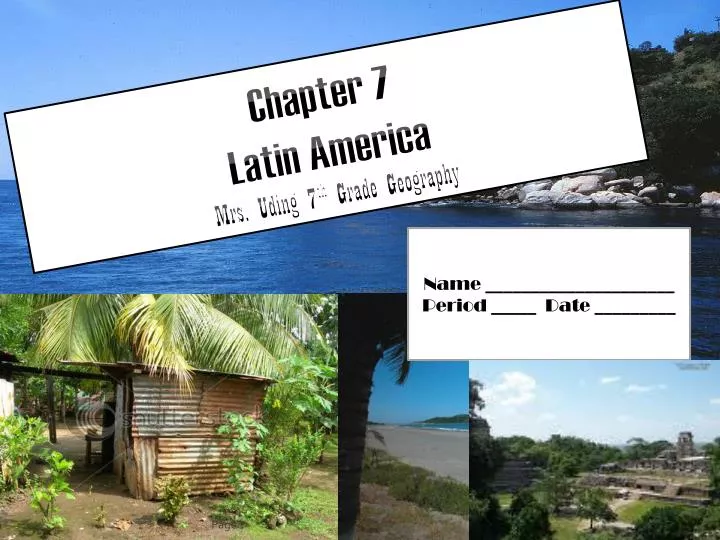
Chapter 7 Latin America Mrs. Uding 7 th Grade Geography. Name _____________________ Period _____ Date _________. Physical Geography of Mexico. Mexico, Central America and the Caribbean Islands make up the Middle America.

E N D
Chapter 7 Latin America Mrs. Uding7th Grade Geography Name _____________________ Period _____ Date _________ Page 1
Physical Geography of Mexico • Mexico, Central America and the Caribbean Islands make up the Middle America. • Their languages derived from Latin, so they called this region Latin America
Mountains and Islands • Mexico’s landforms include mountains, plateaus, and plains. • Plateau- a broad, flat area of land higher than the surrounding land. • Two major mountain ranges • Sierra Madre Occidental located in western Mexico • Sierra Madre Oriental located in eastern Mexico
Earthquakes and Volcanos • Tectonic Plates are large rigid sections of the earth’s crust that is in constant motion. • Because of the physicial geography, Mexico and Central America are especially prone to earthquakes
Earthquakes • An earthquake devastated the central area of Managua, the capital of Nicaragua, in 1792, killing as many as 10,000 and leaving 300,000 homeless. • 1985, Mexico City a quake struck killing about 10,000 and leveling hundreds of buildings. • Mexico’s and Central America’s location on the edge of tectonic plate are the major contributing factor to earthquakes.
Mexican Plateau • Lies between the two mountain regions • 40% of the land regions • Most of Mexico’s people live here • Rises about 4,000 feet above sea level in the northern part 8,000 in the southern part
Central America • South of Mexico are the countries of Central America • Central America is an isthmus, a strip of land that connects two larger land masses. Connecting the North and South America continents. In Central America, a string of volcanoes lines the Pacific Coast
The Caribbean Islands • East of Central America • The islands are made up of three parts • The Bahamas are an archipelago • 1. Archipelago- a chain of islands • 2. The Greater Antilles • Include Cuba, Jamaica, and Puerto Rico
Caribbean Islands • 3. Lesser Antilles • Include the remaining smaller islands. • Many of the Caribbean Islands are actually the exposed tops of underwater mountains.
Climate in Mexico • About half of Mexico lies south of the tropic of Cancer • The temperatures in this part of Mexico are generally warm and constant year round, with abundant rainfall. • Tropical rain forests thrive in this area. • Temperatures vary greatly North of the Tropic of Cancer. • The driest areas are in the deserts of northwestern Mexico.
Climate in Central America • All of Central America is located in the tropical zone, so temperatures are generally warm year round. • The plains along the Caribbean coast receive the greatest amount of precipitation. • The climate is perfect for the lush rain forests that grow there.
The Caribbean Islands • Winds play a big role in the climate of the Caribbean Islands. • The waters in the Caribbean sea stay warm most of the year and heat the air over them. • Warm winds that blow across the Caribbean Sea keeps the islands temperatures warm.
Section 2 Physical Geography of South America South America
Landforms, Rivers, and Lakes • South America has nearly every type of physical feature. • Highlands: Mountainous or hilly sections of a country • Few large lakes but, is drained by five major river systems, including the Amazon River.
The Andes • The Andes Mountains stretch along western covering over three-fifths of South America. • Stretching a distance of 5,500 miles. Longer than any other mountain range above sea level. The world’s second highest range. • Only the Himalayas in Asia are higher. • The Andes also includes altiplano or a high plateau.
Plains and Highlands • Central Plains extend eastward from the Andes and cover about three-fifths or 40%of Brazil. • Llanos, Gran Chaco, Amazon rain forest make the Central Plains. • Llanos: are wide grasslands that stretch across northeastern Columbia and western Venezuela. Amazon Basin--Capyberra Largest rodent in the world, they're about 3 ft. tall. But they're really slow and sweet, they reminded us of a creature from a Miyazaki film
Tropical Rain Forest • A tropical rain forest in the Amazon Basin covers about 40% of Brazil • The Gran Chaco is a largely uninhibited area consisting of subtropical grasslands and low forests. • South of the Gran Chaco lies a large grassy plain called the Pampas Argentinia’s most populated area.
Angel Falls • Angel Falls in the Guiana Highlands of southeastern Venezuela, the world’s tallest waterfall, drops 3,212 feet. The waterfall was named for Jimmy Angel, an American pilot who spotted it from his plane in 1935. • Jimmy was searching for gold when he saw Angel Falls. The falls drop off one of Venezuela’s flat topped mountains.
Rivers and Lakes • South America has five major river systems • The Amazon River is the largest carrying about 1/5th of the Earth’s river water. The Amazon River flows from the Andes all the way to the Atlantic.
The Amazon River • The Amazon River is the second longest river in the world. • What river is the largest? • (The Nile in Africa) • The Amazon may have gotten its name after a Spanish explorer who fought a battle against Indians in the region in which women had fought alongside men. • The explorer believed the women resembled the Amazon warriors in Greek myths.
Geographical Features of South America • The main geographical features of South America include the Andes, the Central Plains, the Eastern Highlands, the Amazon River system and the rain forest.
Climate and Vegetation • Most of the grasslands in South America are found in Venezuela, Colombia, Argentina, and Uruguay. • The climate of the Amazon is affected by the high humidity levels. • The average temperature is only about 80 degrees, but the high humidity makes it seem much hotter. • The Amazon River is the second largest river in the world (after the Nile river in Africa).
South America Mountain Climates • South America has a wide range of climates- from the steamy rain forests of the Amazon Basin to the icy cold of the upper Andes. • Mountain climates and vegetation changes as the elevation increases because the climate becomes colder as the elevation rises. • The climate to the Andes mountains changes with elevation. • The climate at the lower or midway up the mountain is a tropical climate because it is closer to the equator. • Midway up the mountain it becomes cooler and top becomes frigid cold.
Tropical Rain Forest in South America • Much of South America lies in the low latitudes, which are tropical. • Amazon River covers more than 2 million square miles. • The rain forest located primarily in Brazil is bordered to the east by the Guiana Highlands. • The Amazon rain forest has the world’s richest collection of life forms. In fact, many of its insects, birds, and plants have yet to be named.
Desert or Dessert • Desert climates occur along much of Peru’s coast, as well as northern Chile. • Desert climates are dry, and temperatures can be cold or warm. • The Atacama Desert is warmer, with summer temperatures averaging in the mid 60 degrees. • In the center of the Atacama Desert, no rainfall has ever been recorded. • There nothing grows!!!