Download
1 / 23
240 likes | 463 Vues
Evapotranspiration from Landsat for IDWR Curtailment Order. William J. Kramber and Dr. Allan Wylie Idaho Dept of Water Resources Dr. Richard G. Allen University of Idaho. Collaborators: Dr. Jeppe Kjaersgaard, Dr. Ricardo Trezza, Clarence Robison, University of Idaho

E N D
Evapotranspiration from Landsatfor IDWR Curtailment Order William J. Kramber and Dr. Allan Wylie Idaho Dept of Water Resources Dr. Richard G. Allen University of Idaho Collaborators: Dr. Jeppe Kjaersgaard, Dr. Ricardo Trezza, Clarence Robison, University of Idaho Dr. Magali Garcia, University Lapaz, Bolivia Tony Morse, IDWR (retired), and Spatial Analysis Group NASA September 14, 2009
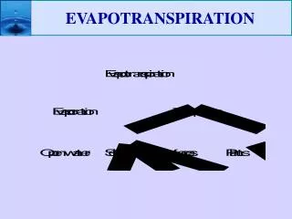
Why is Evapotranspiration (ET) important? • ET shows the amount of water consumed by irrigated agriculture • Idaho has 3.4 million acres of irrigated agriculture • Irrigated agriculture accounts for over 90% of the water consumed in Idaho
Water Law Terms • Water Right • Authorization to use water • Includes priority date • Call • When a senior water right holder experiences a water shortage they may place a call • Curtailment Order • Defines how the state directs junior water right holders to stop diverting water in response to a call
8/1/2009 8/11/2009
In the past • Potential ET using crop coefficients • Needs crop type acres and stage of growth • Produces one ET value per county
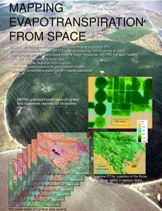
In the present • Actual ET from Landsat using METRIC • No crop information required • ET per pixel can be summed by field
GW Model Cells and Water Rights Landsat p40r30, 20060722
Summary • ESPA GW model used METRIC ET data • For model calibration • To select water rights to curtail • No complaints from junior users about GW model or METRIC ET data
More Information www.idwr.idaho.gov www.kimberly.uidaho.edu/water/metric
Acknowledgements Dr. Masahiro Tasumi, University of Miyazaki, Japan Dr. Wim Bastiaanssen, WaterWatch
Wish List • Four Landsat satellites to collect an image of the same area every 4 days • Cloud and shadow algorithm or mask included with images
ESPA Ground Water Model • MODFLOW • Developed by the USGS • Perhaps the most used ground water model • Ground Water Flow model • Used to track the impact of various administrative decisions • Calibrated to 22 years of data • 1 May 1980- 30 April 2002 • 15987 observations
For information about the Ground Water Model Dr. Allan Wylie Idaho Department of Water Resources 322 East Front St PO Box 83720 Boise, ID 83720-0098 Phone 208 287 4963 e-mail allan.wylie@idwr.idaho.gov