CORS and SNARF
CORS and SNARF. Giovanni Sella NOAA- National Geodetic Survey giovanni.sella @ noaa.gov AGU Fall Meeting SNARF Splinter Session San Francisco, CA December 11, 2007. CORS Network in CONUS 2007. CORS Monthly Data Downloads 2002-2007. CORS. New sites continue being added rapidly

CORS and SNARF
E N D
Presentation Transcript
CORS and SNARF Giovanni Sella NOAA- National Geodetic Survey giovanni.sella @ noaa.gov AGU Fall Meeting SNARF Splinter Session San Francisco, CA December 11, 2007
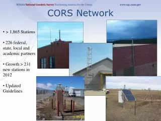
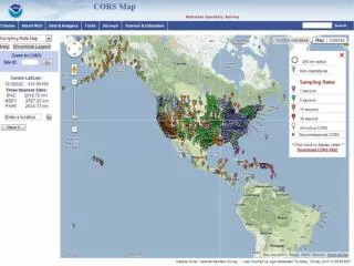
CORS New sites continue being added rapidly Monumentation of new sites has improved (MA building 17ft pillars) All use force centering devices Monumentation information is stored both photographs and text descriptions in logs (many older sites are still lacking in this info) Continued revising meta data and now checking all online storage data.
NGS Mission NGS is responsible for defining, maintaining and providing access to the National Spatial Reference System for the civilian sector of the US government CORS provide two critical elements to this, direct access to the NSRS which is in large part defined using CORS coordinates and for post-processing positioning services e.g. OPUS and OPUS-RS Legal binding datum for the United States is NAD83
Evolution of NAD83 NAD83 (1986) relied on Doppler COM, orientation, and scale COM was off by 2m compared to ITRF and orientation off by 0.03 arc seconds and scale by 0.0871 ppm NAD83 (HARN) (1989) state-by-state update kept same COM and orientation but adopted ITRF scale (ellipsoidal coordinates changed by -0.6m. NAD83 (CORS93/CORS94/CORS96) tied to a multi-year analysis of CORS nationwide transformation kept original COM and orientation (from 1986) scale equal to ITRF
Future NAD83 and SNARF NAD83 is an international effort NAREF is the vehicle for combining new solutions After complete re-processing by all participating agencies and new multiyear NAREF solution. Revision of NAD83 considered (~2010?) SNARF is the scientific frame which can be used as the template for NAD83 revisions Changes in frame definitions are delicate “business” due to large legal implications