Download
1 / 17
170 likes | 299 Vues
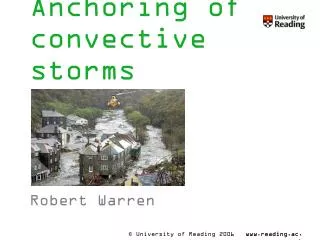
Anchoring of convective storms. Robert Warren. Contents. My background Introduction & Motivation Project aims and methodologies Work so far Background reading Boscastle Flood Case studies 21/07/2010 Work going forward. My background. Weather enthusiast

E N D
Anchoring of convective storms Robert Warren
Contents • My background • Introduction & Motivation • Project aims and methodologies • Work so far • Background reading • Boscastle Flood • Case studies • 21/07/2010 • Work going forward
My background • Weather enthusiast • Reading Graduate – 4 year MMet degree with a year in Oklahoma • 2 Met Office summer placements: • 2009: Stratospheric Sudden Warmings • 2010: Orographically enhanced rain • Storm chasing!
Project motivation • Flash flooding: one of the greatest natural hazards • Results from specific combination of meteorological and hydrological conditions • Precipitation proportional to rain rate, R, and duration, D (Doswell et al. 1996) • Anchored convective storms: • Large R and relatively large D • Often involve echo training (quasi-stationary convective systems) • Can cause flash flooding in just a few hours (e.g. Boscastle) • Difficult to forecast
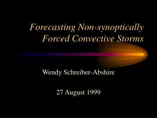
Project aims and methodology • Investigate mechanisms behind anchoring of convective storms in the UK • Case studies: • Observational data (Met Office analyses, radar, rain gauges, satellite imagery) • High-resolution UM simulations • Idealised simulations – isolate mechanisms • Ensemble model runs – determine predictability • Automatic detection algorithm – build climatology • End goal: ‘guidelines’ for forecasters
Background reading • High-resolution modelling of convection: • Bryan et al. (2003) – Use of Large Eddy Simulation • Lean et al. (2008) – Comparison of 12 km, 4 km and 1 km UM • Rainfall verification from high-resolution models: • Roberts and Lean (2008), Roberts (2008) – Fractions Skill Score • Banded orographic convection: • Kirhsbaum and Durran (2005a,b), Kirshbaum et al. (2007) • Case studies of UK anchored convective storms (Weather): • Burt (2005), Golding et al. (2005) – Boscastle, 16 August 2004 • Mayes and Winterton (2008) – Surrey, 13 August 2006
The Boscastle Flood • Devastating flooding in coastal settlements of Boscastle and Crackington Haven • Echo training over high ground just inland of north Cornwall coast • 200 mm of rain in under 4 hours • Intense rainfall gradients (50 mm km-1) on SE flank • Rain rates up to 400 mm hr-1 Rainfall totals from rain gauges (top) and radar (bottom). From Burt (2005).
The Boscastle Flood, cont... 1200 1300 1400 1500 1600 1700 Rain rates from the Cobbacombe Cross radar in Devon. From Burt (2005).
The Boscastle Flood, cont... • High precipitation efficiencies due to large-scale ascent • Storms forced by persistent narrow convergence line • Combination of sea-breeze circulation and frictional backing in coastline-parallel low-level flow Accumulated precipitation (mm) from 1200–1700 UTC UM simulations at 1 km grid-spacing: (a) Full simulation, (b) Flat orography, (c) Flat orography and no land-sea contrasts in surface heat and moisture fluxes and surface temperature . From Golding et al. 2005 Surface wind vectors and convergence (s-1) at 11 UTC
Case Studies • Subjective identification: • Looked at last 2 summers • Examined looped animations of composite radar images for each day • Several (8+) cases found • Some common features: • Echo training • Related to topography • Organised into flow-parallel bands • Some days have several, widely separated anchored storms
Case 1 – 21/07/2010 • Remarkably similar to Boscastle storm • Repeated convective development along North Cornwall/Devon coast • Interesting evolution: • Early initiation (~08 UTC) • Organised into a line • Stationary until ~15 UTC • Sudden inland propagation after this time, starting from the south
Case 1 – 21/07/2010, cont... • Radar maximum: 51.8 mm of rain in 3 hours (12–15 UTC) • Event was not accurately captured by UKV model UKV: 13 UTC (t+10h) – 18 UTC (t+15h)
Case 1 – 21/07/2010, cont... • NAE model analyses reveal some features of environment: • Ahead of vertically stacked low • SSW–SW surface flow • Some evidence of convergence line from surface winds • Conditionally unstable with capping inversions at 900 and 750 hPa – moist at low levels • Weak vertical wind shear • Approaching surface trough may have forced eastward propagation after 1500 UTC
Case 1 – 21/07/2010, cont... • Satellite images reveal widespread cloud streets / bands MODIS high-resolution image for 1233 UTC on 21/07/2010
Case 1 – 21/07/2010, cont... • Cloud tops up to 20,000ft (-18°C) • Deep enough to generate heavy rain but shallow enough to allow development of closely-packed storms with weak downdraughts (c.f. Boscastle) Derived cloud top temperature for 1400 UTC Derived cloud-top height for1400 UTC
Work going forward • Focus on Cornwall case: • Continue examining analysis data • Environment Agency gauge data • Program to calculate CAPE and CIN across domain • High-resolution UM simulations of event • Identify more cases (climatology?): • Program to automatically detect anchored convective storms in past radar data
References • Bryan, G. H., J. C. Wyngaard, and J. M. Fritsh, 2003: Resolution requirements for the simulation of deep moist convection, Mon. Wea Rev., 131, 2394–2416. • Burt, S., 2005: Cloudburst upon Hendraburnick Down: The Boscastle storm of 16 August 2004. Weather, 60, 219–227. • Doswell, C., H. E. Brooks, and R. A. Maddox, 1996: Flash flood forecasting: An ingredients based methodology. Wea. Forecasting,11, 560–581. • Golding, B., P. Clark, and B. May, 2005: The Boscastle Flood: Meteorological analysis of the conditions leading to flooding on 16 August 2004. Weather,60, 230–235. • Kirshbaum , D. J., and D. R. Durran, 2005a: Observations and modelling of banded orographic convection. J. Atmos. Sci., 62, 1463–1479. • Kirshbaum, D. J., and D. R. Durran, 2005b: Atmospheric factors governing banded orographic convection. J. Atmos. Sci.,62, 3758–3774. • Lean, H. W., P. A. Clark, M. Dixon, N. M. Roberts, A. Fitch, R. Forbes, and C. Halliwell, 2008: Characteristics of high-resolution versions of the Met Office Unified Model for forecasting convection over the United Kingdom. Mon. Wea. Rev., 136, 3408–3424. • Mayes, J., and J. Winterton, 2008: The west Surrey thunderstorm of 13 August 2006. Weather,63, 50–55. • Roberts, N. M., 2008: Assessing the spatial and temporal variation in the skill of precipitation forecasts from an NWP model. Meteor. Appl.,15, 163–169. • Roberts, N. M., and H. W. Lean, 2008: Scale-selective verification of rainfall accumulations from high-resolution forecasts of convective events. Mon. Wea. Rev.,136, 78–97.