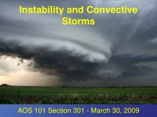
Forecasting Non-synoptically Forced Convective Storms
Forecasting Non-synoptically Forced Convective Storms. Wendy Schreiber-Abshire 27 August 1999. Outline. Radar Capabilities and Review of Nowcasting Science (Schreiber-Abshire) Realities of Applying Nowcasting Techniques in a WFO (Denver-Boulder, Szoke) BREAK

Forecasting Non-synoptically Forced Convective Storms
E N D
Presentation Transcript
Forecasting Non-synoptically Forced Convective Storms Wendy Schreiber-Abshire 27 August 1999
Outline • Radar Capabilities and Review of Nowcasting Science (Schreiber-Abshire) • Realities of Applying Nowcasting Techniques in a WFO (Denver-Boulder, Szoke) • BREAK • Using the Auto-nowcaster at the Sterling, VA WFO (Zubrick) • The SCAN Program in AWIPS (Smith)
Radar Meteorology References • Radar in Meteorology: Battan Memorial and 40th Anniversary Radar Meteorology Conference (AMS,1990) • Radar for Meteorologists (Rinehart, 1991) • Radar Observation of the Atmosphere (Battan, 1973) • Doppler Radar and Weather Observations (Doviak and Zrnic, 1984)
Convergence and Convection Initiation • The Thunderstorm. Byers and Braham, 1949 • The role of surface divergence and vorticity in the life cycle of convective rainfall. Part I. Observations and analysis. Ulanski and Garstang, JAS, 1978 • The relationship between total area divergence and convective precipitation in south Florida. Watson and Blanchard, MWR, 1984
Known Convergence Lines • Synoptic Fronts • Sea Breeze/Land Breeze • Davis et al., 1889 • Gust Fronts • Fujita, JM, 1959
Known Convergence Lines (cont.) • Urban Heat Island Circulation • Changnon, Meteor. Monogr. 40, 1981 • Cloud Shading Boundaries • Purdom and Gurka, 5th Conf. WFA, AMS, 1974 • Segal et al., MWR, 1986 • Soil Moisture/Vegetation Inhomogenities • Ookouchi et al., MWR, 1984 • Nice review of all these in Meso. Met. and Fcsting, Chap. 23, Ed. P.S. Ray, 1984
Known Convergence Lines (cont.) • Slope/Valley Circulations • Mesoscale Atmospheric Circulations, Chap. 6, 1981 • Cloud Streets • (Visual Observations) Kuettner, Tellus, 1971 • Longitudinal/Horizontal Rolls • (Aircraft) Lemone, JAS, 1973 • (Radar) Kelly, JAS, 1984
Specific Geographic CZs • The Dryline • Beebe, JM, 1958 • The San Fernando Convergence Zone • Edinger and Helvey, BAMS, 1961 • The Puget Sound Convergence Zone • Mass, Weatherwise, 1980 • Denver Convergence/Vorticity Zone • Szoke et al., MWR, 1984
Boundaries from Satellite • Satellite Cloud Arc lines • Meso-highs and satellite imagery. Purdom, MWR, 1973 • Subjective interpretations of geostationary satellite data for nowcasting. Nowcasting, Purdom, K. Browning, Ed. Academic Press, 1982 • Thunderstorm trigger mechanisms over the southeast U.S. Purdom and Marcus, 12th Conf. SLS, 1982
Clear-air Radar Echoes • Boundary layer clear-air radar echoes: Origin of echoes and accuracy of derived winds. Wilson et al.,J. Atmos. Oceanic Tech., 1994 • Echoes come from both refractive index gradient (Bragg scattering) and insects and birds (particulate scattering) • Bragg scattering dominates at and above the top of the PBL and is primarily observed via 10 cm (S-band) radars • Insects are principal scatter in mixed boundary layer
Clear-air Radar Echoes and Velocity • Doppler velocities can be used to estimate horizontal winds in the PBL (when insects and birds are not migrating) • Determination of the boundary layer airflow from a single Doppler radar, Tuttle and Foote, J. Atmos. Oceanic Tech., 1990 • Wind and thermodynamic retrieval from single-Doppler measurements of a gust front observed during Phoenix II, Sun and Crook, MWR, 1994
Cumulus Cloud Echoes • First radar echoes from cumulus clouds. Knight and Miller, BAMS, 1993 • radar used to study entrainment and mixing (via Bragg scattering) as well as precipitation formation (via backscatter from hydrometeors) • “Mantle Echoes” from Bragg scattering rediscovered • Developing thunderstorm forecast rules utilizing first detectable cloud radar-echoes. Henry and Wilson, 5th Conf. Av. Wx. Sys., AMS, 1993
Clear-air Radar Boundaries and Convection Initiation • Statistical considerations in the estimation of divergence from similar Doppler radars. • Koscielny, Doviak and Rabin, JAM, 1982 • Nowcasting with Doppler radar: The forecaster-computer relationship. • Wilson and Carbone, Nowcasting II, K. Browning, Ed., 1984 • Initiation of convective storms at radar-observed boundary-layer convergence lines. • Wilson and Schreiber, MWR, 1986.
Wilson and Schreiber Results • No apparent rhyme or reason to convective storm initiation locations along the Front Range of Colorado!
Wilson and Schreiber Results (cont.) • Storm initiation NOT random when viewed relative to boundary-layer convergence zones!
Wilson and Schreiber Results (cont.) • 79 % of storms > = 30 dBZ that were not advected into study area formed along a boundary • 92 % of storms > = 60 dBZ that were not advected into study area formed along a boundary
Other Key NCAR Papers (cont.) • The role of boundary-layer convergence zones and horizontal rolls in the initiation of thunderstorms: A case study. Wilson et al.,MWR, 1992 • The utility of sounding and mesonet data to nowcast thunderstorm initiation. Mueller, Wilson and Crook, WF, 1993 • Nowcasts of thunderstorm initiation and evolution. Wilson and Mueller, WF, 1993
Other Key NCAR Papers (cont.) • Convection initiation associated with a sea-breeze front, a gust front, and their collision. Kingsmill, MWR, 1995 • Sensitivity of moist convection forced by boundary layer processes to low-level thermodynamic fields. Crook,MWR, 1996 • 1oC, 1 g/kg can make the difference! • Thermodynamic variability within the convective boundary layer due to horizontal convective rolls. Weckwerth, Wilson and Wakimoto, MWR, 1996 • Natural variability and limits of observing systems are at least this magnitude!
Other Key NCAR Papers (cont.) • Integration of WSR-88D and GOES-8 data for detecting and forecasting storm initiation. Roberts,15th Conf. WAF, AMS, 1996 • Thunderstorm initiation, organization and lifetime associated with Florida boundary layer convergence lines.Wilson and Meganhardt,MWR, 1997 • Nowcasting thunderstorms: A status report. Wilson et al.,BAMS,1998
Some Recent Research by Community 1 • Mesoanalysis of summertime convergence zones in central and eastern North Carolina.Koch and Ray, WF, 1997 • A boundary in NC is muchmore likely to initiate convection and is ~ twice as likely to interact with another boundary than a boundary in NE CO is!
Some Recent Research by Community 2 • Doppler radar analysis of a Snake River plain convergence event. • Andretta and Hazen,WF, 1998 • (Important year round, including a heavy snow event)
Some Recent Research by Community 3 • A numerical investigation of the Las Vegas convergence zone. • Runk and Schreiber-Abshire,Eighth Conf. on Meso. Proc., 1999 • Key player in 9 July 1999 major flooding event in Las Vegas
Factors Influencing Convective Storm Initiation and Evolution • Updraft Source • Boundary-layer forcing (radar can see) • Stability • Changes in moisture, CIN (satellite can see) • Shear (Updraft Tilt) • Lifting depth at boundary, boundary-relative motions
Automating this Knowledge to Produce a Forecast • Various Regional, Mesoscale and especially Storm-scale Modeling Efforts • The Auto-nowcaster • Mesonet Data (stability) • Satellite (Cu and boundary information) • Radar (Cu, boundary, and wind field information) • High Resolution Model • Numerous Algorithms
Meteorology of Storm Evolution • Prior to Storms • No Convergence Line • Fair Weather Cu • Initiation • Convergence Line Present • LI < 0 • Cu in Lifting Zone • Deep Erect Updrafts • (Depending on convergence strength, LL Shear, Boundary relative cell speed)
Meteorology of Storm Evolution (cont.) • Growth/Merger • Boundary Motion = Storm Motion • Convergence Strong and Deep • LI < 0 • Dissipation • Convergence Line Moving Away from Storms • LI > 0
Summary (another way to say it...) • Convection Initiation is favored by: 1) Strong, deep, low-level convergence 2) Convergence line moving into existing cumulus clouds 3) Deep vertical updrafts (moderate low-level shear) • Storm Merger, Organization, and Longevity is favored by: 1) The above for initiation 2) Boundary relative steering flow near zero
Summary (cont.) • Dissipation is favored by: 1) Convergence line moving away from cell 2) Convergence line moving into stable region
This Science is Being Applied NORTHEAST AND NORTH CENTRAL CO AREA FORECAST DISCUSSION 258 PM MDT THU AUG 5 1999 <snip> CURRENTLY RADAR AND SATELLITE PICTURES ARE INDICATING A FEW THINGS. THERE’S A CONVERGENCE AREA GOING ACROSS WASHINGTON AND ELBERT COUNTIES…WITH A WEAK BROAD CIRCULATION CENTERED IN MORGAN COUNTY. SOUTH-SOUTHEASTERLY FLOW ON THE INCREASE SOUTH OF THE LINE. THE CURRENT RADAR IS SHOWING A DECENT LINE OF STORMS DEVELOPING ALONG THE CONVERGENCE ZONE AND WEAKER SCATTERED RETURNS COVERING THE MOUNTAINS AND FOOTHILLS. THE LOWER CLOUD DECK IS ALSO DISSIPATING OVER A GOOD PORTION OF THE PLAINS WITH SUNSHINE ON THE INCREASE. EXPECT BOUNDARIES TO GET GOING WITH LIKELY TO WIDESPREAD PRECIPITATION A GOOD BET IN MOST AREAS. <snip>
But How Useful is it on a Daily Basis? Here’s………... Ed!