Download
1 / 9
100 likes | 215 Vues
This dataset includes detailed imagery from the CSX QuickBird satellite, featuring 435 panchromatic image tiles across 41 scenes, with one scene missing for Hancock County. The multispectral dataset comprises 370 image tiles from 39 scenes, also with one scene missing. Each scene includes index tiles for easy navigation, allowing researchers access to raw data, mosaics, and vector coverages. The directory structure and file naming conventions are systematically organized, facilitating the usage of geographic data for analysis and research.

E N D
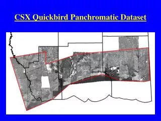
CSX Quickbird Panchromatic Dataset • 435 Image Tiles • 41 Scenes • Missing 1 scene for Hancock County • Index tiles for each scene
CSX Quickbird Multispectral Dataset • 370 Image Tiles • 39 Scenes • Missing 1 scene for Hancock County + additional scenes • Index tiles for each scene
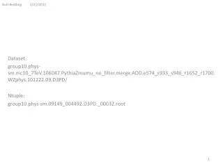
Directory Structure • gri on ‘Samba’ (K:)\projects\csx • docs • figures • projects • raster • Quickbird • mosaics • ms • pan • raw • vector • coverages • shapes • mosaic_tiles • ms • pan
File Naming Convention • Pan image scenes begin with “pan” • Pan index tiles begin with “pt” (Pan Tile) • MS image scenes begin with “ms” • MS index tiles begin with “mt” (MS Tile) • Example: pan6663_10756_43911_p006.img • This pan image was created from scene# 43911_p006 image tiles on cd 6663_10756 • The associated image tile index shapefile is pt6663_10756_43911_p006.shp
Index Shapefile Attributes • mt6663_10754_43911_p001.shp Image tiles Image scene
Pan QB Scenes – Hancock County • pan6250_10226_29365_p004.img • pan6311_9873_41925_p002.img • pan6311_9875_41925_p006.img • pan6311_9875_41925_p007.img • pan6311_9876_41926_p001.img • pan6311_9876_41926_p002.img • pan6311_9877_41926_p004.img • pan6577_10276_29365_p001.img • pan6577_10277_29365_p002.img • pan6577_10277_29365_p003.img • pan6577_10278_29365_p005.img • pan6577_10278_29365_p006.img * • pan6663_10754_43911_p001.img • pan6663_10754_43911_p002.img * • pan6663_10755_43911_p003.img • pan6663_10756_43911_p006.img • pan6663_10762_43911_p018.img
MS QB Scenes – Hancock County • ms6250_10226_29365_p006.img • ms6311_9872_41925_p002.img • ms6311_9874_41925_p002.img • ms6311_9876_41926_p004.img • ms6311_9872_41925_p005.img • ms6311_9874_41925_p008.img • ms6311_9874_41925_p007.img • ms6311_9874_41925_p001.img • ms6311_9873_41925_p006.img • ms6577_10276_29365_p001.img • ms6577_10276_29365_p004.img • ms6663_10760_43911_p018.img • ms6663_10755_43911_p006.img • ms6663_10754_43911_p001.img • ms6663_10754_43911_p002.img • ms6663_10755_43911_p003.img • ms6663_10755_43911_p004.img * Total cloud cover – not usable • ms6577_10276_36943_p001.img • ms6577_10276_29365_p002.img • ms6577_10276_29365_p003.img