Download
1 / 13
130 likes | 283 Vues
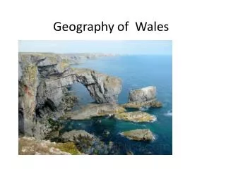
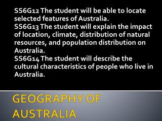
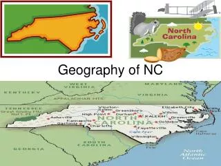
North Carolina, the 28th largest state in the U.S., stretches 500 miles east to west and 188 miles north to south. Its geography is intricately divided into four main regions: Tidewater, Coastal Plain, Piedmont, and Mountains. The Tidewater region features low elevation areas, numerous lakes like Lake Mattamuskeet, and significant swamps. The Coastal Plain is characterized by rolling hills and vast farmland. The Piedmont region, most populous, hosts large cities and industrial economies. Lastly, the Mountains region includes Mount Mitchell, the highest peak east of the Mississippi River, offering stunning landscapes and famous tourist attractions.

E N D
Geography of NC Basic facts 28th in size in US 500 miles from East/West 188 miles North/South Highest Point Mt. Mitchell Lowest Point Sea Level
Geography of NC • Composed of 4 regions • Tidewater • Coastal Plain • Piedmont • Mountains
Tidewater • Easternmost counties • 30 feet or less in elevation from SL • Several Sounds, Saltwater stretch of water that lies between two bodies of land. • Pamlico and Albemarle two largest • Numerous swamps, the largest is The Great Dismal Swamp (111,000 square miles) • Home of the Venus Flytrap!
Tidewater • Many Lakes, largest in NC being Lake Mattamuskeet(natural lake). Other lakes include Waccamaw, Phelps, and Great Lake. • Outer Banks: String of narrow islands with numerous inlets difficult to navigate if you don’t know them. • Graveyard of the Atlantic: Nickname for the Outer Banks because of numerous shipwrecks.
Above: Border sign at Camden County, Bottom Left mudflats of the Cape Fear River, Bottom right Venus Fly Trap native to GDS, Top Right Swamps meet the sounds
Lake Phelps (under Plymouth) and Lake Mattamuskeet. Below: Lake Phelps, Below Right Tundra Swans gather at Lake Mattamuskeet
Coastal Plain • Large rivers including Cape Fear, Tar, Neuse, Pee Dee, and White Oak. • Cape Fear busiest river in NC, • Large areas of flat or rolling hills • Sandhills in SW CP, popular tourist section, most of CP excellent region for large farms • Many military bases here, Example Ft. Bragg
Left: Pine trees being “tapped” for their tree sap Above-Weymouth Nature Preserve Below Left: A farm in SE of Southern Pines in Moore County Eastern NC. Below Right: Tryon Palace, the original colonial capital.
Piedmont • “at the foot of mountains” • Named after Italian province • Largest region of NC • Most large cities here, highest population • Economy based on Industrial or production of goods through machines. • Small farms • Also services or jobs that offer skills and knowledge instead of a physical good (ex. Banking, education, Legal services)
Above Moravian Wagon Right City of Winston Salem Below: Pilot mt. • Below Left Textile mill Below: Furniture Plant High Point
Above: Sauratown Mt, Stokes County Above: King’s Mt, Gaston County
Mountains • Mt. Mitchell highest peak E. of Miss R. • Average elevation above sea level 4,000 ft • Many large caves such as Linville Caverns (McDowell County) and Bat Cave (Buncombe County) • Part of the Appalachian system, extends from GA to ME. • Major tourist area, Blue Ridge Parkwaymttravel route.
Above: Swinging Bridge Grandfather Mt. Above: Linville Viaduct, Blue Ridge Parkway • Below: Mount Mitchell Below: mountains of NC in summer and fall