MARFC River Ice Briefing
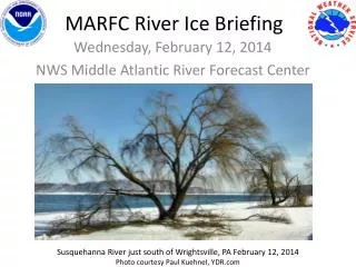
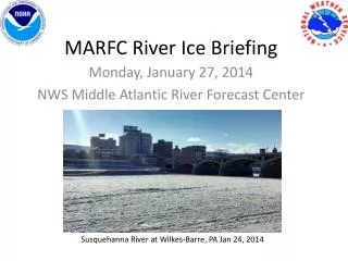
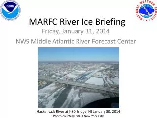
MARFC River Ice Briefing . Friday, January 31, 2014 NWS Middle Atlantic River Forecast Center. Hackensack River at I-80 Bridge, NJ January 30, 2014 Photo courtesy WFO New York City. Our Current Status. River ice continued to increase in areal coverage and strength all this week.

MARFC River Ice Briefing
E N D
Presentation Transcript
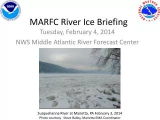
MARFC River Ice Briefing Friday, January 31, 2014 NWS Middle Atlantic River Forecast Center Hackensack River at I-80 Bridge, NJ January 30, 2014 Photo courtesy WFO New York City
Our Current Status • River ice continued to increase in areal coverage and strength all this week. • We may get some softening of the river ice this weekend with milder temperatures. Southeastern PA & Southern NJ in particular could see some ice melt this weekend. But without a good amount of rain to accompany this warmth, we are generally expecting ice to remain stable through early next week. • We are monitoring forecasts for the potential of a storm the middle of next week. The two important ingredients to break up the ice and have it start moving, building jams and possibly causing flooding is warmth and rain. Depending on how the storm evolves, the type and amount of precipitation we get (rain vs. snow) and the strength of any warming will all need to be determined. • We'll know more next week, in the meantime, stay alert, monitor http://weather.gov, and share river ice observations with your local NWS office.
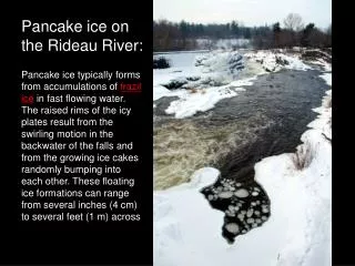
River Hydrographs – What’s going on? • The following 3 slides help explain why you’ve been seeing some strange river readings on the NWS river forecast website http://water.weather.gov • Depending on where the ice is in relation to the stream gage, or the type of streamgage equipment, the river readings will behave differently. • River forecasting is difficult enough, but with river ice, we cannot predict when these sharp quick rises or falls will occur. • This is why we need to stay in communication with each other, share our river photos and news about river ice.
Rises of this magnitude are likely the result of "anchor ice" building up on the orifice of the streamgage equipment. The ice increases the pressure that is measured by the equipment and is interpretted as an increase in river stage. When these readings are noticed, both the USGS and the NWS will filter these out as soon as possible.
Temperature Forecast for Saturday Where we have river ice, High Temperatures will range from the mid 30s to near 50 during the day Saturday. Overnight low temperatures will cool back into the 20s.
Temperature Forecast for Sunday High Temperatures Sunday will range from the mid 30s to near 50 Overnight lows will be in the 30s
Precipitation Forecast through the weekend Not enough rain is forecast in the Mid Atlantic to cause the river ice to break up this weekend.
Recent River Ice Photos & News • Thank you to everyone who is sharing your photos of the river ice with us. • We are sharing these photos, plus any news we gather, through our Facebook and Twitter accounts, everyday. Following MARFC on Facebook & Twitter is the best way to stay up to date on the river ice because, as you know, conditions can change rapidly. • If you notice anything urgent, such as a jam forming and flooding, please notify your local emergency management and your local National Weather Service office soon as possible.
How to stay updated • Monitor your river forecast at: http://water.weather.gov • Follow MARFC on Facebook https://www.facebook.com/US.NationalWeatherService.MARFC.gov • Follow MARFC on Twitter @NWSMARFC • Follow your local NWS Weather Forecast Offices too. They are also sharing photos and news about river ice.
Additional Resources • NWS Middle Atlantic River Forecast Center Website: http://weather.gov/marfc • NWS Temperature Forecasts: http://preview.weather.gov/graphical/ • NWS Precipitation Forecasts: http://www.hpc.ncep.noaa.gov/qpf/day1-7.shtml • NWS MARFC Water Temperature Observations (raw data - not quality controlled): http://www.erh.noaa.gov/marfc/Maps/water_temps/ • NWS Susquehanna and Delaware River Basins River Ice Website http://www.erh.noaa.gov/er/ctp/hydro/riverice/index.php
As long as conditions remain stable, the next MARFC River Ice Briefing will be Tuesday, February 4th. If you have any questions or concerns, please email patricia.wnek@noaa.gov