Introduction to Hurricane Forecasting
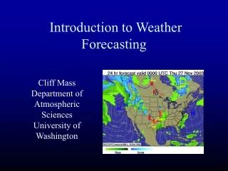
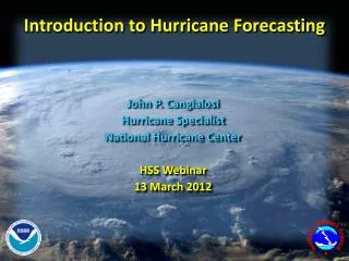
Introduction to Hurricane Forecasting. John P. Cangialosi Hurricane Specialist National Hurricane Center HSS Webinar 13 March 2012. NHC Six-Hour Forecast Cycle. 00:00. Hurricane specialist collect and analyze available observations. Reconnaissance data. Visible image. Radar loop.

Introduction to Hurricane Forecasting
E N D
Presentation Transcript
Introduction to Hurricane Forecasting • John P. Cangialosi • Hurricane Specialist • National Hurricane Center • HSS Webinar • 13 March 2012
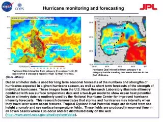
00:00 Hurricane specialist collect and analyze available observations Reconnaissance data Visible image Radar loop Microwave image
Receive satellite fix data 00:45 Hurricane specialist receives estimates of location and intensity via satellite imagery from 2 different agencies • Determine the center location • Determine past motion (6-12 h) • Determine the intensity/wind speed • Determine various wind radii • 34-, 50-, and 64-kt (when applicable)
Determining Initial Location 29/1525 TRMM 29/1318 SSMIS 29/1745 29/1745 29/1721
Computing Initial Motion (Speed) About 102 n mi during past 12 h yields 8-9 kt
Computing Initial Motion (Direction) About 300 degrees
How big is the storm? -NHC estimates cyclone “size” via wind radii in four quadrants NE NW SW SE Tropical Cyclone Wind Radii radii represent the largest distance from center in particular quadrant • Wind radius = Largest distance from the center of the tropical cyclone of a particular sustained surface wind speed threshold (e.g., 34, 50, 64 kt) somewhere in a particular quadrant (NE, SE, SW, NW) surrounding the center and associated with the circulation at a given point in time leads to an inherent over-estimate of radii, especially near land Wind radii in Hurrevac
Initialize models 1:00 After determining the center, strength, motion, and size of the tropical cyclone, the hurricane specialist gives that information to a supercomputer to run the models • Initialize computer models
Receive model guidance and prepare forecast 1:10 • Analyze and QC computer models • Prepare track, intensity, and wind radii forecasts
Intensity Prediction Water temperatures Amount of moisture Wind shear
Don’t Make Any Sudden Moves! (unless you really, really have to) • Previous official forecast exerts a strong constraint on the current forecast • Can damage credibility by making big changes from one forecast to the next, and then having to go back to the original Windshield Wipering Tromboning • Consequently, changes to the previous forecast normally made in small increments • We also strive for continuity within a given forecast • Gradual changes in direction or speed from 12 to 24 to 36 h, etc.
Dennis Guidance 6 July 1200 UTC Official forecast near model consensus in extreme western FL panhandle.
Dennis Guidance 6 July 1800 UTC Guidance shifts sharply westward toward New Orleans. Official forecast nudged westward into AL.
Dennis Guidance 7 July 0000 UTC Little overall change to guidance, but NGPI shifts slightly eastward. Little change in official forecast.
Dennis Guidance 7 July 0600 UTC Rest of the guidance shifts sharply eastward, leaving official forecast near the center of the guidance envelope (and very close to the actual track of Dennis.