4-d Digital Camera:
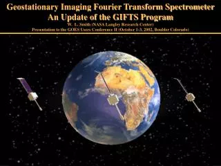
Geostationary Imaging Fourier Transform Spectrometer An Update of the GIFTS Program W. L. Smith (NASA Langley Research Center) Presentation to the GOES Users Conference II (October 1-3, 2002, Boulder Colorado).

4-d Digital Camera:
E N D
Presentation Transcript
Geostationary Imaging Fourier Transform Spectrometer An Update of the GIFTS Program W. L. Smith (NASA Langley Research Center)Presentation to the GOES Users Conference II (October 1-3, 2002, Boulder Colorado)
GeostationaryImagingFourierTransformSpectrometerGIFTS – A revolutionary weather forecast tool New Technology for Atmospheric Temperature, Moisture, & Winds Originators: NASA(LaRC), University of Wisconsin (CIMSS), and Utah State University (SDL) EO-3 “GIFTS-IOMI” 4-d Digital Camera: Horizontal: Large area format Focal Plane detector Arrays Vertical: Fourier Transform Spectrometer Time: Geostationary Satellite
Advanced Geostationary Studies (AGS) Program Roadmap Studies Laboratory Demonstration Aircraft Water Vapor Tracer Wind Demonstration Future Geo-Sats EO-3 (GIFTS-IOMI)
Partner Contributions NASA GIFTS Instrument & Supporting Technologies (~105 M) NOAA US Ground System, Algorithms, Data Processing & Archive (~40 M) Navy Spacecraft & Instrument Lifetime Enhancements (~70 M) Air Force (STP) Launch Vehicle & Launch Services (~65 M) Australia (BoM)* IO Ground System, Data Processing & Archive (~20 M) Revolutionary Weather Observations Validation of Next Generation Geostationary Meteorological Satellite System (~300 M) * Under negotiation
Indian Ocean Ops TECHNOLOGY GIFTS-IOMI Program Concept VALIDATION Imaging Interferometer Cryogenic Michelson Interferometer Laser Metrology System On-Board Calibration LFPA and Cryogenic Cooling 128 x 128 Infrared Detector Arrays Redundant Cryo-Coolers High Speed Signal Processing Rad-Hard Analog to Digital Converters PowerPC Rad750 Data Compression Rad-Hard Processors Pointing and Control Star Tracker 512 x 512 Visible Detector Arrays Lightweight Optics SiC Telescope INFUSION NASA - Demonstrate Wind Sounding Measurement Concept & Validate the Technologies NOAA - Demonstrate Operational Utility & Infuses Technology into NOAA instruments Navy - Provides Advanced Imaging/Sounding Data Products for Fleet Operations
GIFTS Sampling Characteristics • Two 128x 128 Infrared focal plane detector arrays with 4 km footprint size • Two 512 x 512 Visible focal plane detector arrays with 1 km footprint size • Field of Regard 512 km x 512 km at satellite sub-point • Ten second full spectral resolution integration time per Field of Regard • ~ 80,000 Atmospheric Soundings every minute
GIFTS IR Measurements and Products (8.8 to 14.6 microns) (4.4 to 6.1 microns) Products: Water vapor (soundings, fluxes, winds) Temperature (sounding, stability) Carbon monoxide concentration (2 Layers) Ozone concentration (4 Layers) Surface Temperature and emissivity Clouds (altitude, optical depth, microphysical properties, winds) Aerosol Concentration and Depth
GIFTS Performance Relative to GOES 2 x 1 Per 3000-km x 3000-km area 2 Vertical Resolution (3:1) per Area Resolution (4:1) per Coverage Rate (6:1) relative to GOES
GIFTS Improvements WRT GOES Sounding System 100 100 GIFTS (1750) GOES (18) Pressure (hPa) Pressure (hPa) 1000 1000 Moisture Weighting Functions GIFTS will have more and sharper weighting functions compared to the current GOES sounder Retrievals will have much better vertical resolution
GIFTS – Water Vapor Airborne Validation Airborne Demonstration of Concept: 1-2 km vertical resolution water vapor profile measurements Raob NAST Altitude (km) H2O Radiance Spectrum Relative Humidity (%) Wavelength (m) 3km Distance (75 km) Wavenumber(cm-1)
I-HOP Radiosonde Comparisons NAST:16:02 UTC 36.61N, -97.48W NAST:12.53 UTC 36.61N, -97.48W June 3, 2002 June 9, 2002 RAOB: WWR (14UTC) 36.43N, 99.53W RAOB: CF (15/18 UTC) 36.61N, 97.49W NAST:16:18 UTC 36.46N, 101.05 W NAST:19:40 UTC 36.,27N, 99.73 W June 12, 2002 June 11, 2002 RAOB: WWR (14UTC) 36.43N, 99.53W RAOB: WWR (17UTC) 36.43N, 99.53W
Wind Measurement δt~35 min NAST-I Water Vapor Tracking Demonstrates GIFTS Wind Profiling Technique 60 km x 40 km
GIFTS Fills Geostationary Data Void (India) 83 E GIFTS-IOMI (USA) 75º E
GIFTS – The Geostationary AugmentationOf the Earth Observing System (EOS) GIFTS CALIPSO CloudSat Aqua PARASOL Aura NPP/NPOESS
Summary • Weather & Air Quality Forecasting: • Hurricane landfall (steering wind profiles) • Tornadic storms (stability change monitoring) • Nowcasting (rapid measurement update) • Numerical prediction (initial p,T,q,V data) • Air quality forecasts (O3 and CO transport) • Enhanced Research Data Sets: • Aerosol and Cloud Radiation Feedback Mission • Atmospheric Chemistry Mission • Global Precipitation Mission • Global Weather Experiments (e.g., THORPex) • Technology Transfer into GOES: