Download

1 / 12
120 likes | 158 Vues
This presentation introduces Dennis Mkhonta from Swaziland Meteorological Service, covering weather patterns, services, and challenges in Swaziland. Learn about the country's climate, economic factors, and meteorological department structure.

E N D
Swaziland Presentation Mahe 4th – 8th May 2015 By Dennis S. Mkhonta email: dennis.mkhonta@gmail.com
PURPOSE OF THIS PRESENTATION • To introduce myself, to fellow participants in the Training Workshop for National Meteorological and Hydrological Services (NMHSs) on Design Socio-Economic Benefits Studies of Meteorological/ Hydrological Services and Products for Members of the Southern African Development Community (SADC) • Briefly tell about country and organization 2
BACKGROUND • My name is Dennis SikhulisoMkhonta from the Kingdom of Swaziland. • I am a Senior Forecaster and Focal Person for the Swaziland Meteorological Service with the WMO Public Weather Service (PWS).
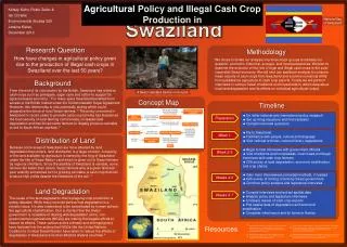
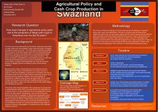
Background Swaziland’s geographical position exposes the country to weather systems from: The Indian Ocean i.e Tropical cyclones, Torrential rains (Summer Season) Tropical unstable air from the north. (Summer Season) Cold fronts from the south. (Summer and Winter) Convection from the west (Summer) Strong damaging winds from the west in winter Tropical Air Cyclones Convection Cold Fronts
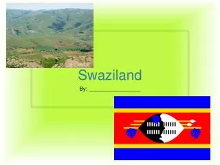
Swaziland • Swaziland is a land locked country with a total area of 17,364 km2 (6,704 sq mi) • Population as of 2014 estimate1,106,000 -2007 census1,018,449 • GDP (PPP) 2014 estimate - Total$7.039 billion - Per capita $6,367
Climate of Swaziland • Divided into four climatic regions, the Highveld, Middleveld, Lowveld and Lubombo plateau. • The seasons are the reverse of those in the Northern Hemisphere with December being mid-summer and June mid-winter. Generally speaking, rain falls mostly during the summer months, often in the form of thunderstorms.
Weather hazards Summer –Severe thunderstorms with hail, lightning and strong damaging winds. - heavy rains that lead to flooding, flash floods and tropical cyclones Winter – strong winds that result in wild fires, frost, very cold temps and mountain snow
The Met. Department • Established by an Act of Parliament • The only authorized provider of met services in support of the social and economic development of Swaziland and the safety and well being of the people of Swaziland. • Has personnel of less than 40 with an annual budget of about E8m approx $678000.00 • Divided into 5 sections: Forecasting, Support, Advisory, Climate change and Administration
The Met. Department cont. • The forecast section deals with public/ general, aviation forecasts and Public weather services • Support is mainly for taking care of station network • Advisory deals with data retrieval and archiving and also agromet advisories. • Climate change issues are taken care of by the climate change section which also deals awareness.
The Met. Department cont. • Public weather forecasting is the currently the mhost visible of all the sections as it deals wit warnings on hazardous weather events and as such government ministries including the NDA use the products for their emergency preparedness. • The weakest section is the support which lacks funding and depends on donor funding mostly.
Products and services provided • Swaziland’s economy mainly depends on the agricultural and tourism sector. • Swaziland's forests (pine and eucalyptus) are among the world's largest planted forests, covering 161,000 ha (398,000 acres), or about 9% of the land area. As a result FDIs are mostly on demand manly in winter. • Seasonal forecasts are on high demand with the farming community for planning purposes.
End Thank you! Siyabonga!!