Download

1 / 92
930 likes | 1.12k Vues
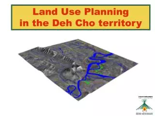
Land Use Planning in the Deh Cho territory. Agenda. WHAT IS LAND USE PLANNING? UPDATE ON DCLUPC ACTIVITIES & PROGRESS INPUT DATA FOR LAND USE OPTIONS LAND USE OPTIONS + ECONOMIC MODEL CUMULATIVE EFFECTS RESEARCH QUESTIONS AND DISCUSSION 7:00 – 9:00 P.M. OPEN HOUSE.

E N D
Agenda • WHAT IS LAND USE PLANNING? • UPDATE ON DCLUPC ACTIVITIES & PROGRESS • INPUT DATA FOR LAND USE OPTIONS • LAND USE OPTIONS + ECONOMIC MODEL • CUMULATIVE EFFECTS RESEARCH • QUESTIONS AND DISCUSSION 7:00 – 9:00 P.M. OPEN HOUSE
Committee & Staff • Committee Members • 2 DCFN reps (Tim Lennie and Petr Cizek) • 1 GNWT rep (Bea Lepine) • 1 Federal Government rep (Adrian Boyd) • Chairman selected by the 4 members (Herb Norwegian) • 5 Staff Members • Executive Director (Heidi Wiebe) • Office Manager (Sophie Bonnetrouge) • GIS Analyst (Monika Templin) • Land Use Planner (Paul Wilson) • Land Use Planner Trainee (Priscilla A. Canadien)
What is Land Use Planning? Potential Land Uses Decisions (Planning Partners) (Staff & Committee) ? ? ? ? • DevelopmentConservation • Forestry - Green TLUO – Red • Tourism – Orange Wildlife – Blue • Oil and Gas – Purple Archaeology - Black • Minerals – Brown • Agriculture – Yellow Zones (Planning & Management)
Land Use Planning in the Deh Cho • Land Use Planning means determining what types of land use activities should occur and where they should take place • “The purpose of the plan is to promote the social, cultural and economic well-being of residents and communities in the Deh Cho territory, having regard to the interests of all Canadians.” • Our planning area extends to the whole Deh Cho territory, excluding municipal areas and Nahanni National Park Reserve
Land Use Planning and the Deh Cho Process • Land Use Planning is only one part of the larger Deh Cho Process of negotiations looking at land, resource management and governance issues • Draft Land Use Plan (2005) • Final Land Use Plan (March 2006) • Land Use Plan used by three parties to negotiate in the Deh Cho Process • Complete Deh Cho Process (~ 2008)
Planning Partners + + 2nd Priority Businesses, Associations, non- governmental organizations 1st Priority Residents Approve Plan
Planning vs. Management • Our mandate is to plan for future resource development – map potential, identify issues, write final plan to show “what” and “where” • We are not involved in past or current resource applications – current government structures do that (DCFN, GNWT and Gov of Canada) • May change with Deh Cho Process – Future Deh Cho Resource Management Authority
Update on DCLUPC Activities & Progress • Staff Recruitment • Round 1 Consultation Feedback • Q & A Report • Further Research: • Wildlife Workshop, • Dene Nahodhe Workshop • Economic Development Model Completed • Reviewing Various Land Use Options
Land Use Options • Land Use Options represent different visions for the final land use map • Represent 5 different levels of development • Based on information (mostly scientific) gathered to date – no community or planning partner input yet • Will be revised based on feedback and presented at the next round of meetings
Wildlife • Traditional Knowledge & Expert Research • Regional Wildlife Workshop - Held: November 2003 • 308 species in the Deh Cho territory (3 amphibians, 36 fish, 213 birds and 56 mammals) • Key species include: • Caribou, Moose, Bison, Fish and Waterfowl for consumption • Trumpeter Swan, Whooping Crane, Peregrine Falcon (Endangered) • Black Bear, Grizzly Bear, Furbearers, Dall’s Sheep, and Mountain Goat (Trapping & Hunting species) • Critical wildlife areas include: • Nahanni National Park Reserve • Mackenzie Bison Sanctuary (denning, staging and calving, etc.) • Edehzhie • Central area between Fort Liard & Wrigley • Important consideration for Cumulative Effects Management
Traditional Use Density • Important to Traditional Dene Lifestyles • Information gathered by DCFN • Consulted over 386 harvesters and mapped information • Harvest areas, kill sites, sacred sites, berry patches • DCFN approved publication and use at Kakisa Assembly 2004
Archeology, Cabins, Historic Sites & Rare features • Evidence of past human use • Important small sites i.e. fire rings, cabins, trails • Buffer required for protection • Development must avoid these areas • Rare Features: • i.e. Hot Springs and Karst Formations Conservation Value is determined by distance from these important sites
Agricultural Potential • Minor Land Use – not developed • Small scale, market gardening within community boundaries • Lack of development and research on large scale agriculture • What are the barriers to development? • Limitations • Northern Edge of Agricultural Zone • Climate, short growing season, water logged soils and stoniness (Highest known potential Upper Mackenzie & Liard Valleys) • Difficulties with access and power requirements • Competitive Advantage • Southern producers have better growing conditions, cheaper costs, larger market, better distribution network • Potential for community use
Agricultural Soil Capability Class Very High: 1 No significant limitations ; wide range of crops possible; not found in the Deh Cho . High: 2 Moderate limitations; restricted range of crops; some conservation practices required; moderate to high productivity; found in the Liard Valley. Moderate: 3 & 4 Moderate to severe limitations ; reduced choice of crops; special conservation practices required; high risk of crop failure; found throughout the upper Mackenzie River and Liard River valleys. Low: 5 - 6 Unsuitable for annual field crops; only grasses, legumes, or perennial forage plants; limited improvements possible; some natural grazing capacity; limitations too severe for other crops; scattered throughout the upper Mackenzie River and Liard River valleys. No Potential: 7 Organic soils and unmapped areas. (Day. J.H. 1966-8.).
Access and Power • RWED indicated no agricultural development > 20 km from existing power grids due to the increased cost of extending the power grid • Soil Capability Rankings were modified as follows: Distance From Existing Power Grid Within 5 km Agricultural potential rankings were not changed 5 – 10 km Downgraded one rank to account for additional costs which might prevent some potential areas from being developed (i.e. if the area was ranked moderate based on agricultural potential, it would be downgraded to low). We did not downgrade low potential areas as they are already at the lowest class. 10 – 20 kmDowngraded 2 ranks. Again, we did not downgrade past low so both high and moderate agriculture classes would now be ranked as low. >20 km Considered to have no potential (Gene Hachey pers. Comm.).
Minerals • Assessed 9 mineral types thought to have the most potential in the region • The highest potential is in the western tip of the territory, moderate in the west-central portions and low in the remaining areas • The most significant minerals types are Copper, Lead-Zinc & Tungsten (existing mines) • The western portion has high to very high potential for Skarn (Lead-Zinc, Gold and Tungsten)
Oil & Gas • 20 hydrocarbon plays in the Deh Cho • 9 confirmed • 11 unconfirmed • 419 hydrocarbon wells drilled, most are wildcat wells (exploratory) but 127 (25%) found hydrocarbons • Current producing regions are Fort Liard and Cameron Hills; other significant discoveries found but not yet developed • Greatest potential is in the Liard Plateau and the Great Slave Plain (northern extension of the western sedimentary basin)
Tourism • The greatest potential is along the Mackenzie and Liard River valleys and radiates out from communities (the “hub and spoke” effect.) • Exceptionally scenic, offer various types of tourism experiences and have good access • Key tourism destinations include Nahanni National Park Reserve, the Ram Plateau and North Nahanni River, Little Doctor Lake, Cli Lake, Trout Lake and some lodges • Deh Cho tourism is not well developed but has lots of potential - it can still offer tourists pristine wilderness free from commercial interruption
Forestry Potential • Productive timber stands around Fort Liard, Nahanni region, Jean Marie River and the Cameron Hills • Current timber harvest well below sustainable harvest levels (20 years harvest) • Low prices $ and difficult access may impact commercial viability • Potential for community use for log houses and cut lumber in fly-in communities
Preliminary Land Use Options • Change Priority of Conservation and Development • Create 5 Land Use Options • Shows a range of possibilities available • Compare to Current Land Withdrawals • Use Economic model to compare effects on economy Low Development High Conservation High Development Low Conservation Options 1 2 3 4 5
Zones • Multiple Use Zones: all development uses permitted subject to general regulations • Conservation Zones: no development permitted • Uncertain Zones: conservation and development hold equal priority, no decision possible • Traditional Use Allowed Everywhere
Land Use Option # 1 • Priority given to development sectors (Multiple Use Zones) • Some Uncertain Zones • Few conservation areas outside Nahanni and Edehzhie • Employment: 51,339 new person-years of employment (~3000 per year) • In-Migration: 3041 people need to move here to fill jobs • Tax Revenues: $3 billion over 20 years ($150 million/yr) • GDP: $11.6 billion over 20 years ($580 million/yr) • Move to wage employment and modern lifestyle • Education, training and management a priority to secure benefits for communities • Fragmented wildlife habitat and population declines • Loss of traditional knowledge culture and language • Other factors determine if development occurs
Land Use Option # 2 • Development focus although more weight to conservation than Option 1 • Conservation Zones protect key wildlife habitats and traditional areas i.e. Nahanni National Park • No Uncertain Zones – clear what is permitted development • Employment: 41,000 new person-years of employment (~2044 per year) • In-Migration: 1941 people need to move here to fill jobs • Tax Revenues: $2.0 billion over 20 years ($100 million/yr) • GDP: $8.8 billion over 20 years ($440 million/yr) • Strong Economy – lots of opportunities, especially in the South Deh Cho • Habitat fragmentation - may impact traditional harvesting • Lifestyle changes may result in loss of traditional knowledge culture and language • May increase social problems
Land Use Option # 3 • Balance of Development and Conservation Priorities • Uncertain Zones cover 40% of the Deh Cho - special conditions for development may apply • Conservation Zones better able to sustain wildlife populations, traditional harvesting and seasonal employment • Employment: 25,128 new person-years of employment (~1250 per year) • In-Migration: 1000 people need to move here to fill jobs • Tax Revenues: $1.25 billion over 20 years ($62.5 million/yr) • GDP: $5.4 billion over 20 years ($270 million/yr) • Economic benefits available from development including employment given sufficient education and training • High disposable income for some, immigration and pressure on housing and social and medical services • Opportunity to balance traditional lifestyle and development
Land Use Option # 4 • Focus on Conservation layers, Wildlife and TLUO promotes subsistence harvesting and traditional activities • Some Multiple Use Zones for Development - no Uncertain Zones • Employment: 24,951 new person-years of employment (~1248 per year) • In-Migration: 1057 people need to move here to fill jobs • Tax Revenues: $1.2 billion over 20 years ($60 million/yr) • GDP: $5.4 billion over 20 years ($270 million/yr) • Some benefits from development i.e. employment and tax revenue • Young people may leave communities or Deh Cho for employment or education • Local and regional governments are a major employer and have a lead role in skills development
Land Use Option # 5 • Conservation Zones a Priority to promote traditional use and culture • Development restricted to areas away from communities with high potential • A few Uncertain Zones where decisions have to be made • Employment: 14,514 new person-years of employment (~726 per year) • In-Migration: 700 people need to move here to fill jobs • Tax Revenues: $628 million over 20 years ($31.4 million/yr) • GDP: $2.5 billion over 20 years ($125 million/yr) • Lack of revenue and income may limit services and opportunities • Lack of opportunities may create social problems • Young people may leave communities or even the Deh Cho for employment or education • Key role for government in employment, training and controlling development
Interim Land Withdrawals Approval Land Use Planning • Land Withdrawals identified critical areas for interim protection • Land Use Plan will revise Land Withdrawals 5 years in parallel Interim Land Withdrawals
Current Land Withdrawals • 50% of the Deh Cho is protected • Other 50% available for development subject to IMA conditions • No uncertain zones • Employment: 41,000 new person-years of employment (~2,045 per year) • In-Migration: 2099 people need to move here to fill jobs • Tax Revenues: $2.5 billion over 20 years ($125 million/yr) • GDP: $9.0 billion over 20 years ($450 million/yr) • Assumes full development – currently not the case • Many other factors determine whether or not development proceeds • Environmental factors • Political factors and regulatory certainty • Market values of natural resource products • Infrastructure and access • Interest and marketing