FLOODS
Hydrology and Water Resources RG 744 Institute of Space Technology December 18 2013. FLOODS. Flood: Peak in a hydrograph. Response of river to precipitation An unusually high stage of a river May fill up the stream up to its banks and often spills over to the adjoining flood plain.


FLOODS
E N D
Presentation Transcript
Hydrology and Water Resources RG 744 Institute of Space Technology December 18 2013 FLOODS
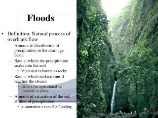
Flood: Peak in a hydrograph • Response of river to precipitation • An unusually high stage of a river • May fill up the stream up to its banks and often spills over to the adjoining flood plain
Movement of Flood Wave • Flood may be considered as a wave that propagates downwards • In an ideal channel with frictionless fluid, flood wave may be considered traveling with no change from its point of origin • In natural channel energy is lost due to frictional forces • As a result magnitude of flood wave reduced or attenuated as it travels downstream • But discharge may also increase in downstream reaches due to increase in watershed area
Flood Estimates • Estimate of extreme flood flow is required for the design of hydraulic structures • Proper selection of design flood value is of great importance • A higher value results in an increase in the cost of hydraulic structures, • An under-estimated value is likely to place the structure and population involved at some risk • Magnitude of flood may be estimated in accordance with the importance of the structure
Design Flood • Design flood may be defined as • The maximum flood that any structure can safely pass • The flood considered for the design of a structure corresponding to a maximum tolerable risk • The flood which a project (involving a hydraulic structure) can sustain without any substantial damage, either to the objects which it protects or to its own structures • The largest flood that may be selected for design as safety evaluation of a structure
Routing Routing is the process of predicting temporal and spatial variation of a flood wave as it travels through a river (or channel) reach or reservoir There are Hydrologic and Hydraulic Routings – here we will study Hydrologic Routing
Flood/Channel Routing • Once overland flow arrives at a stream it becomes channel flow • Routing • To know how outflow from a reservoir/stream is related to its inflow? • What the downstream hydrograph (outflow) will be if upstream hydrograph (inflow) is known?
Hydrologic Routing • Known parameters: • you have a hydrograph at one location (I) • you have river characteristics • Need: • a hydrograph at different location (O)
Flood Routing 1 2 3 4
Hydrographs routed thru one reach of the watershed I – Q = dS/dt
Routing Impact: Inflow, Outflow Hydrographs Assume no seepage, leakage, evaporation or inflow other than main inflow
Hydrologic Routing • In hydrologic routing techniques, equation of continuity and an analytical/empirical relationship between storage and outflow in a river or reservoir are used • Continuity Equation: I – O = ΔS/Δt Where: I = Inflow rate O = outflow rate ΔS/Δt = rate of change of storage
Application of Flood Routing • Flood prediction and flood warning • Design of hydraulic structures (dams, spillways, etc.) • Evaluation of flood control measures • Etc.
Two Flood Routing Problems • Reservoir Routing (storage routing): • Study of effect of a flood wave entering a reservoir • River Routing (channel or stream flow routing): • change in shape of hydrograph as it travels down a channel is studied
River vs. Reservoir Routing • During the advance of a flood wave, inflow exceeds outflow producing a wedge of storage • During the recession, outflow exceeds inflow, resulting in a negative wedge • Also, there is a prism of storage which is formed by a volume of constant cross-section along the length of prismatic channel • Assumption: X-sectional area of the flood flow is directly proportional to the discharge at that section S = KQ Levelpool reservoir
Flood Routing in River • Predicting temporal and spatial variation of a flood wave as it travel through a river reach • Flood waves passing down a river have their peaks attenuated due to storage characteristics of the stream reach if no lateral inflow is added
Muskingum Method • Estimates the transformation of flood wave as it moves through a river channel S = KO + KX(I-O) S = storage O = Outflow I = inflow X = weighting factor that varies between 0 and 0.5 K = storage time constant (T)
Muskingum Method Homework: show derivation of the above simplified equations
Example: • tp = 4 hr • L = 2 miles • Vavg = 2.5 ft/s • K = ? • X = ? • Δt = ? • Co =? • C1 =? • C2 =?
Flood Routing in Reservoir • Reservoirs are important in flood control because of large storage capacity • Downstream hydrograph peaks are smaller in magnitude and delayed in time
Peak flow at the upstream side of the reservoir is controlled in such a way that the flow at the downstream side is reduced to safe discharge • In figure below upstream hydrograph has higher peak with shorter base • Flood waves passing through a reservoir have their peaks attenuated and time base enlarge due to storage • Downstream hydrograph with lower peak and broader base achieved by detaining flood water for some time by closing the spillways and then gradually releasing it
Flood routing involves • Fixation of maximum reservoir level up to which the structure is completely safe • Implementation of outflow pattern from the reservoir so that it may not create any danger in the downstream side Inflow = outflow + change in storage
Reservoir Routing • Two relationships specific for reservoir
Reservoir Routing • Data required • Inflow hydrograph • Starting elevation above spillway
Storage-Indication Method • Consider a reservoir having an ungated spillway (weir, outlet discharge pipe) or gated spillway with fixed position • Use relationship between outflow (Q) and elevation head (H) for a sharp crested rectangular weir Q = CLH3/2 • Q = Discharge at the outlet (cfs) • C = Discharge coefficient of weir (cfs) • L = Length of crest (ft) • H = Depth above spillway
Reservoir Routing • Estimation of Δt • Δt < tp/5
Flood Estimation • Rainfall-runoff modeling • Flood Frequency Analysis (Statistical methods)
Review: Flood Frequency Analysis • There may be floods exceeding the design specification of a structure • What is a probability of those floods occurring in any given year • The probability of a flood exceeding or equaling a given magnitude? • Highest or peak discharges (floods) in each year used for calculation • Procedure for frequency calculation: Refer lecture 3 under “ Recurrence Interval of a Storm”
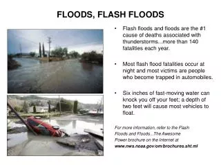
History of Floods • Floods occurring along rivers, streams and in coastal area are natural events that have always been occurring throughout the history • Due to excessive rain runoff increases and streams or rivers overflow
Natural Floodplain Features • Floodplain: Normally dry land area adjoining rivers, streams, lakes, bays or ocean that is undated during flood events