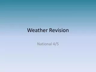
Weather Revision
Weather Revision. National 4/5. What is the difference between weather and climate?. Weather is the day to day changes in the atmosphere. . precipitation. temperature. humidity. wind speed. wind direction. cloud cover. air pressure. sunshine. Climate graphs.

Weather Revision
E N D
Presentation Transcript
Weather Revision National 4/5
What is the difference between weather and climate? Weather is the day to day changes in the atmosphere. precipitation temperature humidity wind speed wind direction cloud cover air pressure sunshine
Climate graphs Climate graphs are a way of showing how temperature and precipitation vary throughout the year for a particular place.
The British Climate The British Isles has a temperate climate. This means that it is not too hot, not too cold, not too dry and not too wet!
Why is the South of Britain warmer than the North? Therefore, the sun’s rays are more concentrated in the South rather than the North of Britain.
Why is it warmer in the West in January? TheNorth Atlantic Driftis a warm ocean current that brings higher temperatures to the west of the UK. The North Atlantic Drift starts its journey in the Gulf of Mexico.
Rainfall in the British Isles Describe the pattern of rainfall in the UK. Why is there more rainfall in the West of the British Isles?
The West is therefore more likely to experience relief rainfall. Why is there more rainfall in the West? Many of the mountain ranges in the British Isles occur in the West.
The prevailing wind comes from the SW. This wind blows over the Atlantic, bringing moisture-laden air. Why is there more rainfall in the West? The prevailing wind is the most common direction of wind.
Can you explain? This is a wet day in February. Explain the following… 1) why C is warmer than B. 2) why it is raining at D. 3) why A is colder than B.
The junction between these two different air masses is called a front. A front is associated with a change in the weather. What happens to the weather when the air masses meet? Depressions (low pressure system) form when a cold air mass meets a warm air mass.
A warm front means that warm air is coming. At a warm front, warm air is rising over cold air. This usually produces clouds and rain. A cold front means that cold air is coming. At a cold front, cold air pushes under the warm air. This produces strong winds and heavy rain. What happens at fronts?
Formation of a depression Click on the red labels find out more!
At night, however, there are no clouds to stop the heat escaping so nights can be cool. Cloud free Europe High pressure systems When air sinks and warms this causes a high pressure system. There are clear skies and no rain. In Summer, clear skies mean that there are no clouds to stop the sun shining through and so days can be warm.
High pressure systems In Winter, high pressure systems give rise to clear, bright days. However, clear skies also mean that there are no clouds to stop the heat escaping and so ice and frost can form.
Isobarsare lines joining areas of equal pressure. LOW Pressure is decreasing towards the middle. This is a low pressure system. Pressure is shown in millibars. Synoptic charts Synoptic charts are charts of surface pressure. They help meteorologists predict the weather.
This is a high pressure system. The pressure is increasing towards the centre. HIGH Synoptic charts What type of pressure system is shown on this chart? isobars
Cloud Cover (oktas) Wind Speed (mph) Precipitation Weather Symbols
Synoptic charts C A B • Is this a low or high pressure system? • Describe the weather at A, B and C.
F D Match the statements to the correct letter/s. Wind speed 8-12 mph C Low Pressure High Pressure Clear Sky E Drizzle A G Rain Shower B Northerly winds Overcast Wind speed 18-22 mph North westerly winds