Download
1 / 25
250 likes | 422 Vues
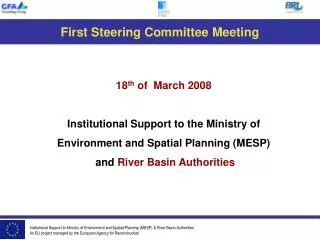
This report outlines the proceedings of the Steering Committee meeting held on January 23, 2008, focusing on institutional support to the Ministry of Environment and Spatial Planning (MESP) and River Basin Authorities. Key discussions centered on the implementation of information systems for water resource management, monitoring networks for rivers and groundwater, and modeling tools for flood risk and water resource planning. The importance of training and capacity building in these areas was emphasized, alongside planned activities for the next period. The report also addresses identified problems and risks affecting ongoing initiatives.

E N D
Steering Committee Meeting 23th of January 2008 Institutional Support to the Ministry of Environment and Spatial Planning (MESP) and River Basin Authorities
1 - Information system for water resource management Laboratory analysis Data capture and storage, exchange Reference data - GIS
RESULT 1 - Information System for Water Resource Management -
RESULT 1 : Problems / risks, plan for next period Info. available and transparent Partners sufficient resource and capacity Partners sufficient resource and capacity
2- Monitoring system River Lakes Ground Water Protected zones Monitoring system Laboratory analysis Insure the quality of data Storage and control in the Hydrometerological institute (HMIK) or other institutions Programme of surveillance (WFD) WISKI software
RESULT 2 : Problems / risks / plan for next period Importance of monitoring understood Sufficient detail and quality informed decisions for the design TOR
3 - Modeling for water resource planning Data capture and storage, exchange Indicators, Water quality evaluation Data use for planning, decision Synthetic information for public and stakeholders Feasibility, Involvement of stakeholders River Basin Authorities inputs Realistic objectives and Plans Permit Issuing Tools box of modelsAssumptions, scenario Water demand, water balance,
RESULT 3 : Problems / risks / plan for next period Availability of staff with sufficient modelling background Quality of recent and future data
4 - Modeling for flood risks plans Data capture and storage, exchange Indicators, Water quality evaluation Data use for planning, decision Synthetic information for public and stakeholders Feasibility, Involvement of stakeholders River Basin Authorities inputs Realistic objectives and Plans Flood risk maps and plans Tools box of models Flood risk Vulnerable areas
RESULT 4 : Problems / risks / plan for next period Availability and quality of data
Steps Towards River Basin District Authorities Establishement A first draft has been submitted to the Water Department for internal discussion
Outputs done in 2008 / Outputs to be done in 2009 Outputs done To be done Data catalogue Data status report Codification -database Pilot Project Strategy monitoring- Data quality Tor Groundwater ToR Monitoring system Pilot project Model set up and tested Water balance Pilot project (PP) Flood risks plans Draft WSS investment Plan RBA Inst Dev. Plan Training plan report
Subjects with progress expected in the next 3 months INFORMATION SYSTEM Sql /GIS database prototype for permitting, Ground water acquisition, Data catalogue, databases for measurements data, preparation of pilot exercises MODELING WITH WEAP – River basin management Calibration of model Water demand , water balance assessment with participation of stakeholders MODELING FLOODING RISKS Study on floods events and of vulnerability of areas WATER SUPPLY AND WASTEWATER INVESTMENT PLAN Donors meeting to receive comments on the INSTITUTIONS comments on role of RBDA and on draft subsidiary act TRAINING Preparationof training tours a) Lab. Analysis, b) Institutions c) Hydrology
MANAGEMENT ISSUES - CONCLUSIONS • Process of replacement of KE3 is under way • More contacts and discussion about the development of River Basin District Authorities needed, • Project monitoring mission and mid-term review of the project with the partners will provide opportunities to optimise allocation of project resources for project results achievement • Practices of the methodologies and tools developed has to be developed • New activities will start especially on flooding risks, on groundwater information acquisition and ToR for drilling contract and for monitoring
THE END Thank you for your attention