Download
1 / 19
190 likes | 324 Vues
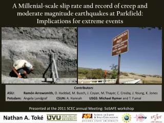
A Millenial -scale slip rate and record of creep and moderate magnitude earthquakes at Parkfield: Implications for extreme events. Presented at the 2011 SCEC annual Meeting: SoSAFE workshop. Nathan A. Toké. Contributors

E N D
A Millenial-scale slip rate and record of creep and moderate magnitude earthquakes at Parkfield: Implications for extreme events Presented at the 2011 SCEC annual Meeting: SoSAFE workshop Nathan A. Toké Contributors ASU: Ramón Arrowsmith, D. Haddad, M. Busch, J. Coyan, M. Thayer, C. Crosby, J. Young, K. Jones Potsdam: Angela Landgraf CSUN: A. Hannah USGS: Michael Rymer and T. Fumal
Reviewhistorical slip release (mechanisms and rates) atParkfield along the SAF. • Late Holocene Paleoseismic results from the Miller’s Field site 1km south of Parkfield, CA. (deformation structures and slip rate) • Historic and Late Holocene records agree • Discussion Points • distributed fault parallel slip? • variable long term moment release?
Visualizing the historical slip release at Parkfield Toke and Arrowsmith, 2006 Similar to Murray and Langbein, 2006 ~ 0 mm/yr ~ 10 mm/yr ~ 28 mm/yr Aseismic slip
Historically we have: At Parkfield: Creep ~10 mm/yr 6-8 earthquakes with ~40cm in 153 years Slip rate = creep + earthquakes = 10 mm/yr + (2400 to 3200 mm)/ 153 yr) = 10 mm/yr + (16 to 21) mm/yr = 26-31 mm/yr ~10% less than Carrizo Estimates
Fault surfaces are primarily oblique to the SAF strike filled with clay, minimal displacement Probably filled surface cracks from creep and small ruptures
Similar faulting fabric -extends to surface -fabric merges at depth Despite the location, no colluvial wedge deposits.
NO Colluvial Wedges NO Filled Fissures No good evidence of large earthquake ruptures… Deformation fabrics consistent with surface slip from Creep and moderate magnitude ruptures!
Offset channel: 18.5-23.0 m Age of offset: 890-1450 A.D.
Millennial-scale Slip Rate: 26.2mm/yr +6.2/-4.2 (using software of Zechar and Frankel, 2010)
Results • Trenches exposed 1000-3000 years of stratigraphy (fluvial terrace and sag pond) • No good evidence for large magnitude ruptures • Structures in trenches: Numerous, SAF oblique, Clay Shear Bands that extend to the surface – consistent with observations of creep and earthquakes that barely break the surface. • Right lateral stream offset is constrained by the age of the fluvial terrace in which it is incised and its first datable deposits within the sag pond: yields a 1 sigma slip rate of 26.2 +6.4/-4.3 mm/yr over the past ~1000 years
The Question • If the late Holocene slip rate at Parkfield is ~10% lower than the Carrizo (e.g., Sieh and Jahns, 1984), where does the remaining slip go? • Is it distributed among sub-parallel structures? • Is the slip rate modulated over longer time spans? (in extreme events?)
Conclusions The data are pointing toward the idea that there is little slip deficit northwest of Cholame, CA Extending the paleoseismic record back farther in time and spatially in width from the SAF would be advisable. We need suitable sites.
Lienkaemper and Prescott, 1989, Historic surface slip along the San Andreas Fault near Parkfield, California: Journal of Geophysical Research. Murray and Langbein, 2006, Slip on the San Andreas Fault at Parkfield over two earthquake cycles and the implications for seismic hazard: Bulletin of the Seismological Society of America. Noriega et al., 2006, Stream Channel offset and late Holocene slip rate of the San Andreas fault at the Van Matre Ranch site, Carrizo Plain, California: Bulletin of the Seismological Society of America. Platt and Becker, 2010, Where is the true transform boundary in California: G3. Sieh, 1978, Central California foreshocks of the Great 1857 Earthquake. Bulletin of the Seismological Society of America. Sieh and Jahns, 1984, Holocene activity of the San Andreas fault at Wallace Creek, California: GSA Bulletin. Sims, 1887, Late Holocene slip rate along the San Andreas fault near Cholame, CA: Annual GSA Cordilleran Meeting Titus et al., 2006, Thirty-five year creep rates for the creeping segment of the San Andreas fault and the effects from the 2004 Parkfield earthquake: Constraints from alignment arrays, continuous GPS, and creepmeters: Bulletin of the Seismological Society of America. Titus et al., 2011, Geologic versus geodetic deformation adjacent to the San Andreas fault, central California: GSA Bulletin. Toke et al., 2006, Paleoseismic and post-seismic observations of slip along the Parkfield segment of the San Andreas Fault: Bulletin of the Seismological Society of America. Toke and Arrowsmith, 2006, Reassessment of a slip budget along the Parkfield segment of the San Andreas Fault: Bulletin of the Seismological Society of America. Toke et al., 2011, Late Holocene slip rate of the San Andreas fault and its accommodation by creep and moderate magnitude earthquakes at Parkfield, CA: Geology. Zechar and Frankel, 2010, Incorporating and reporting uncertainties in fault slip rates: Journal of Geophysical research. Zielke et al., 2010, Slip in the 1857 and earlier earthquake along the Carrizo Plain, San Andreas Fault: Science.