Gridded TAF Generation and the RLX Enhanced Short-Term Forecasting Program
340 likes | 505 Vues
Gridded TAF Generation and the RLX Enhanced Short-Term Forecasting Program. Chris Leonardi ER Sub-Regional Aviation Conference May 24, 2006. State of the art West Virginia weather forecasting!. Outline. Enhanced Short Term Forecasting Polices/procedures/philosophy Science/models

Gridded TAF Generation and the RLX Enhanced Short-Term Forecasting Program
E N D
Presentation Transcript
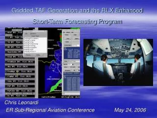
Gridded TAF Generation and the RLX Enhanced Short-Term Forecasting Program Chris Leonardi ER Sub-Regional Aviation Conference May 24, 2006
Outline • Enhanced Short Term Forecasting • Polices/procedures/philosophy • Science/models • Gridded aviation forecasting • What, when, why, and how • Pros/cons and lessons learned • Stats • Ongoing work
Enhanced Short Term • 12+ Hour, High Detail, Deterministic, Hourly Grids • Focus off text onto meteorology • Full Automation of selected text products • AFM, PFM, SFP, FWF • 90% Automation “primary” text products • ZFP, NWR ZFP, NOW • Generated by schedule • Forecaster/HMT reviews and sends
Enhanced Short Term • ZFP • 4 times/day • Low detail • One County One Zone • Standard 39 zones (out of 49) • Run manually if deadline is missed or update desired
Enhanced Short Term • NWR ZFP • Every 3HRs • 3 HR detail first 12 hours • 6 hour detail period 2 and 3 • 12 hour detail beyond period 3 • Maximum of 2 groups • NOW • One County One Zone, 12 hr forecast • 3 hour detail from county perspective
Enhanced Short Term • Aviation incorporated in forecast process • Aviation grids part of the short term forecasters suite • Aviation grids (cloud height, visibility and ceiling) produced every 6 hours out to 30 hours • Set of TAF’s generated by AVNFPS from grids for each initial TAF release • Individual TAF’s monitored and amended by hand as needed
Enhanced Short Term PROS • Customers have good detail for decision making • A better warning service/advance notice in both space and time of specific threat areas • With automation of text, more time to focus on, and provide, detail in the forecast • Skill/verification improves with more focus on detail in short term • Cost/Benefit ratio high with high detail forecasts • Focus on the area in the forecast process where the technology and availability of the human/forecast resources of the NWS can enhance the information to the private sector for their use. • Additional aviation services available with aviation grids
Enhanced Short Term CONS • While a forecaster is working in a continual update/high detail mode, they are basically removed from other activities • With high activity in the short term, there may be some detachment with the weather expected in the long term • Collaboration more difficult in a “continually” updating forecast situation • Forecasters rely more heavily on the observational/forecast data as well as technology. Failure becomes more critical • Additional and collateral duties (ie training and focal point work) can not be done while working an enhanced short term operation
SCIENCEForShort Term * MESONET CAPTURED ALL AVAILABLE DATA ADDED RIDGETOP SITE AT NWR COORDINATED WV IFLOWS MESONET 2 MET SENSOR SYSTEMS/COUNTY EXPANDED LOCAL LAPS DOMAIN FOR IMPROVED LOCAL MODELING INCREASED LAPS RESOLUTION - 5KM
SCIENCEForShort Term * LOCAL SHORT RANGE MODELS/FCSTS * WSETA FORECAST EVERY 6 HOURS HOURLY OUT 18 HR, 5KM RESOLUTION * WRF FORECAST EVERY 3 HOURS HOURLY OUT 24 HR, 5KM RESOLUTION HIGH LOW LEVEL LAYER RESOLUTION RUNS ON BEOWULF CLUSTER INCLUDE PBZ IN DOMAIN “HOT START” INITIALIZING ON LAPS EVERY 2 HOURS IN SEVERE WX
SCIENCEForShort Term • OTHER OPERATIONAL SHORT RANGE MODELS • LAMP HOURLY FORECASTS EVERY 3 HR • RUC • PARTICIPATING WITH MDL TESTING OF NEW MAV BASED LAMP (LAV) • NCAR AVIATION FORECAST GRIDS (NCV) • ALL MODEL DATA AVAILABLE IN GFE • GFE 2.5 KM
Typical Forecaster Shifts 10 forecasters “Periods, not Desks” Y - Short Term Z - Long Term Winter H - Short Term J - Extended/Extra K - “Mid Term” Summer H - Short Term J - Extended then “Mid Term” P – Assist with forecast/Extra/Convection Q - Short Term
Percent of time First Period Forecast Within +- 3 Degrees
Why Aviation Grids? • FAA wants increase in number of TAF locations – grid generation could streamline process • Point-and-click terminal/route forecasts • Facilitate collaboration of aviation parameters • Graphical area service in space and time to the centers
The new grids • PredHgt – “conditional ceiling height” in hundreds of feet (0-250) • Ceiling if Sky ≥ 57%, height of predominant cloud layer otherwise • Collaboration grid…also used with Sky to construct CigHgt grid for web display • Vsby – visibility in miles (0-10) • CigHgt – ceiling height (in feet) • Ceiling height if sky > 57%, otherwise no ceiling • Generated as last step (totally dependent on Sky/PredHgt • Source of web graphic
Potential pitfalls • Smoothing out of local effects in a gridded database • Can be mitigated by improved smart tools, e.g. AviationFmFog, elevation-dependent tools • Creation of new edit areas (rivers, individual TAF locations) • Interpolation problems with PredHgt/Vsby • Creative solutions can be found (NoBasesBetween, Extrapolate, use of edit area query) • Tools that work over a time range (AviationFogTimer)
General philosophy • Be deterministic! Focus on what WILL be, not what COULD be • TEMPOs (first 12 hours only) should be used for truly varying conditions, not to cover all possibilities • Initial 12 hours are the most important and deserve the most attention/scrutiny • 12-24 hours should capture major trends but not necessarily be as detailed (slosh it!)
AvnFPS modifications • Enable ingest of all aviation-relevant grids • PredHgt, Sky, Vsby, Wx, Wind, WindGust • Enable TAF formatting of gridded elements • Cig/vis related TEMPOs, wind shear need to be added by hand • Some local tweaks of grouping logic (grp_taf.cfg)
Gridded TAF limitations • Since we have only one grid for each element… • No TEMPOs for non-Wx related ceiling/visibility (yet!) • Limited TEMPOs for Wx (PoP-based only) • Only one cloud layer • TAF formatting itself is not perfect • Generation process a bit cumbersome (copy/paste)…a bit less of this in 3.2
Lessons Learned • New paradigm tough to adjust to • Areal thinking instead of point thinking • Editing/interpolating grids can be frustrating • Some resistance from forecasting staff • Few real gridded guidance tools…although some are just getting going • RUC/NAM grids for cig/vsby recently available • NCAR NCV grids • Verification performance may initially drop
Aviation POD IFR Goal 0.47 First fully operational month November ‘05
Aviation FAR IFR Goal 0.65 First fully operational month November ‘05
Aviation POD vs FAR for IFR FAR Goal POD Goal First fully operational month November ‘05
March/April stats March ’06 - POD 0.37, FAR 0.63 in ’06 March ’05 - POD 0.40, FAR 0.60 in ’05 • Comparable, but worse • April…stats incomplete but not good • What went wrong??? • Different weather regime (winter vs. summer) • Tools we have work better in winter scenarios BUT…we are working on this!
Coming soon… • TEMPO grids! • First 6 hours only (PredHgtTempo, VsbyTempo) • Meant to capture short-lived precip (especially convection) • Automated generation where possible based on model data or forecaster updated grids • Ingested into AvnFPS for TAFs
New tools! • Improved smart tools • Extrapolate – move features across domain • LAPS radar ingest • PoPs from WRF and consensus PoP from WRF/RUC/WsETA • New model data • Cig/vis data from RUC13 • Additional LAV runs (09Z, 21Z now, 03Z soon) • Local statistical analysis (MOS-type approach)
Severe Potential Grids • Short-term convective threat grid (none, low, medium, high) based on model parameters
