Download
1 / 20
210 likes | 1.21k Vues
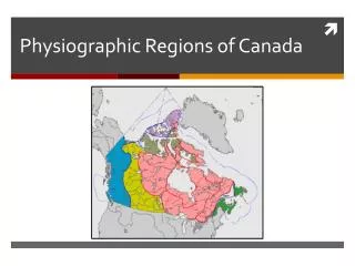
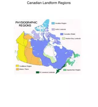
Canada’s Landform Regions. Canada's Landform Regions. Canada can be divided up based on its physical geography, much like we divide the country into political boundaries. We have 8 different landform regions in Canada. What does the land look like in Canada?. Western Cordillera.

E N D
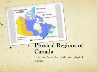
Canada's Landform Regions • Canada can be divided up based on its physical geography, much like we divide the country into political boundaries. • We have 8 different landform regions in Canada
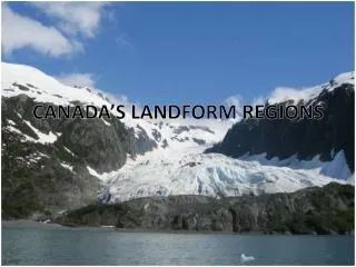
Western Cordillera • Range of mountains on the west coast (B.C. & Yukon) separated by valleys and plateaus • Mountains run in a north-south direction, which poses a problem for developing transportation routes • The forestry industry is huge due to the climate
Interior Plains • Once covered by shallow inland seas that were deposited with sediments from the Shield and the Rocky mountains. The sediments became compressed by their own weight, forming sedimentary rock • The layers of coral reef in the original seas were also compressed which have led to rich oil and natural gas deposits in Alberta & Saskatchewan
The soil developed on sediments of lake bottom therefore, it is deep & fertile. This makes it good for growing grain, like wheat. Called “Canada’s Breadbasket”
The Canadian Shield • More than ½ of Canada is covered by the Shield. • The world’s oldest rocks are found here (igneous & metamorphic formed from magma & lava) • Is a storehouse for valuable minerals • As a result, mining is an important industry (i.e., Timmins, Sudbury) • Many lakes & rivers = hydroelectric power
The Great Lakes – St.Lawrence Lowlands • Biggest feature is the Niagara Escarpment (created by glaciers) – made of sedimentary rock • Great Lakes were gouged out by glaciers • St.Lawrence river was created by tectonic plates (faulting) • This area has excellent soil & climate so it is well suited to agriculture (especially fruit) • Also, the most densely populated area of Canada b/c of transportation routes
Appalachian Mountains • Oldest highland region, therefore the mountains no longer have jagged peaks and are smaller in height than the western mountains • There are long bays in this region, allows for big ships = fishing • Fertile valleys = good soil
Innuitian Mountains • Icy “watch towers” in the far North mountains are as high as 2500 metres • Barren mountains because trees cannot survive in the cold temperatures • Many minerals in rocks, but not yet explored due to climate and inaccessibility.
Hudson Bay-Arctic Lowlands • Very flat, low area covered by swampy forests (Hudson Bay Lowlands) • Layers of sedimentary rock that rests on top of the ancient rock of the Shield • Very harsh climate, therefore no farming (due to permafrost) • There are natural gas deposits here
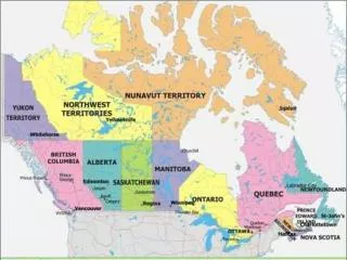
At this point: • Label and colour your Landform Regions map of Canada. • 1,2,3 represent Highlands, Lowlands and Shield. • After you are done, read pages 125-133. Answer questions 1,3,4.