Download
1 / 13
130 likes | 177 Vues
Explore the impact of geography on ancient Indian civilizations, from the fertile lands along the Indus River to the effects of the Himalayas as barriers and gateways. Discover how monsoons shaped agriculture and society, and delve into the mysteries of the Indus Valley civilization, Aryan culture, and the development of the caste system.

E N D
Ancient India • PG 104 • What conclusions can you draw about the effect of geography of the civilizations of ancient India? Ancient civilizations arose near the Indus River where people had a source of water nearby for farming. But Hinduism, could not spread beyond geographical barriers of the Hindu Kush and the Himalayas.
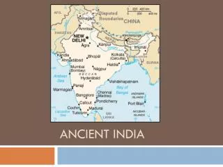
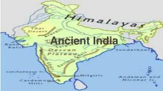
Indus River & Ganges River Valley India is separated from the rest of the world by a huge mountain range called the Himalayas. It is a kite shaped land south of Himalayas bordered by the Indian Ocean and is called a subcontinent or a large landmass that juts out from a continent. Because of the mountains to the north and the Sea to the east and west there was little contact with outsiders.
Climate of Monsoons • India’s climate is dominated by Monsoons or strong winds that blow across the region at certain times of the year. • PG107 • From October to May-Winter monsoons came from Northeast spreading dry air. • Middle of June-Wind came from Indian Ocean and brought moisture and rains that drench the plains and river valley. • People of India depended on Monsoons, if the rains are late or weak, the crops would die causing famine or if there is too much rain it could overflow the river and cause deadly floods.
Barriers and Pathways • Even though they were bordered by mountains there were pathways for them to travel through. • Great Rivers begin in the mountains. The Indus River flows from the Himalayas and empties into the Arabian Sea. • The Ganges River flows from the Himalayas into the Bay of Bengal. • Fed by the melting snow, the Indus and Ganges rivers cut through the mountain ranges and flow into Northern India were farming is possible.
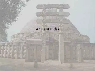
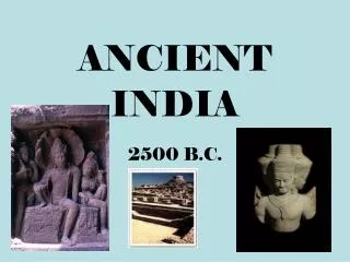
Life in the Indus River Valley • Rich soil of Indus Valley created a surplus of wheat and other grains and population grew. • Harappa and Mohenjo-Daro (larger of the two and lay along the Indus River) were cities that flourished and are located in present day Pakistan.
Ancient City Planners • The ruins of Mohenjo-Daro show how carefully the city was planned. • The city was built above sea level to prevent flooding. • Homes and workshops were on one side of the city and public buildings were on the other side. • A citadel, or fortress, was the highest point of the city.
Life in Mohenjo-Daro • Merchants and artisans sold wares from shops that lined the streets. Carts were rolled through the city filled with grain. • People from all over, including Mesopotamia, came to buy and sell. • Houses were a lot like the Sumerian culture. Houses opened to courtyards. • The language is still a mystery. The writing appeared on square seals but we don’t know what the symbols mean. • Government and religion are also unknown. There is evidence that shows that the people had a number of gods.
A Mysterious Decline • Around 2000 B.C., Indus Valley farmers started abandoning their land. • Don’t really know why they left but the people from the north settled in after the farmers left and gained control.
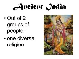
A New Culture Arises • The newcomers called themselves Aryans, which in their language meant “noble” or “highborn”. • They migrated, or moved, from their homelands in central Asia. • For several centuries, waves of these nomadic herds swept into India. • The Aryans drove horse-drawn chariots that helped them gain power. • Locals began to adopt the Aryan language and beliefs and the two group members married creating a mixed population.
Aryan Culture Spreads • This new culture first developed in the northern Indus valley but spread to Ganges valley to the east. • By around 800 B.C. people of northern India learned to make tools and weapons out of iron. • With iron axes, these people cleared out the dense rain forests. • There they built farms, villages, and even cities.
Aryan Life • Most of what we know of early Aryan life comes from religious books called Vedas (knowledge). • It tells us the earliest Aryans were herders and warriors that lived in temporary villages because they were always on the move. • Aryans organized their society around three classes: Aryan priests called Brahmans who performed religious services and composed hymns and prayers, then warriors and nobles, then artisans and merchants. • Gradually a fourth class formed which included farmers, laborers, and servants.
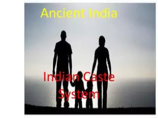
Social Order • By 500 B.C., there was a strict division of classes and it was later called a caste system by the Europeans. • At first each class or caste had specific duties. • People always had to stay in the caste of their parents. • The caste system became more complicated and the main castes were divided into over a hundred groups based on occupation. • Since people could not leave their caste, they did the same work as their parents and other members did. • The caste system still exists in India but is much less rigid and people can interact more freely.
Questions • Describe the geography of the Indus and Ganges river valley? It was created by rivers that start in the Himalayas and flow across rich plains. • How do the monsoons affect India and its climate? Summer monsoons produce wet summers and bring water for crops but can also bring flooding. Winter monsoons produce dry winters.