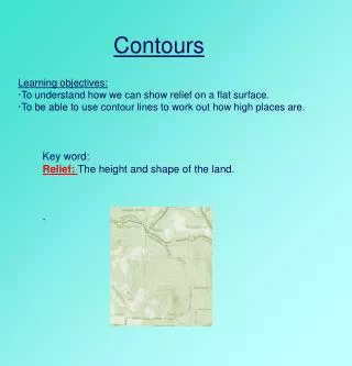
Understanding Contours
Understanding Contours. What are Contour Lines. Contours Lines - are imaginary lines that join points of the same height above the datum (points of equal elevation). What are Contour Lines. RL 10.000 AHD . What is the datum ?. What are Contour Lines. RL 20.000 AHD . What is the datum ?.

Understanding Contours
E N D
Presentation Transcript
What are Contour Lines • Contours Lines - are imaginary lines that join points of the same height above the datum (points of equal elevation)
What are Contour Lines RL 10.000 AHD What is the datum ?
What are Contour Lines RL 20.000 AHD What is the datum ?
What are Contour Lines RL 30.000 AHD What is the datum ?
What are Contour Lines RL 40.000 AHD What is the datum ?
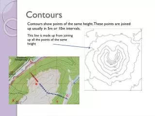
Contour Interval • The contour lines represent the height of the land in the form of a Reduced Level above the datum. • Each contour will represent a Reduced Level, so an impression of the shape of the land can be formed the contours must be determined at a regular interval. • This is the Contour Interval.
Contour Interval In this case the contours are at a regular interval of 10m of vertical elevation
Contour Interval Each Terrace represents a different Reduced Level The difference in Vertical height is the contour interval
Gentle Slope Plan View
Using Contours Lets us quickly draw a profile of the land RL 47.400 RL 47.200 Contour Interval Must be regular RL 47.000 RL 46.800 RL 46.600
RL 47.400 RL 47.200 RL 47.000 RL 46.800 RL 46.600 RL 46.400 RL 46.200 RL 46.000 The Closer the Contour line to each other the steeper the land RL 45.800 RL 45.600 Horizontal Distances will be irregular