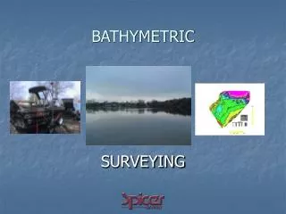
Bathymetric Dynamic Digital Elevation Model Update
Bathymetric Dynamic Digital Elevation Model Update. NG-CHC Fall Retreat 25th to 26th October 2012. USM DDEM Team: Stephan O’Brien, Dave Dodd and Jerry Wiggert. MLW/MLLW CRM and NAVD88 CRM Comparison.

Bathymetric Dynamic Digital Elevation Model Update
E N D
Presentation Transcript
Bathymetric Dynamic Digital Elevation Model Update NG-CHC Fall Retreat 25th to 26th October 2012 USM DDEM Team: Stephan O’Brien, Dave Dodd and Jerry Wiggert
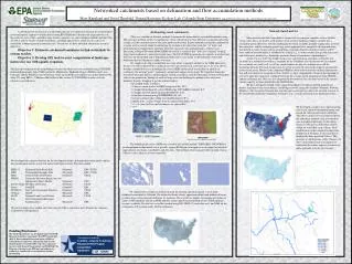
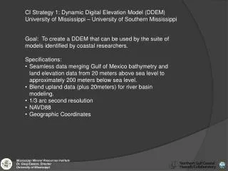
MLW/MLLW CRM and NAVD88 CRM Comparison • An analysis was done between the 3 arc-second MLW CRM, 3 arc-second NAVD88 CRM and 1/3 arc-second NAVD88 Mobile DEM. • The CRM was translated from MLW to NAVD88 with VDatum. • The area analyzed was located in Mobile Bay and approximately 20 km2 .
Difference: CRM NAVD88 – CRM MLLW_MLW Mean = -0.09 m St. Dev. = 0.002 m
Difference: NAVD88 Mobile DEM – NAVD88 CRM Mean = -0.02 m St. Dev. = 0.07 m
Development of DDEM using Generic Mapping Tools and VDatum • A set of methods was developed that use NOAA’s VDatum software and the Generic Mapping Tools (GMT) to produce the Dynamic Digital Elevation Model (DDEM) product. • As necessary, VDatum is used to translate the bathymetry from other datums to NAVD88. • The resampling of the CRM to finer resolution and the replacement of the CRM data with more recent bathymetry is done in GMT. • Statistical analysis of new data and existing CRM is also done in GMT. • One advantage of using these software tools is that they are freely available and accessible to all users.
Development of DDEM using Generic Mapping Tools and VDatum • The current challenge is the smoothing along the edges of the bathymetric data sets replacing the existing CRM data. • The GMT command ‘grdblend’ will be used for this step. This command can combine partially overlapping grids and compute weighted average depths along the edges of the grid.
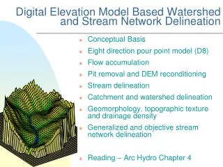
Resample the 3 arc second Northern Gulf NAVD88 CRM (nCRM_3) to 1 arc second (nCRM_1) Translate the 3 arc second MLW/MLLW CRM (Volume 4) to NAVD88 using VDatum Update the 3 arc-second CRM with the 1 arc-second Northern Gulf DEM Update the nCRM_1 with Northern Gulf 1 arc second DEM Updated nCRM_1 to survey date 12/31/2001 Conduct a statistical analysis of the elevation differences between the nCRM_1 and the ingested Northern Gulf DEM
Update the 1 arc-second CRM with the 1/3 arc-second NGDC DEMs Resample the nCRM_1 to 1/3 arc second (nCRM_1/3) Update the nCRM_1/3 elevations with currently available DEM products◉ Updated nCRM_1/3 to survey date 01/31/2009* Conduct a statistical analysis of the elevation differences between the nCRM_1/3 and the ingested DEMs ◉1) Southern Louisiana DEM; 2) New Orleans Louisiana DEM; 3) Biloxi Mississippi DEM; and 4) Mobile Alabama DEM * This is date of US ACE surveys. The most recent NOS Bathymetric Survey data used in developing these DEM products is from 2001-2003.
Update the 1/3 arc-second CRM with most recent NOS surveys* Updated through 05/12/2010 Updated nCRM_1/3 Obtain NOS survey from NGDC repository. Translate from MLLW to NAVD88. Conduct a statistical analysis of the elevation differences between nCRM_1/3 and NOS survey. Update the nCRM_1/3 with translated NOS data. *Single-beam and multibeam surveys since 2001: Alabama (18); Mississippi (12); and Louisiana (51)
VDatum Coverage Issues • The conversion of datums within VDatum is restricted by the extents of ‘Project Area’. • Not all the ‘Project Areas’ extend to the 200 m isobath. • One proposed solution is the use of VDatum to develop a MLW to NAVD88 separation model in the areas not covered by VDatum. • An additional issue is that off the coast of western Louisiana there is a gap between two VDatum project areas (~1.1 km).
Availability of Bathymetric Data on DMS THREDDS Server • The NGDC DEMs are accessible on the web via the Department of Marine Science THREDDS server. • The available DEMs (all at NAVD88) are: • 1) Central Gulf of Mexico CRM (3 arc-second) • 2) Northern Gulf Coast DEM (1 arc-second ) • 3) Southern Louisiana DEM (1/3 arc-second ) • 4) New Orleans DEM (1/3 arc-second ) • 5) Mobile DEM (1/3 arc-second ) • 6) Biloxi DEM (1/3 arc second)
Plans for Completed DDEM • The completed Bathymetric DDEM will be available as a web-accessible resource from the Department of Marine Science THREDDS server. • Software tools will be offered to users to facilitate OpenDAP data download of available DEM products, including updated nCRM_1/3. • Open source tools will be available for performing further nCRM_1/3 updates for users with access to personal or newer NOS bathymetric data.