Enhancing Oceanographic Research through the Royal Malaysian Navy Oceanographic Data Centre
120 likes | 254 Vues
The Royal Malaysian Navy Oceanographic Data Centre (RMNODC) was established in 1965 to support hydrographic, oceanographic, and charting activities in Malaysian waters. This report outlines the RMNODC's initiatives in data management, including oceanographic cruises and environmental monitoring. The Centre collaborates with various national agencies and universities to promote scientific research and data management standards. Key projects involve collecting and managing vital oceanographic data such as tide tables, marine biology, and geophysical data to enhance knowledge and operational capabilities in Malaysian waters.

Enhancing Oceanographic Research through the Royal Malaysian Navy Oceanographic Data Centre
E N D
Presentation Transcript
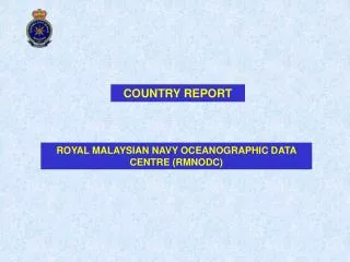
COUNTRY REPORT ROYAL MALAYSIAN NAVY OCEANOGRAPHIC DATA CENTRE (RMNODC)
SCOPE • BACKGROUND • AREA OF INTEREST • SURVEYING PLATFORM AND PERSONNEL • STATUS OF COEANOGRAPHIC DATA MANAGEMENT • RMNODC ACTIVITIES • DEVELOPMENT • OCEANOGRAPHIC PUBLICATION
BACKGROUND • HDRMN ESTABLISHED IN 1965 – TO CATER FOR HYDROGRAPHIC, OCEANOGRAPHIC AND CHARTING OF MALAYSIAN WATERS. • THE OCEANOGRAPHIC SECTION – BEGAN PRODUCTION OF TIDES AND TIDAL STREAM PREDICTION IN 1987. • RMNODC WAS SET UP WITH ASSISTANCE FROM AODC - RMN OFFICERS HAS BEEN TO AUSTRALIA FOR TRAINING SINCE 1994. • THERE AFTER RMNODC HAS BEEN ACTIVE IN PROMOTING COOPERATION AMONG THE NATIONAL SCIENTIFIC COMMUNITY.
AREA OF INTEREST MALAYSIA MALAYSIA
SURVEY PLATFORM KD MUTIARA (12 JAN 1978) Length 71 m Beam 13 m Draught 4.2m Speed 16knot Range 6,500 NM Complement 155 (14 Officers) KD PERANTAU (12 OKT 98) Length 67.8m Beam 13.3m Draught 4.0m Speed 16knot Range 6,000@ 10knot Complement 94 (17 Officers)
STATUS • NATIONAL PROJECTS - OCEANOGRAPHIC CRUISES CONDUCTED ON REGULAR BASIS. • COOPERATION WITH VARIOUS NATIONAL ANGECIES UNIVERSITIES, NATIONAL PETROLIUM COY (PETRONAS) etc. • DATA HELD BY RMNODC: • - CTD • XBT • Geophysical Data • Wave • Marine Biology • Bathymetry • INTERNATIONAL MSR 2001 – 2 with Japan and 1 with Germany
RMNODC ACTIVITIES • Tide table, T/stream – Malaysia, Brunei, Singapore. • Data Management – Data inventory of RMNOC as well as other agencies data held. • Environmental monitoring– by Nat. Meteor Dept – RMN plans to estb own collection system. • GODAR – Data archaeology and rescue via national agencies and International bodies. • Oceanographic cruises – to date 14 cruises carried out – 9 Malacca Strait, 5 South China Sea.
DEVELOPMENT • Oceanographic Research Coordination Committee – comprising 15 agencies (including 5 universities) - Foster cooperation between various agencies - Establish procedures in data management, QC, exchange & archiving format - Identify funding for oceanographic activities of common interest - Disseminate and update new technology - Encourage exchange of info among members - Encourage pooling and sharing of resources and expertise
DEVELOPMENT • Acquisition of Oceanographic Facilities - Online tide and tidal system - Environmental monitoring system - Oceanographic ship
OCEANOGRAPHIC PUBLICATION • MALAYSIAN TIDE TABLES - Volume 1- Peninsular Malaysia & Singapore - Volume 2- Sabah, Sarawak & Brunei • LIST IF TIDAL BENCHMARKS - Volume 1 – Peninsular Malaysia - Volume 2- Sabah and Sarawak • OCENAOGRAPHIC DATA INVENTORIES – listing of oceanographic data held by RMNODC. • ENVIORNMENTAL BRIEF – report to support military exercises or operations