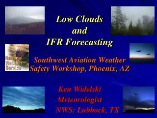
Low Clouds and IFR Forecasting
Low Clouds and IFR Forecasting. Southwest Aviation Weather Safety Workshop, Phoenix, AZ Ken Widelski Meteorologist NWS: Lubbock, TX. Objectives. Low Cloud Formation Types of Fog: Advection vs. Radiation Flight Categories (Review) Applicable Pre-Flight Planning Tools Pre-Flight Tips

Low Clouds and IFR Forecasting
E N D
Presentation Transcript
Low CloudsandIFR Forecasting Southwest Aviation Weather Safety Workshop, Phoenix, AZ Ken Widelski Meteorologist NWS: Lubbock, TX
Objectives • Low Cloud Formation • Types of Fog: Advection vs. Radiation • Flight Categories (Review) • Applicable Pre-Flight Planning Tools • Pre-Flight Tips • Recap • Questions??
Low Clouds (Stratiform and Cumuliform at or below 6500 ft). Can cause significant hazards to both commercial and general aviation. Form from 4 main processes Low Cloud Formation
The 4 Main Processes • Low Level Moisture transport Warm air advection (Veering) Low Level Jet (Band of stronger winds aloft) • Frontal Passages Cold Front (Shallow cold air advection) Warm Front (Warm air atop cooler air) • Upslope Flow (No Penetration) Topographic influences • Precipitation Saturated low levels
Clouds form when air is cooled to its dew point. If the air is cooled to its dewpoint it reaches saturation. Air can reach saturation in a number of ways. The most common way is through lifting. Formation Perspective .
Low Level Moisture Transport -Warm Air Advection (Veer) -Low Level Jet
Fog • Stratus cloud in contact with the ground • Saturated low levels of the atmosphere Three Main Types of Fog: • Advection Fog -Moisture transport over a relatively large area 2) Radiation Fog -Clear skies, moist ground and light winds -Localized dense fog 3) Upslope Fog -Moist flow against topographic influence
Flight Categories • VFR - Visual Flight Rules; Visibility > 5 SM Ceiling > 3000 feet • MVFR - Marginal Visual Flight Rules; Visibility 3 to 5 SM; Ceiling 1000 to 3000 feet • IFR - Instrument Flight Rules; Visibility 1 to <3 statute miles; Ceiling 500 to 900 feet • LIFR - Low Instrument Flight Rules; Visibility <1 statute mile; Ceiling < 500 feet • VLIFR- Very Low Instrument Flight Rules; Visibility <1/2 mile; Ceiling <200 feet
Pre-Flight Planning Tools • Advancements in technology over the past decade have allowed pilots to use reliable tools for pre-flight planning purposes. • Planning tools range from: Nationwide Access to TAFS, TWEBS, Area Forecast Discussions, Model Output Statistics, Visible, Water Vapor and multi-channel satellite imagery and Soundings.
TAF Forecast TERMINAL AERODROME FORECAST -The area within 5SM of the center of the runway complex -FOUR ROUTINE ISSUANCES PER DAY 12Z, 18Z, 00Z AND 06Z • Nationwide TAF access is conveniently linked to one NWS website (Aviation Weather Center)
Low Cloud TAF Examples KLBB101730Z 101818 25008KT P6SM SCT020 SCT200 FM2200 03015G25KT 5SM BR BKN010 FM0600 08010KT 1SM BR BKN005 FM1000 VRB04KT 1/2SM FG OVC003 FM1400 20015KT P6SM SCT020 SCT120 KCDS061730Z 061818 13015KT 3SM BR BKN010 FM2000 19022G32KT P6SM SCT030 SCT250 FM0000 16013KT P6SM SCT250
NWS: Aviation Weather Centerhttp://adds.aviationweather.gov/tafs/
TWEB TRANSCRIBED WEATHER BROADCAST -TWEB ROUTE: 50 NM WIDE CORRIDOR ALONG A LINE CONNECTING THE ANCHOR POINTS OF THE ROUTE. Example: KAMA-KLBB-KMAF -FOUR ISSUANCES PER DAY
Aviation Discussion • Purpose: Better understand the forecast reasoning in the TAF.
Experimental AFD Pagehttp://aviationweather.gov/testbed/afd/
MOS: Model Output Statistichttp://www.nws.noaa.gov/mdl/synop/products.shtml
CIG 8 8 8 8 8 8 8 8 8 8 8 8 8 8 8 8 8 8 8 7 7 VIS 7 7 7 7 7 7 7 7 7 7 7 7 7 7 7 7 7 7 7 7 7OBV N N N N N N N N N N N N N N N N N N
RAOBhttp://www.spc.noaa.gov/exper/soundings • Sounding: Vertical snapshot of the atmosphere. (Twice daily)
Pre-Flight Tips • Know before you go • Develop a good knowledge of forecast patterns ahead of time. • Access the wide array of pre-flight tools available. • If Low Clouds and Fog are forecasted, be sure to make sound “go-no go” decisions. -It can save your life • For further assistance…contact your local NWS Office 24/7/365
References • NWS Aviation Weather Center • Local NWS Weather Offices • NWS Storm Prediction Center • NWS Meteorological Development Laboratory • NASA • NWS Aviation Directive 813 • Geog.ucsb.edu • NWS SRH Jet stream Project • Wikipedia.org • Weather Doctor: Island.net
Thank you for attending Any Questions

