Download

1 / 21
210 likes | 347 Vues
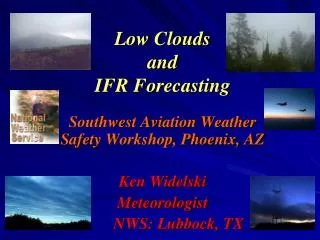
This report, dated August 12, 2009, outlines the evening weather forecast for the Indiana region, specifically addressing IFR (Instrument Flight Rules) conditions due to potential fog and late-afternoon thunderstorms. The analysis shows the effects of a slowly departing cold front and a secondary trough impacting local weather. Light rain at HUF and IND is mentioned as a contributor to expected IFR conditions. The focus lies on fog formation overnight and the effects of dewpoints, with a typical diurnal cycle expected to clear the fog by morning.

E N D
IFR Study – 08/12/09 IFR Ceilings Joe Nield – Your Friendly Neighborhood 08/11/09 Evening Shift Aviation Forecaster
Setting the Stage • Isolated to scattered late afternoon/evening thunderstorms improve setting for IFR with HUF/IND both receiving some rainfall. (Radar image from near 00z 8/12)
Synopsis • Slowly departing cold/quasistationary front (12z sfc not shown due to extreme movement of boundary between 09-12z – appeared unreasonable) • Slowly weakening secondary trough/troughs • Advancing surface high with light northerly/northwesterly flow ahead
What Was Forecast? 000 FTUS43 KIND 112300 TAFIND TAF KIND 112320Z 1200/1306 33007KT P6SM FEW040 SCT140 FM120900 36004KT 3SM BR SKC FM121300 01005KT P6SM FEW250 FM121700 35008KT P6SM SCT040 FM130000 03005KT P6SM SKC= 000 FTUS43 KIND 112300 TAFLAF TAF KLAF 112320Z 1200/1224 36009KT P6SM SKC FM120700 36003KT 5SM BR SKC FM121000 00000KT 2SM BR SKC FM121300 03005KT P6SM SKC FM121700 01007KT P6SM FEW040 AMD LTD TO CLD VIS AND WIND 1201/1213= 000 FTUS43 KIND 112300 TAFHUF TAF KHUF 112320Z 1200/1224 30004KT P6SM FEW040 FM120500 34003KT 4SM BR SKC FM120900 00000KT 1SM BR SKC FM121300 01005KT P6SM SKC FM121700 36006KT P6SM SCT040= 000 FTUS43 KIND 112300 TAFBMG TAF KBMG 112320Z 1200/1224 33004KT P6SM FEW040 FM120500 33003KT 4SM BR SKC FM120900 00000KT 1SM BR SKC FM121300 02005KT P6SM SKC FM121700 36006KT P6SM SCT040 AMD LTD TO CLD VIS AND WIND 1201/1213=
Why Was It Forecast? AREA FORECAST DISCUSSION NATIONAL WEATHER SERVICE INDIANAPOLIS IN 710 PM EDT TUE AUG 11 2009 .AVIATION...DISCUSSION FOR THE 00Z TAFS. IMPACT FOR THIS TAF PKG WL BE PSBL IFR FOG OVRNGT. 18Z MOS APPEARS TO BE HANDLING SFC DEWPOINT SITUATION MUCH BETTER THAN 12Z DID...AND ALL SITES SAVE FOR IND ARE SHOWN WITH IFR FOG LATE TNGT. BOTH HUF AND IND HAVE SEEN SOME LIGHT RAIN LATE THIS AFTN TO SET THE STAGE EVEN FURTHER. W/ SFC HIGH MOVING IN BEHIND SECONDARY TROUGH SWINGING THROUGH...AND DRIEST DEWPOINTS SLOW TO FOLLOW...SIGNIFICANT RADIATION INVERSION SHOULD SET UP TNGT W/ DRY AIR ALOFT...MORE THAN ADEQUATE CONDITIONS FOR IFR FOG FORMATION AND MAINTENANCE. FOG WL FOLLOW TYPICAL DIURNAL CYCLE...BURNING OFF AROUND 13Z...AND TMRW WL BE QUIET W/ ONLY FEW-SCT040 AFTN CU.
How about at 06Z? 000 FTUS43 KIND 120500 TAFIND TAF KIND 120520Z 1206/1312 01006KT P6SM FEW100 FM120900 36004KT 3SM BR SKC FM121300 01005KT P6SM FEW250 FM121700 35008KT P6SM SCT040 FM130000 03005KT P6SM SKC= 000 FTUS43 KIND 120500 TAFLAF TAF KLAF 120520Z 1206/1306 01003KT P6SM SKC FM120800 36003KT 5SM BR SKC TEMPO 1210/1212 2SM BR FM121300 03005KT P6SM SKC FM121700 01007KT P6SM FEW040 AMD LTD TO CLD VIS AND WIND 1201/1213= 000 FTUS43 KIND 120500 TAFHUF TAF KHUF 120520Z 1206/1306 36003KT P6SM FEW100 FM120800 35002KT 4SM BR SKC FM121000 00000KT 2SM BR SKC FM121300 01005KT P6SM SKC FM121700 36006KT P6SM SCT040= 000 FTUS43 KIND 120500 TAFBMG TAF KBMG 120520Z 1206/1306 36003KT P6SM SCT100 FM120800 00000KT 4SM BR SKC FM121000 00000KT 1SM BR SKC FM121300 02005KT P6SM SKC FM121700 36006KT P6SM SCT040 AMD LTD TO CLD VIS AND WIND 1201/1213=
Still Similar – Minor Changes AREA FORECAST DISCUSSION NATIONAL WEATHER SERVICE INDIANAPOLIS IN 1258 AM EDT WED AUG 12 2009 .AVIATION...DISCUSSION FOR THE 12/0600Z TAFS. IMPACT FOR THIS TAF PKG WL BE PSBL IFR FOG TNGT. 00Z MOS NO LONGER SHOWING IFR CONDS LIKE THE 18Z MOS GUIDANCE...BUT THE SETUP IS STILL THERE FOR IFR TO FORM AS A SIGNIFICANT RADIATION INVERSION SETS UP OVERNIGHT. RUC13 MODEL ALSO HINTS AT IFR FOG AS WELL. DRIER AIR IS TRYING TO WORK INTO LAF BUT REMAINDER OF SITES STILL HAVE LOW 60S DEWPOINTS. WITH NO STRONG PUSH OF DRY AIR...AND THE FACT THAT SOME RAIN FELL AT HUF/IND EARLIER...WILL CONTINUE PREV FORECAST OF IFR FOG FOR A PERIOD AT ALL SITES BUT IND. FOG WL FOLLOW TYPICAL DIURNAL CYCLE...BURNING OFF AROUND 13Z...AND TMRW WL BE QUIET W/ ONLY FEW-SCT040 AFTN CU.
More on Why (No, not moron, why?!) • I expected, based on guidance winds/vsbyprogs and relative tendencies at IND, that best conditions would be at IND, with lower conditions at LAF, and even lower at HUF/BMG where rainfall had occurred that evening. • Afternoon/evening BUFKIT data, which I regrettably failed to have archived (06z/12z runs 08/12 were archived and are similar), depicted a shallow but still significant surface moist layer below a strong radiation inversion with dry air aloft. This layer was less shallow on the 18z BUFKIT data than on the archived examples shown next • BUFKIT fog progs (MRi) did hint that stratus might have been favored over fog, but weak MOS winds drew me back to fog
What Happened? 08/12/09 05:54:25 METAR KIND 121054Z 34007KT 10SM CLR 16/14 A3004 RMK AO2 SLP167 T01610144 (CMK) 08/12/09 06:53:21 SPECI KIND 121152Z 33005KT 10SM BKN006 17/15 A3005 RMK AO2 FIBI (MAB) 08/12/09 07:08:25 SPECI KIND 121208Z 33006KT 10SM BKN006 17/15 A3006 RMK AO2 (MAB) 08/12/09 07:54:25 METAR KIND 121254Z 36008KT 10SM BKN006 19/16 A3006 RMK AO2 SLP175 T01890156 (MAB) 08/12/09 08:12:25 SPECI KIND 121312Z 36005KT 10SM SCT006 19/16 A3007 RMK AO2 (MAB) 08/12/09 08:54:25 METAR KIND 121354Z 01006KT 10SM SCT006 21/17 A3007 RMK AO2 SLP179 T02060167 (MAB) • LAF followed a similar pattern, getting down to BKN003. IFR lasted for a shorter period of time at LAF. HUF experienced brief MVFR (BKN012) ceilings, and BMG remained clear.
What went (sort of) right? • Looking at it through the new Categorical Amendment Criteria, IFR was in the forecast at LAF/HUF/BMG, and low end MVFR was forecast at IND – so it didn’t go entirely undetected, although significant false alarms occurred at HUF/BMG, and to a lesser extent, LAF – and IND was a missed event.
What went wrong? • Obviously, low stratus occurred rather than fog. All sites but LAF remained unrestricted at the surface, with LAF dropping to 4SM and coming back up as IFR conditions ended.
What made the difference? • Winds only briefly went calm at most locations – never calm at IND. Winds were generally 4-7 knots throughout the night. • Surface moist layer was perhaps too shallow to support fog development • Recalling BUFKIT profiles shown earlier – with encroaching high pressure, subsidence is seen throughout MOST of the column – but weak lift is present in the lower levels. (Left over from decaying secondary trough/troughs perhaps?) This along with the lack of calm surface winds likely contributed to a lifting of the near surface moisture into a brief low stratus layer near and just after sunrise
Thanks for viewing! I might have gone down, but at least I went down trying!