Download
1 / 39
390 likes | 516 Vues
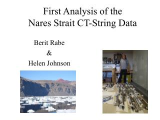
This document presents an analysis of sea surface temperature (SST) in the Nares Strait using infrared measurements from MODIS sensors. Key topics include sensor calibration, atmospheric correction, and cloud detection, which are critical for accurate SST data. The work outlines the motivation for studying the Nares Strait, examines vertical and temporal temperature changes, and emphasizes the importance of validation through comparison with in-situ measurements. Notable references provide insights into ocean measurement techniques and cloud detection methods relevant to this research.

E N D
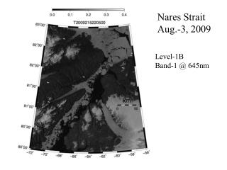
Nares Strait Aug.-3, 2009 Level-1B Band-1 @ 645nm
Infrared measurements of sea surface temperature (SST) Andreas Muenchow, University of Delaware, May-11, 2010 • Nares Strait motivation • Vertical and temporal temperature changes • Sensor calibration • Cloud detection • Atmospheric correction • Validation References: 1. Robinson, I.S., 2004: Measuring the Oceans from Space, chapt.-7 2. Gumley, L., 2006: Modis Ocean Products, http://www.ssec.wisc.edu/library/coursefiles/SouthAfrica/Gumley_MODIS_Ocean.ppt 3. Vincent et al., 2008: Arctic waters and marginal ice zones, a composite Arctic sea surface temperature algorithm, J. Geophys. Res., 113, C04021, doi:10.1029/2007JC004353. 4. Luo, et al., 2008: Developing clear sky, cloud, and cloud shadow mask for producing clear-sky composites at 250-meter spatial resolution, Rem. Sens. Env., 112, 4167-4185. 5. Minnett, P.J., 2001: The marine-atmosphere emitted radiance interferometer, a high accuracy, seagoing infrared spectrometer, J, Atmos. Ocean. Tech., 18, 994-1013.
Nares Strait Aug.-3, 2009 My first MODIS SST image (made 4 days ago): Pretty, but wrong on so many levels … What is SST?
MODIS Ocean Standard Products (Level-2) [from Gumley, 2006]
Planck’s Law: sst4 sst 2 bands used to estimate sst and sst4 sst4 usable only at night (solar contributions) sst usable day and night (negligible solar contributions) [from Robinson, 2004]
sst4 sst [from Robinson, 2004]
Night Day [from Robinson, 2004]
Sensor Calibration Band-integrated radiance as a function of temperature (Planck’s Law) at detector: L(Tb) = ∫ C1() / [5 exp(C2/ Tb)-1] d where Tb blackbody temperature () detector response function (determined pre-launch) C1, C2 constants Calibration finds gain and offset to relate the digital output signal S to radiance at detector L: L = gain*S + offset or Tb = A + B ln(L) Need 2 known points to find gain and offset for each detector
MODIS has 10 detectors scanned by 2 mirror-sides --> 20 calibrations SST Striping due to imperfect inter-detector calibrations [from Gumley, 2006]
Chlor_a [from Gumley, 2006]
MODIS Chlorophyll Algorithm Semi-analytical algorithm(1) Chl_a = 10**(0.283 - 2.753*R + 1.457*R2 + 0.659*R3 - 1.403*R4) where: R = log10((Rrs443 > Rrs488) / Rrs551) Rrs = nLw / F0; remote sensing reflectance F0 = extraterrestrial solar irradiance nLw = water leaving radiance at 443, 488, 551 (1) Performance of the MODIS Semi-analytical Ocean Color Algorithm for Chlorophyll-a Carder, K.L.; Chen, F.R.; Cannizzaro, J.P.; Campbell, J.W.; Mitchell, B.G. Advances in Space Research. Vol. 33, no. 7, pp. 1152-1159. 2004 [from Gumley, 2006]
Canadian Center for Remote Sensing Cloud Detection Standard NASA Cloud Detection [from Luo et al., 2008]
This really is another full lecture [from Robinson, 2004]
2008 [from Luo et al., 2008]
Modis Bands Bi with i=1,2,3,6 [from Luo et al., 2008]
SST = a + b*T4 + c*(T4-T5) + d* (T4-T5)*(sec-1) Atmosphere-A: Atmosphere-B Tbi brightness temperature channel “i”, e.g, T4 (Band-31 in Modis) Tbj brightness temperature channel “j”, e.g, T5 (Band-32 in Modis) [from Robinson, 2004]
Daytime Coefficients for NOAA-12 AVHRR SST algorithm(McClain et al., 1985) a=-263.006 b=0.963563 c=2.579211 d=0.242598 sensor zenith SST = a + b*T4 + c*(T4-T5) + d* (T4-T5)*(sec-1) SST4 SST [from Robinson, 2004]
MODIS Longwave Infrared Sea Surface Temperature ---> SST dBT <= 0.5 sst = a00 + a01*BT11 + a02*dBT*bsst + a03*dBT*(sec() - 1.0) dBT >= 0.9 sst = a10 + a11*BT11 + a12*dBT*bsst + a13*dBT*(sec() - 1.0) 0.5 < dBt < 0.9 sstlo = a00 + a01*BT11 + a02*dBT*bsst + a03*dBT*(sec() - 1.0) ssthi = a10 + a11*BT11 + a12*dBT*bsst + a13*dBT*(sec() - 1.0) sst = sstlo + (dBT - 0.5)/(0.9 - 0.5)*(ssthi - sstlo) where: dBT = BT11 - BT12 BT11 = brightness temperature at 11 um, in deg-C BT12 = brightness temperature at 12 um, in deg-C bsst = Either sst4 (if valid) or sstref (from Reynolds OISST) sec() = 1/(cosine of sensor zenith angle) a00, a01, a02, a03, a10, a11, a12, a13 derived from match-ups [from Gumley, 2006]
MODIS Shortwave Infrared Sea Surface Temperature --> SST4 sst4 = a0 + a1 * BT39 + a2 * dBT + a3 * (sec() - 1.0 ) where: dBT = BT39 - BT40 BT39 = brightness temperature at 3.959 um, in deg-C BT40 = brightness temperature at 4.050 um, in deg-C sec() = 1/(cosine of sensor zenith angle) a0, a1, a2, and a3 are time dependent coefficients derived from match-ups between observed MODIS brightness temperature and field measurements of SST. Note: sst4 is not valid during daytime because of solar reflection. [from Gumley, 2006]
Measuring at-sea skin temperature for SST validation and algorithm development [from Minnett et al., 2001]
Nares Strait Aug.-3, 2009 My first MODIS SST image (made 4 days ago): Pretty, but wrong on so many levels … What is SST?
Standard SST algorithm Arctic SST algorithm [from Vincent et al., 2008]
Is atmospheric correction always appropriate? SST = a + b*T4 + c*(T4-T5) + d* (T4-T5)*(sec-1) Is anything lost by applying atmospheric corrections?
Is atmospheric correction always appropriate? SST = a + b*T4 + c*(T4-T5) + d* (T4-T5)*(sec-1) Is anything lost by applying atmospheric corrections? • Image noise may be enhanced • Includes noise from 2channels • Thermal gradients are modified
Is atmospheric correction always appropriate? SST = a + b*T4 + c*(T4-T5) + d* (T4-T5)*(sec-1) Is anything lost by applying atmospheric corrections? • Image noise may be enhanced • Includes noise from 2channels • Thermal gradients are modified If spatial structures, patterns, fronts, eddies, plumes are studied Use brightness temperatures Ti, not SST