Download
1 / 33
330 likes | 436 Vues
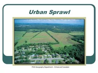
Measuring the Impact of Urban Sprawl on Vehicle Usage and Fuel Consumption. Tom Golob University of California Irvine tgolob@uci.edu ITLS - Sydney Seminar November 2005. Objective. Accurately estimate the impacts of land use density on car usage

E N D
Measuring the Impact of Urban Sprawl on Vehicle Usage and Fuel Consumption Tom Golob University of California Irvine tgolob@uci.edu ITLS - Sydney Seminar November 2005
Objective • Accurately estimate the impacts of land use density on car usage • Important for evaluation of policies concerning • sustainable growth • greenhouse gas emissions • Evidence in the debate about “car dependency”
Measuring car usage • Total distance driven by all household vehicles • result of many travel demand choices: • car ownership • trip generation • mode choice • including drive vs. car passenger • destination choice • Total fuel usage on all vehicles • vehicle type choice • implicit choice of fleet fuel efficiency • vehicle allocation in multi-vehicle households
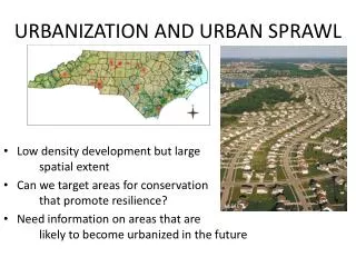
Measuring land use density • Census data (U.S., 2000, with updates) • Typical variables • housing units per sq. mi. (per area unit) • population per sq. mi. • jobs per sq. mi. • Resolution (U.S.) • Census tract (average size 4,000 persons) • Census block groups (average ~1,000) • Other GIS functionality available
Previous studies: aggregate • Compare averages for cities, zones, neighborhoods • Impossible to control effectively for differences in: • Household characteristics • Transport infrastructure • Transport levels of service • Arrangement of land uses • Culture
Previous studies: disaggregate • Household observations • Must control for self-selection with respect to residential location • density related to neighborhood attributes • housing quality • transport level of service by mode • transport preferences • schools, recreation sites, … • cultural and ethnic identity
Our approach to the problem • Make choice of residential density endogenous • Simultaneous equations with three endogenous variables • residential density • annual mileage • fuel consumption • All endogenous variables explained by household characteristics • The residential density variable affects the two travel variables
Data requirements • Annual mileage for all household vehicles • derived from odometer readings or imputed • Fuel usage calculations for all vehicles • according to vehicle make, model and vintage • Census data on land use density • matched to household location
Data availability • The 2001 U.S. National Household Transportation Survey (NHTS) data • annual mileage for all household vehicles • fuel usage for all household vehicles • census data on land use density • 24-hour travel diaries for all members • 28-day record of long-distance travel (50 mi.+) • demographics and socio-economics
2001 U.S. NHTS data • National sample • about 26,000 households • 82% have complete data on fuel usage • N = 21,347 • Residential density in terms of • housing units per sq. mi. at census block level • six categories • scaled in terms of category means
Biases due to missing data • Probability of being missing related to levels of the endogenous variables • Classical sample selection problem • Reference: • Tom Golob and Dave Brownstone (2005) • The Impact of Residential Density on Vehicle Usage and Energy Consumption • Working paper EPE-011, University of California Energy Institute • on the web at: • University of California eScholarship Repository
Correcting estimates • Structural approach • Heckman selection modeling • Add equation to construct a new hazard for sample inclusion • Problems: • Results are sensitive to model specification • Inconsistency when variable sets overlap
Correcting estimates • Weighting • Weighted Exogenous Sample Maximum Likelihood Estimator (WESMLE) • Problem: • incorrect coefficient (co)variances • standard errors will be under-estimated
Estimation method • Weighted estimator (WESMLE) • Estimates using weighted data are robust • Standard errors seriously downward biased • Standard errors are accurately estimated using Wild Bootstrap method • Heteroskedasticity consistent covariance matrix estimator • Cannot reject that errors are exogenous using Structural (Heckman) approach
Model fit on U.S. national data • Model structure • 19 exogenous variables • recursive structure for the 3 endogenous variables • 48 free parameters • Weighting is important • estimates different from unweighted estimates • bootstrap tests reject alternative specifications • Model fits well • All overall goodness-of-fit statistics excellent
Interpretation • Comparing two households identical in terms of: • income, retirement status • numbers of drivers, workers, children • education of head • race and ethnicity • Household A, living in density of 3-5,000 hh./sq. mi. • will drive 3,300 fewer miles on all vehicles • consuming 180 less gallons of fuel annually • than • Household B, living in density of 1-3,000 hh./sq. mi.
Important exogenous variables • Income • Number of drivers • Number of workers • Whether household single-person • Number and age of children • Education of head(s) • Whether household retired • Race/ethnicity
Tests of alternative models • Error term correlations • all can be rejected (no correlation with sig. t) • 2= 6.35; 3 d-o-f (not sig.) • Feedbacks • drive more = move to higher density • (t = 1.27) 2= 1.52; 1 d-o-f (not sig.) • higher fuel usage = move to higher density • (t = 1.03) 2= 1.02; 1 d-o-f (not sig.) • Base model best according to Bayesian criteria (CAIC)
Applications to individual areas • Need approximately 225 observations • rules-of-thumb based on • number of variables • number of free parameters • Translates to 275 at 82% non-missing data • 2001 U.S. NHTS data will support modeling for: • 30 states • 17 metropolitan areas
Contrasting results for 3 NHTS samples • National • N = 21,347 • Oregon (including 2 counties in Washington State) • N = 325 • California • N = 2,079
Extensions • Results similar, but less precise when using other available NHTS density variables • Can be extended to estimate effects of residential density on specific aspects of travel • e.g., trips by public transport • a different estimation method should be used for limited dependent variables (those with large spikes at the value zero) • that estimation method requires larger sample sizes (perhaps 1,500 minimum)
Conclusions: methodological • In measuring the effects of residential density, it is important to control for: • selectivity bias in residential location choice • missing data related to the endogenous vars. • Survey data needs: • odometer readings • vehicle specs. (make, model, vintage of all) • residential location • Appropriate land use data can easily by added to survey data sets using GIS
Conclusions: Empirical • Lower residential density does lead to greater vehicle usage, controlling for other influences • Greater fuel consumption is due to both longer distances driven and vehicle type choice • Results show the importance of using disaggregate data and controlling for self selection • many household characteristics • including race and ethnicity