Download
1 / 1
10 likes | 533 Vues
AmbiguityResolution Z_VALUE DISTANCE_TO_OUTLET NO_RESOLUTION. Utils Functions ClipPolygon(op As PolygonOperation, SubjectPolygon As Shape, ClipPolygon As Shape) As Shape GridInterpolateNoData(Grd As Grid, cBack As ICallback) As Boolean

E N D
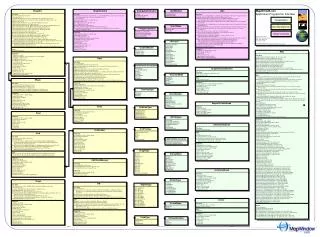
AmbiguityResolution Z_VALUE DISTANCE_TO_OUTLET NO_RESOLUTION Utils Functions ClipPolygon(op As PolygonOperation, SubjectPolygon As Shape, ClipPolygon As Shape) As Shape GridInterpolateNoData(Grd As Grid, cBack As ICallback) As Boolean GridMerge(Grids As Object, MergeFilename As String, Optional InRam As Boolean, Optional GrdFileType As GridFileType, Optional cBack As ICallback) As Grid GridReplace(Grd As Grid, OldValue As Object, NewValue As Object, Optional cBack As ICallback) As Boolean GridToGrid(Grid As Grid, OutDataType As GridDataType, Optional cBack As MapWinGIS.ICallback) MapWinGIS.Grid GridToImage(Grid As Grid, cScheme As GridColorScheme, Optional cBack As ICallback) As Image GridToShapefile(Grid As Grid, Optional ConnectionGrid As Grid, Optional cBack As ICallback) As Shapefile PointInPolygon(Shp As Shape, TestPoint As Point) As Boolean RemoveColinearPoints(Shapes As Shapefile, LinearTolerance As Double, Optional cBack As ICallback) As Boolean ShapeMerge(Shapes As Shapefile, IndexOne As Long, IndexTwo As Long, Optional cBack As ICallback) As Shape ShapeToShapeZ(Shapefile As Shapefile, Grid As Grid, Optional cBack As ICallback) As Shapefile ShapefileToGrid(Shpfile As Shapefile, Optional UseShapefileBounds As Boolean, Optional GrdHeader As GridHeader, Optional Cellsize As Double, Optional U seShapeNumber As Boolean, Optional SingleValue As Short) As Grid TinToShapefile(Tin As Tin, Type As ShpfileType, Optional cBack As ICallback) As Shapefile hBitmapToPicture(hBitmap As Long) As IPictureDisp Area(Shape As Shape) As Double Properties ErrorMsg(ErroCode As Long) As String GlobalCallback() As Object Key() As String LastErrorCode() As Long Length(Shape As Shape) As Double Perimeter(Shape As Shape) As Double ColoringType HILLSHADE GRADIENT RANDOM Shapefile Functions BeginPointInShapefile() As Boolean Close() As Boolean CreateNew(ShapefileName As String, ShapefileType As ShpfileType) As Boolean EditCellValue(FieldIndex As Long, ShapeIndex As Long, NewVal As Object) As Boolean EditClear() As Boolean EditDeleteFields(FieldIndex As Long, cBack As ICallBack) As Boolean EditDeleteShape(ShapeIndex As Long) As Boolean EditInsertField(NewField As Field, ByRef FieldIndex As Long, cBack As ICallback) As Boolean EditInsertShape(Shape As Shape, ByRef ShapeIndex As Long) As Boolean Open(ShapefileName As String, Optional cBack As ICallback) As Boolean PointInShape(ShapeIndex As Long, x As Double, y As Double) As Boolean PointInShapefile(x As Double, y As Double) As Long QuickExtents(ShapeIndex As Long) As Extents QuickPoint(ShapeIndex As Long, PointIndex As Long) As Point QuickPoints(ShapeIndex As Long, ByRef numPoints As Long) As Double SaveAs(ShapefileName As String, cBack As ICallback) As Boolean SelectShapes(BoundBox As Extents, Optional Tolerance As Double, Optional SelectMode As SelectMode, Optional ByRef result As Object) As Boolean StartEditingShapes(Optional StartEditTable As Boolean, Optional cBack As ICallback) As Boolean StartEditingTable(Optional cBack As ICallback) As Boolean StopEditingShapes(Optional ApplyChanges As Boolean, Optional StopEditTable As Boolean, Optional cBack As ICallback) As Boolean StopEditingTable(Optional ApplyChanges As Boolean, Optional cBack As ICallback) As Boolean Subs EndPointInShapefile() Properties CdlgFilter() As String CellValue(FieldIndex As Long, ShapeIndex As Long) As Object EditingShapes() As Boolean EditingTable() As Boolean ErrorMsg(ErroCode As Long) As String Extents() As Extents Field(FieldIndex As Long) As Field Filename() As String GlobalCallback() As Object Key() As String LastErrorCode() As Long NumFields() As Long NumShapes() As Long Shape(ShapeIndex As Long) As Shape ShapefileType() As ShpfileType FieldType LOGARITHMIC LINEAR EXPONENTIAL Map Functions AddLayer(Object As Object, Visible As Boolean) As Integer ApplyLegendColors(Legend As Object) As Boolean GetColorScheme(LayerHandle As Integer) As Object MoveLayer(InitialPosition As Integer, TargetPosition As Integer) As Boolean MoveLayerBottom(InitialPosition As Integer) As Boolean MoveLayerDown(InitialPosition As Integer) As Boolean MoveLayerTop(InitialPosition As Integer) As Boolean MoveLayerUp(InitialPosition As Integer) As Boolean NewDrawing(Projection As MapWinGIS.tkDrawReferenceList) As Integer SetImageLayerColorScheme(LayerHandle As Integer, ColorScheme As Object) As Boolean SnapShot(BoundBox As Object) As Object ZoomToPrev() As Integer Subs AddLabel(LayerHandle As Integer, Text As String, Color As System.UInt32, x As Double, y As Double, hJustification As MapWinGIS.tkHJustification) AddLabelEx(LayerHandle As Integer, Text As String, Color As System.UInt32, x As Double, y As Double, hJustification As MapWinGIS.tkHJustification, Rotation As Double) ClearDrawing(DrawHandle As Integer) ClearDrawings() ClearLabels(LayerHandle As Integer) DrawCircle(x As Double, y As Double, pixelRadius As Double, Color As System.UInt32, fill As Boolean) DrawLine(x1 As Double, y1 As Double, x2 As Double, y2 As Double, pixelWidth As Integer, Color As System.UInt32) DrawPoint(x As Double, y As Double, pixelSize As Integer, color As System.UInt32) DrawPolygon(xPts() As Double, yPts() As Double, numPoints As Integer, color As System.UInt32, fill As Boolean) LayerFont(LayerHandle As Integer, FontName As String, FontSize As Integer) LockWindow(LockMode As MapWinGIS.tkLockMode) PixelToProj(pixelX As Double, pixelY As Double, ByRef projX As Double, ByRef projY As Double) ProjToPixel(projX As Double, projY As Double, ByRef pixelX As Double, ByRef pixelY As Double) Redraw() RemoveAllLayers() RemoveLayer(LayerHandle As Integer) Resize(Width As Long, Height As Long) ShowToolTip(Text As String, Milliseconds As Long) UpdateImage(LayerHandle As Long) ZoomIn(Percent As Double) ZoomOut(Percent As Double) ZoomToLayer(LayerHandle As Integer) ZoomToMaxExtents() ZoomToMaxVisibleExtents() ZoomToShape(LayerHandle As Integer, Shape As Integer) Properties BackColor() As OLE_COLOR CursorMode() As MapWinGIS.tkCursorMode DoubleBuffer() As Boolean DrawingKey(DrawHandle As Long) As String Property ErrorMsg(ErroCode As Long) As String ExtentHistory() As Long ExtentPad() As Double Extents() As Object GetLayerStandardViewWidth(layerHandle As Long, ByRef width As Double) GetObject(LayerHandle As Long) As Object GlobalCallback() As Object GridFilename(LayerHandle As Long) As String IsLocked() As tkLockMode Key() As String LastErrorCode() As Long LayerHandle(LayerPosition As Long) As Long LayerKey(LayerHandle As Long) As String LayerLabelsOffset(LayerHandle As Long) As Long LayerLabelsScale(LayerHandle As Long) As Boolean LayerLabelsShadow(LayerHandle As Long) As Boolean LayerLabelsShadowColor(LayerHandle As Long) As OLE_COLOR LayerLabelsVisible(LayerHandle As Long) As Boolean LayerName(LayerHandle As Long) As String LayerPosition(LayerHandle As Long) As Long LayerVisible(LayerHandle As Long) As Boolean MapCursor() As tkCursor MapState() As String NumLayers() As Long SendMouseDown() As Boolean SendMouseMove() As Boolean SendMouseUp() As Boolean SendSelectBoxDrag() As Boolean SendSelecBoxFinal() As Boolean SetLayerStandardViewWidth(layerHandle As Long, width As Double) ShapeDrawFill(LayerHandle As Long, Shape As Long) As Boolean ShapeDrawLine(LayerHandle As Long, Shape As Long) As Boolean ShapeDrawPoint(LayerHandle As Long, Shape As Long) As Boolean ShapeFillColor(LayerHandle As Long, Shape As Long) As OLE_COLOR ShapeFillStipple(LayerHandle As Long, Shape As Long) As tkFillStipple ShapeLayerDrawFill(LayerHandle As Long) As Boolean ShapeLayerDrawLine(LayerHandle As Long) As Boolean ShapeLayerDrawPoint(LayerHandle As Long) As Boolean ShapeLayerFillColor(LayerHandle As Long) As OLE_COLOR ShapeLayerFillStipple(LayerHandle As Long) As tkFillStipple ShapeLayerLineColor(LayerHandle As Long) As OLE_COLOR ShapeLayerLineStipple(LayerHandle As Long) As tkLineStipple ShapeLayerLineWidth(LayerHandle As Long) As Single ShapeLayerPointColor(LayerHandle As Long) As OLE_COLOR. ShapeLayerPointSize(LayerHandle As Long) As Single ShapeLayerPointType(LayerHandle As Long) As tkPointType ShapeLineColor(LayerHandle As Long, Shape As Long) As OLE_COLOR ShapeLineStipple(LayerHandle As Long, Shape As Long) As tkLineStipple ShapeLineWidth(LayerHandle As Long, Shape As Long) As Single ShapePointColor(LayerHandle As Long, Shape As Long) As OLE_COLOR. ShapePointSize(LayerHandle As Long, Shape As Long) As Single ShapePointType(LayerHandle As Long, Shape As Long) As tkPointType ShapeVisible(LayerHandle As Long, Shape As Long) As Boolean UDLineStipple(LayerHandle As Long) As Long UDPointType(LayerHandle As Long) As Object ZoomPercent() As Double Events ExtentsChanged() FileDropped(Filename As String) MapState(LayerHandle As Int32) MouseDown(Button As Integer, Shift As Integer, x As Long, y As Long) MouseMove(Button As Integer, Shift As Integer, x As Long, y As Long) ReturnVal MouseUp(Button As Integer, Shift As Integer, x As Long, y As Long) SelectBoxDrag(Left As Long, Right As Long, Bottom As Long, Top As Long) SelectBoxFinal(Left As Long, Right As Long, Bottom As Long, Top As Long) GradientModel STRING_FIELD INTEGER_FIELD DOUBLE_FIELD Field Properties ErrorMsg(ErroCode As Long) As String GlobalCallback() As Object Key() As String LastErrorCode() As Long Name() As String Precision() As Long Type() As FieldType Width() As Long GridDataType INVALIDDATATYPE SHORTDATATYPE LONGDATATYPE FLOATDATATYPE DOUBLEDATATYPE UNKNOWNDATATYPE tkCursor CRSRAPPSTARTING CRSRARROW CRSRCROSS CRSRHELP CRSRIBEAM CRSRMAPDEFAULT CRSRNO CRSRSIZEALL CRSRSIZENESW CRSRSIZENS CRSRSIZENWSE CRSRSIZEWE CRSRUPARROW CRSRWAIT CRSRUSERDEFINED GridFileType INVALIDGRIDFILETYPEASCII BINARY ESRI SDTS USEEXTENSION ShapeNetwork Functions Build(Shapefile As Shapefile, ShapeIndex As Long, FinalPointIndex As Long, Tolerance As Double, ar As AmbiguityResolution, cBack As ICallback) As Long Close() As Boolean DeleteShape(ShapeIndex As Long) As Boolean MoveDown() As Boolean MoveTo(ShapeIndex As Long) As Boolean MoveToOutlet() As Boolean MoveUp(UpIndex As Long) As Boolean Open(sf As Shapefile, Optional cBack As ICallback) As Boolean RasterizeD8(UseNetworkBounds As Boolean, Header As GridHeader, Cellsize As Double, cBack As ICallback) As Grid Properties AmbigShapeIndex(Index As Long) As Long CurrentShape() As Shape CurrentShapeIndex() As Long DistanceToOutlet(PointIndex As Long) As Double ErrorMsg(ErroCode As Long) As String GlobalCallback() As Object Key() As String LastErrorCode() As Long Property NetworkSize() As Long NumDirectUps() As Long ParentIndex() Long Shapefile() As Shapefile ShapefileColorScheme Functions Add(Break As ShapefileColorBreak) As Long NumBreaks() As Long Subs Remove(Index As Long) Properties ColorBreak(Index As Long) As ShapefileColorBreak ErrorMsg(ErroCode As Long) As String FieldIndex() As Long GlobalCallback() As Object Key() As String LastErrorCode() As Long LayerHandle() As Long ImageType ADF_FILE BIL_FILE BITMAP_FILE ECW_FILE GIF_FILE GRD_FILE IMG_FILE JPEG2000_FILE JPEG_FILE PGM_FILE PNG_FILE PNM_FILE SID_FILE TIFF_FILE USE_FILE_EXTENSION tkCursorMode CMZOOMIN CMZOOMOUT CMPAN CMSELECTION CMNONE Shape Functions Create(ShpType As ShpfileType) As Boolean DeletePart(PartIndex As Long) As Boolean DeletePoint(PointIndex As Long) As Boolean InsertPart(PointIndex As Long, ByRef PartIndex As Long) As Boolean InsertPoint(NewPoint As Point, ByRef PointIndex As Long) As Boolean Properties ErrorMsg(ErroCode As Long) As String Extents() As Extents GlobalCallback() As Object Key() As String LastErrorCode() As Long NumParts() As Long Part(PartIndex As Long) As Long Point(PointIndex As Long) As Point ShapeType() As ShpfileType numPoints() As Long tkLineStipple LSCUSTOM LSDOTTED LSDASHED LSDASHDOTDASH LSDOUBLESOLID LSDOUBLESOLIDPLUSDASH LSNONE LSTRAINTRACKS ShapefileColorBreak Properties Caption() As String EndColor() As OLE_COLOR EndValue() AsObject StartColor() As OLE_COLOR StartValue() As Object PolygonOperation DIFFERENCE_OPERATIONINTERSECTION_OPERATION EXCLUSIVEOR_OPERATION UNION_OPERATION GridColorScheme Functions GetLightSource() As Vector Subs Clear() DeleteBreak(Index As Long) InsertBreak(BrkInfo As GridColorBreak) SetLightSource(Azimuth As Double, Elevation As Double) UsePredefined(LowValue As Double, HighValue As Double, Optional Preset As PredefinedColorScheme) Properties AmbientIntensity() As Double Break(Index As Long) As GridColorBreak ErrorMsg(ErroCode As Long) As String GlobalCallback() As Object Key() As String LastErrorCode() As Long LightSourceAzimuth() As Double LightSourceElevation() As Double LightSourceIntensity() As Double NoDataColor() OLE_COLOR NumBreaks() As Long tkFillStipple FSCUSTOM FSDIAGONALDOWNLEFT FSDIAGONALDOWNRIGHT FSHORIZONTALBARS FSNONE FSPOLKADOT FSVERTICALBARS PredefinedColorScheme FALLLEAVES SUMMERMOUNTAINS DESERT GLACIERS MEADOW VALLEYFIRES DEADSEA HIGHWAY1 Point Properties ErrorMsg(ErroCode As Long) As String GlobalCallback() As Object Key() As String LastErrorCode() As Long M() As Double Z() As Double x() As Double y() As Double GridHeader Properties ErrorMsg(ErroCode As Long) As String GlobalCallback() As Object Key() As String LastErrorCode() As Long NodataValue() As Object Notes() As String NumberCols() Long NumberRows() Long Projection() As String XllCenter() As Double YllCenter() As Double dX() As Double dY() As Double SelectMode INTERSECTION INCLUSION SplitMethod INSCRIBEDRADIUS ANGLEDEVIATION tkDrawReferenceList DLSCREENREFERENCEDLIST DLSPATIALLYREFERENCEDLIST Grid Functions Clear(ClearValue As Object) As Boolean Close() As Boolean CreateNew(Filename As String, Header As GridHeader, DataType As GridDataType, InitialValue As Object, Optional InRam As Boolean, Optional FileType As GridFileType, Optional cBack As ICallback) As Boolean Open(Filename As String, Optional DataType As GridDataType, Optional InRam As Boolean, Optional FileType As GridFileType, Optional cBack As ICallback) As Boolean Save(Optional Filename As String, Optional GridFileType As GridFileType, Optional cBack As ICallback) As Boolean Subs CellToProj(Column As Long, Row As Long, ByRef x As Double, ByRef y As Double) ProjToCell(x As Double, y As Double, ByRef Column As Long, ByRef Row As Long) Properties CdlgFilter() As String DataType() As GridDataType ErrorMsg(ErroCode As Long) As String Filename() As String GlobalCallback() As Object Header() As GridHeader InRam() As Boolean Key() As String LastErrorCode() As Long Maximum() As Object Minimum() As Object Value(Column As Long, Row As Long) As Object tkDrawMode DMPOINTS DMLINES DMLINELOOP DMLINESTRIP DMTRIANGLES DMTRIANGLESTRIP DMTRIANGLEFAN DMQUADS DMQUADSTRIP DMPOLYGON ShpfileType SHP_NULLSHAPE SHP_POINT SHP_POLYLINE SHP_POLYGON SHP_MULTIPOINT SHP_POINTZ SHP_POLYLINEZ SHP_POLYGONZ SHP_MULTIPOINTZ SHP_POINTM SHP_POLYLINEM SHP_POLYGONM SHP_MULTIPOINTM SHP_MULTIPATCH GridColorBreak Properties Caption() As String ColoringType() As ColoringType ErrorMsg(ErroCode As Long) As String GlobalCallback() As Object GradientModel() As GradientModel HighColor() As OLE_COLOR HighValue() As Double Key() As String LastErrorCode() As Long LowColor() OLE_COLOR LowValue() As Double Image Functions Clear(CanvasColor As OLE_COLOR, Optional cBack As ICallback) As Boolean Close() As Boolean CreateNew(NewWidth As Long, NewHeight As Long) As Boolean GetImageBitsDC(hDC As Long) As Boolean GetRow(Row As Long, ByRef Vals() As Long) As Boolean Open(ImageFileName As String, Optional FileType As ImageType, Optional InRam As Boolean, Optional cBack As ICallback) As Boolean Save(ImageFileName As String, Optional WriteWorldFile As Boolean, Optional FileType As ImageType, Optional cBack As ICallback) As Boolean SetImageBitsDC(hDC As Long) As Boolean Properties CdlgFilter() As String ErrorMsg(ErroCode As Long) As String Filename() As String GlobalCallback() As Object Height() As Long Property ImageType() ImageType IsInRam() As Boolean Key() As String LastErrorCode() As Long Picture() As IPictureDisp TransparencyColor() As OLE_COLOR UseTransparencyColor() As Boolean Value(Row As Long, Col As Long) As Long Width() As Long XllCenter() Double YllCenter() As Double ESRIGridManager Functions CanUseESRIGrids() As Boolean DeleteESRIGrids(Filename As String) As Boolean IsESRIGrid(Filename As String) As Boolean Properties ErrorMsg(ErroCode As Long) As String GlobalCallback() As Object LastErrorCode() As Long tkPointType PTCIRCLE PTDIAMOND PTSQUARE PTTRIANGLEUP PTTRIANGLEDOWN PTTRIANGLELEFT PTTRIANGLERIGHT PTUSERDEFINED Vector Functions CrossProduct(V As Vector) As Vector Dot(V As Vector) As Double Subs Normalize() Properties ErrorMsg(ErroCode As Long) As String GlobalCallback() As Object Key() As String LastErrorCode() As Long i() As Double j() As Double k() As Double tkLockMode LMUNLOCK LMLOCK tkHJustification HJLEFT HJCENTER HJRIGHT TIN Functions Close() As Boolean CreateNew(Grid As Grid, Deviation As Double, SplitTest As SplitMethod, STParam As Double, MeshDivisions As Long, Optional MaximumTriangles As Long, Optional cBack As ICallback) As Boolean Open(TinFile As String, Optional cBack As ICallback) As Boolean Save(TinFilename As String, Optional cBack As ICallback) As Boolean Select(ByRef TriangleHint As Integer, x As Double, y As Double, ByRef Z As Double) As Boolean Subs Max(ByRef x As Double, ByRef y As Double, ByRef z As Double) Min(ByRef x As Double, ByRef y As Double, ByRef Z As Double) Triangle(TriIndex As Long, ByRef vtx1Index As Long, ByRef vtx2Index As Long, vtx3Index As Long) TriangleNeighbors(TriIndex As Long, ByRef triIndex1 As Long, ByRef triIndex2 As Long, ByRef triIndex3 As Long) Vertex(VtxIndex As Long, ByRef x As Double, ByRef y As Double, ByRef Z As Double) Properties CdlgFilter() As String ErrorMsg(ErroCode As Long) As String Filename() As String GlobalCallback() As Object IsNDTriangle(TriIndex As Long) As Boolean Key() As String LastErrorCode() As Long NumTriangles() As Long NumVertices() As Long Table Functions Close() As Boolean CreateNew(dbfFilename As String) As Boolean EditCellValue(FieldIndex As Long, RowIndex As Long, NewVal As Object) As Boolean EditClear() As Boolean EditDeleteField(FieldIndex As Long, cBack As ICallback) As Boolean EditDeleteRow(RowIndex As Long) As Boolean EditInsertField(Field As Field, ByRef FieldIndex As Long, Optional cBack As ICallback) As Boolean EditInsertRow(ByRef RowIndex As Long) As Boolean EditReplaceField(FieldIndex As Long, NewField As Field, cBack As ICallback) As Boolean Open(dbfFilename As String, cBack As ICalback) As Boolean SaveAs(dbfFilename As String, cBack As ICallback) As Boolean StartEditingTable(Optional cBack As ICallback) As Boolean StopEditingTable(Optional ApplyChanges As Boolean, Optional cBack As ICallback) As Boolean Properties CdlgFilter() As String CellValue(FieldIndex As Long, RowIndex As Long) As Object EditingTable() As Boolean Field(FieldIndex As Long) As Field ErrorMsg(ErroCode As Long) As String Filename() As String GlobalCallback() As Object Key() As String LastErrorCode() As Long NumFields() As Long NumRows() As Long MapWinGIS.ocx Application Programmer Interface Daniel P. Ames, Ph.D. Department of Geosciences Idaho State University December 6, 2005 Details and sample code: http://www.MapWindow.org/wiki/ Visualization Data Management Geoprocessing _______ ____________________________________________________________________________Objects ____________________________________________________________________________________ _____________________________________Enumerations_____________________________________ ________________________________________________________Objects _____________________________________________________________