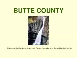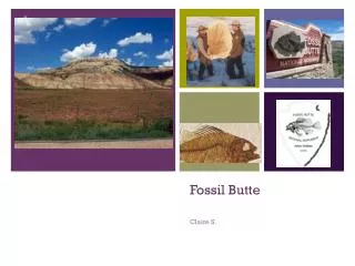
Fossil Butte
Fossil Butte. Claire S. Map it out!. Map of tectonic plates – Fossil Butte National Monument, U. S. A . . Fossil Butte Park Map. Fossil Butte. The foundation of this park….

Fossil Butte
E N D
Presentation Transcript
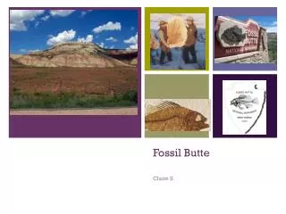
Fossil Butte Claire S.
Map it out! Map of tectonic plates – Fossil Butte National Monument, U. S. A. Fossil Butte Park Map Fossil Butte
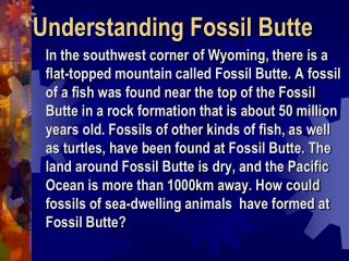
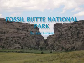
The foundation of this park… On October 23, 1972, Fossil Butte National Park was declared a park to try to preserve it’s almost completely unharmed fossils. This park was, and continues to this day, to be the best paleontological record of tertiary aquatic life in the past in the USA. These fossils are from the Green River lake beds, located in Colorado & Wyoming. Fish found in Fossil Butte:
The park was formed…( geological perspective) The park could have been formed by two convergent plates smashing together, and one going upwards, creating a mountain, which is exactly what the park is, a big mountain with fossils compacted into the inside. This park could also have been formed by two tectonic plates smashing into each other, making both ends go upwards, forcing the fossils on the bottom of both to go up to the center of the mountain. Convergent boundary Tectonic plates making a mountain
Rocks Rock! The rocks in Fossil Butte are sedimentary, and you can tell by looking at the picture of the monument on the title screen because if you were to look closely, you could see different layers of rock, and two examples of the rock that you might find here are shale and gypsum. Fossil Butte Picture Shale Gypsum
Now, Let’s look at the rocks… Separately!!!!!!!!!!!!!!!!!!!!!!!!!!!!!!!!
Shale Since shale only forms in low lying areas, I think that when Fossil Butte was in the middle of Fossil Lake, the shale was formed by some clay pressing into the ground, and hardening. Also, I think the reason there are so many fossils is that some animals and other biological life got trapped in the making of the shale. Another thing I think is that when the shale formed, it stayed at the bottom of the lake, due to it’s weight in the water. One more thing is that some of the shale went into the mountain, making some of the fossils go inside, because of very strong currents in the water.
Gypsum Since gypsum forms from solutions, I think some of the chemicals like sulfur from the land formation mixed with the water, and created a solution. Then, while the chemicals that made the solution, some chemicals like calcium came in and mixed, creating a solution. Then, when the lake dried out, the solutions hardened, creating the gypsum.
Whoa, Check it out! Some landforms in this park include the Green Lake Formation and the Wasatch Formation. The Green Lake Formation was created by fossils in the shale already there, and fish dying out because of the drainage of the lake. The colorful Wasatch Formation was made by sediments depositing into layers that would press down on each other. This formation also has fragments of teeth and bones of past animals who wad lived there over 50 million years ago.
Changing… Changing... The current changes in the park are that it is eroding, so it is getting smaller, kind of like the Application Mountains. As weathering and erosion work together to break down the monument, it continues to get smaller. But since it is so big, it will take hundreds of years to finally get rid of it is my guess.
Beep! Boop! Beep! Some of the technology used to maintain the park is computers, for one example, because they can track how many fossils have come out of the monument, and what the fossil might be. Also, radars are useful because they can see what is underground, and can help paleontologists determine how many fossils might be in one area, and how many should be taken out.
Bibliography • Google Images • Yahoo! Answers • http://www.nps.gov/fobu/naturescience/naturalfeaturesandecosystems.htm • Google
Thanks For Watching! Thanks For Watching! Hope You Learned A Lot!!!!!!!!!!!!!!!!!!!!!!!!!!!