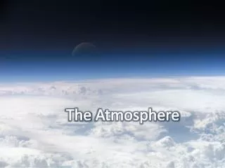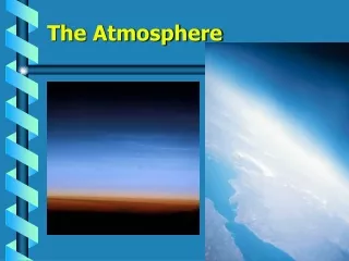
Atmospheric Monitoring Techniques and Network Optimization for Climate Research
160 likes | 247 Vues
Learn about advanced techniques like Radiosoundings, Lidars, Radars, and more to monitor the atmosphere for climate research. Explore strategies for optimizing monitoring networks and enhancing data collection. Collaboration with EUCOS and adapting systems for reliability.

Atmospheric Monitoring Techniques and Network Optimization for Climate Research
E N D
Presentation Transcript
PS3BSounding the atmosphere Ulrich Corsmeier (KIT, Germany) Olivier Bock (IGN, France) Evelyne Richard (CNRS, France)
Our guidelines • Define TTO1 “Sounding the atmosphere” • A) RS • B) Balloons • C) Wind profilers • D) GPS + AERONET • E) Lidars (Backscattering + Raman) + MW radiometers • F) Radars • G) Microphysics + Aerosols • H) Lightening • Contribute to the definition of TTO3 “ Surface fluxes over land” • Contribute to the definition of TTO5 “Surface fluxes over the sea”
a) Radiosoundings • Provide an exhaustive list of RS (location, frequency, reliability) • Identify the gaps, optimize the network • Provide maps with minimum and optimum network • Distinguish the needs between LOP/EOP/SOP • Investigate a potential support from EUCOS • Adapt the AMMA system to monitor the input to the GTS • Investigate solutions for storing High Res RS • Potential leaders:
Radiosonde networkCourtesy O. Bock (IGN, France) & V. Ducrocq (Météo-France) • Compute atmos. moisture convergence • ~ 300 km sep. btw. sites • ~ 4 times daily • coupled with GPS (RS bias correction)
b) Balloons (SOP) • Define a precise strategy for the different types of balloons (PBL ballons, aeroclippers, driftsondes) • Select launching sites and frequencies according to prototype numerical studies • Develop strong connection with T-NAWDEX for the driftsondes • Potential leaders:
c) Wind profilers (UHF/VHF/ Wind lidar)(LOP/EOP) • Provide an exhaustive list of available instruments • Propose optimal location for each movable profiler • Work on the real time transmission issues • Investigate the potential of WP network for 3D wind retrieval • Investigate the potential of new techniques (e.g. water vapor) • Include Wind lidars • Potential leaders:
d) GPS (LOP/EOP/SOP) • Provide an exhaustive map of the permanent stations • Pursue the effort to collect North African data and to integrate them into the existing networks (EUREF, EGVAP) • Propose a list of additional stations for SOPs (supersites and/or local network suited for tomographic analyses) • Investigate the potential of shipborne stations • Include AERONET photometer network (TCWV data) • Potential leaders: O. Bock + X
e) Lidars (SOP/EOP/LOP) Backscattering (aerosols) + Raman (T, q) • Provide an exhaustive list of the available instruments (parameters, altitude range, performances) • Provide a list of collocated instruments • Optimize the network with the few transportable instruments • Include MW radiometers & ceilometers • Potential leaders: G. Liberti + X
e) Lidars 11 WV lidars 3 movable Roma / Potenza Hohenheim Optimal location for SOPs?
f) Radars (SOP/EOP/LOP) • Provide an exhaustive list of the available instruments • Provide a map with minimum/optimum radar coverage • Provide a list of the mobile radars and propose their geographical distribution w/r sites and/or supersites • Motivate the involvement of some major facilities (e.g POLDIRAD, S-POL, DOW SOP)) • Potential leaders: O. Bousquet + X (Spain) + Y (Italy)
g) Microphysics • Provide an exhaustive list of the available instruments • Disdrometers • Aircraft instrumentation • Radar retrieval products • Video-sondes • …. • Include aerosols • Ground measurements • CCN chambers • Potential leaders:
h) Lightening (LOP/EOP/SOP) • Coordinate the two proposals • Provide list of SOP specific deployments + costs • Potential leaders: E. Defer, K. Lagouvardos, S. Coquillat
Proposal N°3: Lightning, obs/modelingby E.Defer (LERMA, France) & coll. ATDnet (UK) Météorage (M-Fr) Linet (Germany) Coupled approach: obs/models Properties of storms, microphysics… Hymex ops Incl. PROFEO (ONERA)