Download
1 / 8
80 likes | 374 Vues
Landsat Data Continuity Mission (LDCM) USGS Project Status Report. January 8, 2008 Mike Headley USGS LDCM Project Manager headley@usgs.gov 605-594-2644. Topics. Ground system development status Ground System Requirements Review (GSRR) results USGS acquisition strategy status

E N D
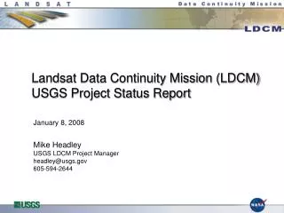
Landsat Data Continuity Mission (LDCM) USGS Project Status Report January 8, 2008Mike HeadleyUSGS LDCM Project Managerheadley@usgs.gov605-594-2644
Topics • Ground system development status • Ground System Requirements Review (GSRR) results • USGS acquisition strategy status • International Cooperator participation in LDCM
Ground System Development Status • Held the Ground System Requirements Review (GSRR) on Sept 26-27 • First major, independent review for the LDCM Ground System • Reviewed Segment level operations concepts and requirements • Described approach and schedule for managing, implementing, and testing the LDCM Ground System to reach operations readiness • Received only 17 Requests For Action (RFAs) – i.e. “action items” • Currently developing the ops concepts and requirements for each ground system element & holding element SRRs through March 2008 • Preliminary design work for some elements has already commenced • Ground System Preliminary Design Review targeted for Sept 2008
GSRR RFAs of Interest • Planned data distribution volume may be too low at 1250 scenes/day • Resolution: Update our sizing analysis to show that 1250 scenes/day with a 10X expandability requirement is sufficient • L0R should be added as a standard data product • Resolution: Developed an estimate and proposed addition of a requirement to distribute 100 L0R scenes per day as a second “standard” product • Reprocessing requirements need examination • Resolution: Adopted an “on-demand” processing approach that limits required reprocessing • Sizing of the online disk cache of L1T data needs better definition • Resolution: Defined data cache sizing as a configurable design choice along with implementing an “on-demand” processing approach • On-line data access performance requirements need refining • Resolution: Establish element level requirements to document expected performance of online data access and download mechanisms
USGS LDCM Procurement Status • Ground antenna / network services procurements planned for mid 2008 • Flight Ops Team (FOT) procurement RFP release planned for Q1 2008 with a contract award in Q3 2008 • MOC Facility (at EROS): Facilities modifications planned in 2008/9 • Remainder of ground system being procured through separate contracts in late 2007 / early 2008 • Landsat Data Continuity Contract (LDCC) • EROS Technical Support Services Contract (TSSC)
International Cooperator Interest in LDCM • USGS provided ICs a questionnaire soliciting interest in LDCM • Several ICs responded • Argentina, Australia, Brazil, Canada, China, ESA, Germany (DLR) Japan (HIT - Hiroshima Institute of Tech.), Japan – RESTEC, South Africa, Thailand • All expressed interest in continuing as ICs into the LDCM era • All prefer to receive LDCM data via a direct downlink • Some expressed interest in also receiving L1T data via the internet • Many ICs desire having control over the processing “recipe” • Good support for thermal imaging expressed • Questions asked about IC role in LDCM scene collection priorities
USGS LDCM Project Organization USGS HQ LRS Program Bruce Quirk / Ray Byrnes LDCM Project Manager Mike Headley Development Manager Tom Hays Landsat Science Team Manager Dr. Tom Loveland NASA LDCM Project Mgr Bill Ochs Project Scientist - John Dwyer Principal Scientist - Dave Meyer* Cal/Val Lead - Ron Morfitt* TSSC Manager - Doug Jaton* Chief Engineer Tom Kalvelage Technical Resource Manager Dave Hair TSSC Chief Engr - Jim Nelson* Financial Analyst - Kim Allington Admin Assistant - Christine Madigan CM - Ron Stumpf* CPIC / Risk Lead - Gregg Johnson* GS Integration Lead Doug Daniels** Int’l Ground Station Network Manager Steve Labahn GS Support Lead - Kari Wulf* Scheduler – Jay Ugolfsky* Data Processing and Archive Segment Manager Karen Zanter Flight Operations Segment Manager Steven Walters Integration and Test Systems Engineer To Be Hired Flight Systems Manager Ron Smilek FOT Lead - TBD*** USGS SE - To Be Hired DPAS Lead - Dave Willard* DPAS SE - Dan Akkerman* I&T Lead - John Olson* USGS SE - To Be Hired FOS Lead - Dave Willard* FOS SE - Jason Williams* Contactor Key * EROS TSSC (SAIC) ** The Aerospace Corp *** Flight Ops Team (TBD)