00:00

Understanding Digital Elevation Models in GIS and Remote Sensing

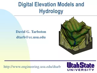
Digital Elevation Models (DEMs) play a crucial role in analyzing topography for various applications in GIS and Remote Sensing. They can be derived from different sources such as point elevation data, contour lines, remotely sensed data, etc. DEMs help in determining terrain characteristics, slope, aspect, watersheds, and drainage networks. Various techniques like LiDAR, photogrammetry, and InSAR are used to generate DEMs which can be further used for hazard analysis and other spatial studies.

plensa
Télécharger la présentation

Understanding Digital Elevation Models in GIS and Remote Sensing

An Image/Link below is provided (as is) to download presentation Download Policy: Content on the Website is provided to you AS IS for your information and personal use and may not be sold / licensed / shared on other websites without getting consent from its author. Content is provided to you AS IS for your information and personal use only. Download presentation by click this link. While downloading, if for some reason you are not able to download a presentation, the publisher may have deleted the file from their server. During download, if you can't get a presentation, the file might be deleted by the publisher.

E N D

Presentation Transcript


More Related