Download
1 / 1
10 likes | 161 Vues
Christopher Lynnes, Richard Strub , Thomas Hearty, Bruce Vollmer Goddard Earth Sciences Data and Information Sciences Center Robert Wolfe, Suraiya Ahmad, Neal Most MODIS Adaptive Processing System Peter Fox, Stephan Zednik , Tetherless World Constellation, RPI

E N D
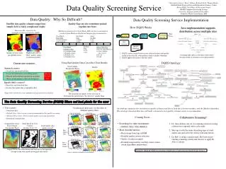
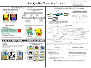
Christopher Lynnes, Richard Strub, Thomas Hearty, Bruce Vollmer Goddard Earth Sciences Data and Information Sciences Center Robert Wolfe, Suraiya Ahmad, Neal Most MODIS Adaptive Processing System Peter Fox, Stephan Zednik, Tetherless World Constellation, RPI Edward Olsen, Jet Propulsion Laboratory Objective: Provide a quaiity screening service Status: DQSS is available forAIRS Level 2 data at GES DISCMODIS Level 2 Water Vapor at MODAPS The Data Quality Screening Service (DQSS) filters out bad pixelsfor the user • Level 1 and2 satellite data productstypically keep all retrieved values. • Quality Control “flags” are often available for these data • Describe instrument performance and calibration • Reflect observing conditions (e.g., cloud fraction) • Are based on algorithm “happiness” • Statistically, the better the quality flag, the less likely it contains systematic biases. Ocean Land Original Data Array: Total Column Precipitable H2O Mask Based on User Criteria (Quality level < 2) Good quality data pixels retained AIRS Level 2 Quality Contol Selection Interface in GES DISC’s Mirador search tool Percent of Biased Data in MODIS Aerosols Over Land Increases as Confidence Flag Decreases Output file has the same format and structure as the input file (except for the extra mask and original data fields) DQSS Ontology Deployment: Distributed architecture supports DQSS at a diverse set of data providers *Compliant data are within + 0.05 + 0.2τAeronet Statistics derived from Hyer, E., J. Reid, and J. Zhang, 2010, An over-land aerosol optical depth data set for data assimilation by filtering, correction, and aggregation of MODIS Collection 5 optical depth retrievals, Atmos. Meas. Tech. Discuss., 3, 4091–4167. GES DISC Operational Environment MODIS Operational Environment MODAPS Post-Processing Selection Interface Use of Java also helps portability...* Goal: Help users apply proper screening to data using quality flags • (a) Quality Control flags can be complicated to handle 0 Coming Soon (Nov-Dec 2011)... Two Different AIRS Quality Schemes MODIS Quality Bitfieldsin Cloud_Mask_SDS Easy: Quality level for total precipitable water Not So Easy: Highest pressure of “Best” quality values in moisture profiles Cloud Mask Status Flag 0=Undetermined1=Determined • Microwave Limb Sounder (relatively easy) • MODIS Level 2 Aerosols (not easy) • Software Release? (Need a requestor) 0 Cloud Mask Cloudiness Flag 0=Confident cloudy 1=Probably cloudy 2=Probably clear 3=Confident clear 1 *...but not nearly as much as we expected Down the Road 2 Sustainment: Ontology-driven software reduces the cost of adding datasets to DQSS Day/Night Flag 0=Night1=Day 3 • OPeNDAP access to DQSS via the OPeNDAP Gateway • Allows OPeNDAP to access REST services on back-end • Ozone Monitoring Instrument (account for row anomalies)? • Link Quality Control ontology with other ontologies? • Quality Assessment Ontology? • Data and Services Ontology (deep description of data fields)? • Collaborative Screening (Dr. Alice shares screening criteria with Dr. Bob) 4 Sunglint Flag 0=Yes1=No An ontology organizes the variations in quality schemes and drives both the selection interface and the Masker algorithm. 5 Snow/Ice Flag 0=Yes1=No deep description of data fields and variables Hurricane Ike, viewed by the Atmospheric Infrared Sounder (AIRS) 6 QualityLevel is the simplest of quality schemes Surface Type Flag 0=Ocean, deep lake/river 1=Coast, shallow lake or river 2=Desert 3=Land 7 • (b) Interpretations and recommendationsvary across and within instruments QualityView ties ScreeningAssertions together MODIS Aerosols Confidence Flags Acknowledgments AIRS Quality Levels Ocean Land Patrick West of RPI; Karen Horrocks, Cid Praderas, Ivan Tcherednitchenko, Greg Ederer, Gang Ye, Ali Rezaiyan-Nojani of MODAPS Use these flags to have 2/3 of values within expected error bounds 0 Best Data Assimilation Good Climatic Studies Do Not Use 3 Very Good 2 Good 1 Marginal 0 Bad 3 Very Good 2 Good 1 Marginal 0 Bad Funded by NASA ACCESS (Accelerating Collaborative Connections for Earth System Science) Ocean Land ±0.03 ± 0.10 t ±0.05 ± 0.15 t