Navigating MAP-21
Navigating MAP-21 . Walter Brooks Executive Director Regional Planning Commission November 2, 2012. Moving Ahead for Progress in the 21 st . Century Act Map-21. (October 1, 2012 thru December 31, 2014). U.S. DOT Priorities . PERFORMANCE MANAGEMENT APPROACH

Navigating MAP-21
E N D
Presentation Transcript
Navigating MAP-21 Walter Brooks Executive Director Regional Planning Commission November 2, 2012
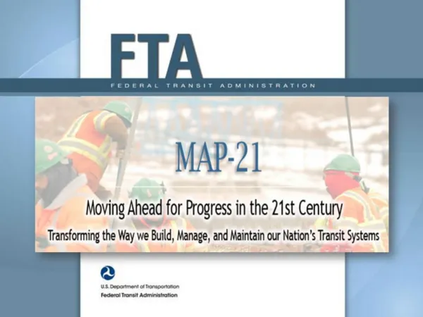
Moving Ahead for Progressin the 21st. Century ActMap-21 • (October 1, 2012 thru December 31, 2014)
U.S. DOT Priorities • PERFORMANCE MANAGEMENT APPROACH • Identifies National Goals (23 USC 150 (b)) • Safety • Infrastructure Conditions • Congestion Reduction • System Reliability • Freight Movement and Economic Vitality • Environmental Sustainability • Reduced Project Delivery Delays
Metropolitan Transportation Planning Metropolitan Transportation Plan (MTP) ((23 U.S.C. 134(i)(2)(A)(i)) • “Shall include identification of transportation facilities (including major roadways, transit, multimodal and intermodal facilities, nonmotorized transportation facilities, and intermodal connectors) that should function as an integrated metropolitan transportation system, giving emphasis to those facilities that serve important national and regional transportation functions.”
MAP-21 • Performance – Based Federal Program • Emphasis on Multimodal Investments (Retain “Flexing” Provision) • Corridor Planning with Environmental Linkages
Roles & Responsibilities • US DOT Establishes Performance Standards and Measures (13 hwy. and 2 transit areas) • State DOT’s and MPO’s set Measurable Targets for each Performance Measure • Conduct Sound Multimodal Planning Process • Develop Plans and Programs and Select Projects to Demonstrate Target Acheivement • US DOT to Track State and MPO Progress in Achieving Performance Targets (7/6/17)
RPC as the Metropolitan Planning Organization Long Range Transportation Plan (MTP) Short Range Transportation Pan (TIP)
Average Annual Investments • 1999 – Current $239M/year • 2040 Plan • System Preservation 42% • Safety & Operations 27% • Bike/Ped 10% • New Capacity 21% • Transit • Discretionary $ Competitive Pot • New Starts 50% Local Share • Operating Cost TMAs 100% Local • Small Urbans 50/50% • Inter-City Rail FRA (not FTA) Transportation Investments
Transportation Investments – FY-10 Total Investments $203M - 87 Projects
RPC Transportation Policy Committee How We Make Decisions RPC Staff • Advisory Councils • Complete Streets Advisory Council • Transit Advisory Council • Freight Advisory Council • Regional Livability Advisory Council • Technical Advisory Committee • Parish & Planning Directors • Parish Department of Public Works • Parish & City Chief Administrative Officers • Local Transit Operators • Louisiana DOTD • New Orleans Public Belt Railroad • Port of New Orleans • LA Motor Transport Association • Louisiana Airport Authority • National Safety Council • Greater New Orleans Expressway Commission • Crescent City Connection Commission • U.S. Housing and Urban Development (HUD) • Federal Highway Administration (FHWA) • Federal Transit Administration (FTA) RPC Staff The General Public
RPC’s Pedestrian and Bicycle Program Has Trained 250+Engineers and Planners 40+ Police in 8 Jurisdictions
RPC’s Pedestrian and Bicycle Program Effectiveness Bicycle fatalities are27% Pedestrian fatalities 15%
The Magazine Street Example Making Livable Communities Happen
Harrison Avenue Harrison Avenue
Harrison Ave – Land Use and Transportation Success • Road overlay & ADA access improvements through Submerged Roads Program • String of commercial enterprises reopened, led by banks and followed by restaurants including Reginelli's, Lakeview Deli, the Steak Knife, Lakeview Harbor and Mondo (Susan Spicer)
Fat City: Strategic Plan Vision • Enhancement of existing development patterns • Vibrant, mixed-use neighborhood with a stable residential base • Pedestrian-oriented core centered on 18th Street • Compatible transitions between the mixed-use core, residential areas, and heavier commercial areas at the periphery
Pedestrian Core at 18th St. Walkable mixed-use 18th Street as ‘Main Street’ of Fat City Upper floor: mix of office, lodging, and residences Street level: restaurants, specialty retail, and entertainment uses 65’ height max
French Quarter Streets Project • Under construction • Overlay 8 streets • Installation of ADA compliant ramps • Sidewalk replacement-in-kind where needed • Improved signage and striping for pedestrians and bicyclists • Construction cost: $13.5M • Work complete before Super Bowl
Ada Access Improvements • 5000+ ADA ramps installed through Submerged Roads • New Orleans CBD improvements on high volume ped/transit routes • Jefferson Parish ADA Transition Plan to identify barriers to accessibility and create a schedule for making improvements
Bike and pedestrian • Awarded Bronze Level Bicycle Friendly Community by League of American Bicyclists • Lane striping coordinated with Bike Master Plan • Bike-on-bus Coordination • Complete Streets policy • Training Workshops
Magnolia Bridge • 150+ yrs old & pedestrian only • Address civil & structural needs in addition to architectural rehabilitation • Aligns with CNO priorities of public safety, sustainable communities, and promoting family recreation areas • $1.1M cost
West End Master Plan • RPC initiated a market analysis and feasibility study based on community vision • Army Corps of Engineers announced its intentions to locate a permanent pump station in the West End vicinity • 1st Public Meeting held Jan 2012, 2nd Public Meeting held July
Thank you Walter R. Brooks, Executive Director Regional Planning Commission November 2, 2012