The HPC Surface Desk
The HPC Surface Desk. M. Sean Ryan NOAA/NCEP/Hydrometeorological Prediction Center. HPC Surface Desk Responsibilities. Products 3 hourly North American Surface Analyses Storm Summaries Tropical Advisories National Forecast Chart Users WFOs Media Aviation Government Officials Public.
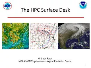

The HPC Surface Desk
E N D
Presentation Transcript
The HPC Surface Desk M. Sean Ryan NOAA/NCEP/Hydrometeorological Prediction Center
HPC Surface Desk Responsibilities • Products • 3 hourly North American Surface Analyses • Storm Summaries • Tropical Advisories • National Forecast Chart • Users • WFOs • Media • Aviation • Government Officials • Public
Unified Surface Analysis • The Hydrometeorological Prediction Center (HPC) Surface Desk creates the North American Surface Analysis product every 3 hours. (00Z, 03Z, 06Z…..) • Unified surface analysis created every 6 hours (00Z, 06Z…) • HPC analysis deadline is +1:30 NHC
HPC Surface Analysis Process • Surface analysis is a combination of science and art • Time constraints: ~60 minutes to complete North American analysis • Different analysts have different backgrounds/experience From Uccellini et al. (1992)
HPC Surface Analysis Process • NCEP criteria for a front: Minimum of 10 deg F over 300 nm (smaller gradients needed over oceans) • 6 deg C / 500 km • Cold front leading edge of density discontinuity • Warm front equatorward edge of density discontinuity • Trough positioned along zone of convergence • Lake breeze/baroclinic zones often meet this criterion, but on such a small scale they do not get analyzed as fronts, but rather, as surface troughs, similar to an outflow boundary • Dry lines look for 20 degree dew point gradient, with minimum 55 degree F dew point in moist air • Squall lines, outflow boundaries, coastal fronts
HPC Surface Analysis Process • Fronts are drawn manually, isobars are partially automated (first guess provided by GFS) • Manual edits based on surface observations and model (GFS/RUC/RAP) frontogenesis, theta, thickness fields, satellite/radar • Previous analysis overlaid to maintain continuity
Fronts in the Great Lakes Region From Payer et al. (2011), the number and type of fronts analyzed by HPC across the Great Lakes region from January 2000 to December 2005.
Fronts in the Great Lakes Region From Payer et al. (2011), the frequency of fronts and type by lake, normalized by lake area, from January 2000 to December 2005.
The Challenges of Surface Analysis in the Great Lakes • Distinguish lake-induced baroclinic zones from fronts • Lake-induced deepening of surface lows • “Hurricane Huron” , September 11-15, 1996 From Miner et al. (2000)
The Challenges of Surface Analysis in the Great Lakes MSLP and surface frontogenesis from the RAP32
Storm Summaries • Issued for major winter weather events and heavy rainfall/flash flooding events affecting multiple WFO county warning areas, commerce and transportation, and are likely to attract media attention. • Issuance times: 03Z, 09Z, 15Z, 21Z • Sections include • Description of what is happening now (position of the low, precipitation, wind) • Rain/Snow/Wind Reports • Forecast • Precipitation Data Sources: METAR 6-hourly precipitation (compiled by running a script), CoCoRaHS, CO-OP, PNS, LSR • Also include high wind reports (>50 mph) within the past 6 hours
Tropical Advisories • Issued after NHC discontinues advisories on subtropical or tropical cyclones that move inland in the continental United States or Mexico, which still pose a threat of flash flooding. • Advisories end when threat of flash flooding has ended • Format the same as NHC advisories, with the addition of rainfall totals • Summary • Watches/Warnings • Discussion and 48-Hour Outlook • Hazards • Rainfall Totals • Next Advisory • Forecast Positions
National Forecast Chart • Highlights areas of hazardous weather potential • Composite product of: • HPC Short Range Instantaneous Precipitation Forecasts • Short Range Front Forecast • Excessive Rainfall Outlook (HPC) • Heavy Snow/Freezing Rain Outlooks (HPC) • Convective Outlook (SPC) • Tropical Cyclone Forecast Position (NHC) • Day 1 (issued 5 AM/PM) • Day 2/3 (issued 5 AM)
Summary • The HPC Surface Desk duties include: • 3-hourly surface analyses • Storm summaries/tropical advisories • National Forecast Chart • Troughs are the feature most often analyzed across the Great Lakes region. • Lake Ontario has the most fronts analyzed per unit area, with cold fronts the most common. • Thermodynamics associated with the lakes create challenges for surface analysis • Lake-induced baroclinic zones/lake breezes • Diabatic heat transfer augments low development