Chapter 9 Weather Patterns
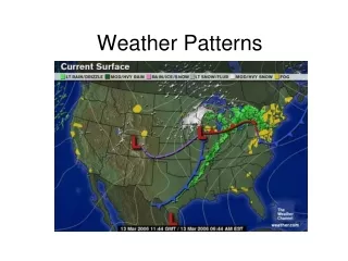
Chapter 9 Weather Patterns. Tuscon, AZ. New York Feb 2003. Weather Patterns. The primary weather producer at mid-latitudes (e.g., North America) is the mid-latitude cyclone. Weather is interpreted in terms of the polar front or Norwegian Cyclone Model. Weather Patterns - 2.


Chapter 9 Weather Patterns
E N D
Presentation Transcript
Weather Patterns The primary weather producer at mid-latitudes (e.g., North America) is the mid-latitude cyclone. Weather is interpreted in terms of the polar front or Norwegian Cyclone Model.
Weather Patterns - 2 In general, Fronts are boundary surfaces that separate air masses of different densities. A polar front separates cold Arctic air from warm subtropical air. Fronts are normally between 15 and 200 km wide - where the two air masses fight each other.
Weather Patterns - 3 It is always the warmer, less dense air that is forced aloft. Cool air acts as a wedge on which lifting takes place. Called overrunning. Types of front are: warm, cold, stationary, occluded & drylines.
Warm Fronts The ground position of the warm air occupies territory previously held by the cold air. On weather maps - red line with red semicircles pushing into the colder air. As the colder air retreats, friction with the surface gradually slows down the surface position of the front compared to its position aloft - less dense warm air has difficulty in replacing more dense cold air.
Warm Fronts - 2 The front therefore attains a slope, with a wedge of warm air lying over a wedge of cold air. Slopes are 1:200 on average. As the warm air rises over the cold air, it expands & cools adiabatically, causing condensation and precipitation First sign of an approaching front is cirrus clouds, which form where the overrunning warm air has ascended high up the wedge of cold air. Surface front could be 1000 km behind.
Warm Fronts - 3 Approaching fronts can also be recognized from aircraft contrails that last hours (need moist air). Warm fronts normally produce light to moderate precipitation over a large area for an extended period. As the front approaches a given point, the cirrus clouds grade into cirrostratus, then thicker stratus and nimbostratus clouds, which bring the rain. Precipitation occurs well ahead of the surface location of the front.
Warm Fronts - 4 As the rain falls through the cold air in the lower wedge, some evaporates, saturating the cloud base. Then get a stratus cloud deck. These clouds can move rapidly downwards, giving frontal fogs. If the cold air is below freezing, rain drops become supercooled as they fall. When they hit the Earth, they flash-freeze to form glaze. When the warm front passes, the temperatures rise, and the winds shift from the east to the southeast. (more later).
Cold Fronts When cold continental polar air advances into a region occupied by warm air, the zone of discontinuity is called a Cold Front. Friction with the ground slows the advance of the surface position of the front relative to its position aloft. Cold fronts normally move in from the north or northwest (blame Canada).
Cold Fronts - 2 The cold air forces the warm air to rise. If this rise is rapid, the moisture in the warm air freezes, releasing latent heat (of fusion). So the air gets warmer, and rises even faster. The arrival of a cold front is often preceded by altocumulus clouds, followed by cumulonimbus clouds and rain. Cold air behind the front is usually subsiding, so the weather is clear (and cold).
Cold Fronts - 3 Cold fronts are about twice as steep as warm fronts, and move about 50% faster. Consequently cold-front weather is more violent than warm-front weather. Intensity of precipitation is greater than for a warm front, and has a shorter duration. Represented on weather maps by blue line + blue triangular symbols that point into the retreating warm air.
Figure 9-7 Cold Front Thunderstorm Development over Great Plains
Stationary Fronts Sometimes neither the warm air or cold air wins the battle, and we get a stationary front (stalemate). Air flow is parallel to the line of the front. Represented on weather maps by blue triangular symbols on one side of the line (cold), and red semicircles on the other. Gentle to moderate precipitation, but possible floods if the front remains in the one place for too long.
Occluded Fronts One front overtakes another. Cold-type occluded front - cold front overtakes warm front. e.g. East of Rockies. Expect heavy rain - warm air is forced aloft. Warm-type occluded front - warm front overtakes cold front. e.g. Along the Pacific coast. Mild maritime polar air invades frigid continental polar air. Represented on weather maps by a purple line with alternating purple triangles & semicircles pointing in the direction of the movement.
Drylines Drylines arise when dry air overtakes and lifts not so dry air. Generate a band of severe thunderstorms. Weather maps show that dewpoints are much lower behind a dryline. (The air is drier.) See also Chapter 10. E.g. southern Great Plains. Dry continental tropical air from SW US meets moist maritime air from the Gulf of Mexico.
Mid-Latitude Cyclone Development & intensification of a midlatitude cyclone is explained in terms of the "polar-front" theory . Cyclones form along fronts. Life cycle last about 3 to 7 days.
Mid-Latitude Cyclone - 2 Six stages:1. Formation (cyclogenesis)2. Development of wave in the front3. Cyclonic circulation established4. Occlusion begins5. Occluded front develops6. Cyclone dissipates
Mid-Latitude Cyclone - 3 Stage 1. Two air masses of different densities & temperatures are moving parallel to the front, and in opposite directions. Typically - cP associated with polar easterlies on the north of the front, mT driven by westerlies on the south. (This causes counterclockwise rotation of the air mass.) Stage 2. Under suitable conditions, the front takes on a wave shape that is usually several hundred km long.
Mid-Latitude Cyclone – 4 Stage 3. For a cyclone to develop, the wave must steepen and "break" (just like surfing beaches). The warm moves pole-wards into the cold air, establishing a warm front, while cold air moves equator-wards, establishing a cold front. This sets up a circular flow pattern in a counterclockwise direction - the cyclone. Stage 4. Cold front normally travels about 50% faster then the warm front, and overtakes it, causing occlusion. Ends of the fronts in center of cyclone occluded first.
Mid-Latitude Cyclone - 5 Stage 5. The size of the occluded front grows in length, displacing the warm front aloft. The storm usually intensifies, the central pressure falls, and wind speeds increase. During Winter, can get heavy snowfalls and blizzard-like conditions (because of the high winds). Stage 6. Once all the warm air has been displaced, we have just the cold air and no temperature gradient. There is thus no energy left to drive the cyclone, which therefore dissipates.
Cyclogenesis / Formation Polar-front model shows that cyclone formation occurs where a frontal surface is distorted into a wave-like discontinuity. Wave is caused by surface factors, such as topographic irregularities, temperature contrasts, ocean currents. The flow aloft is usually intensified before the formation of a surface cyclone, so the flow aloft is a very important contributor to cyclone formation.
Cyclogenesis - 2 When the flow aloft is generally zonal (east to west), little cyclonic activity occurs at the surface. When the upper air forms waves, these waves drive the air north and south as well as east-west and set up alternating troughs and ridges. Surface cyclones tend to form below such regions. When surface cyclones form, they are usually centered below the jet stream, and downwind from an upper level trough.
Cyclogenesis - 3 Cyclonic & Anticyclonic Circulation - cyclones & anticyclones generally appears in pairs, below the jet stream . The surface air that flows into the low pressure center of a cyclone is forced aloft where it diverges. On the other hand, the air above an anticyclone converges, sinks to the surface, and becomes the outflow from the anticyclone.
Cyclogenesis – 4 It is quite common for diverging air above a cyclone to become the converging air above an anticyclone, with the reverse situation on the ground. Divergence & Convergence Aloft - divergence aloft tends to flow generally west to east along sweeping curves. (At the surface, divergence is in all directions over the surface.)
Cyclogenesis - 5 This flow is controlled by the jet stream. On entering the zone of high wind speed around the jetstream, air accelerates and stretches out (divergence). On entering a zone of low wind speed, air slows down and piles up (convergence)
Cyclogenesis - 6 Upper level divergence and surface cyclonic flow around a Low generally develop downstream (to the east) from an upper level trough. Upper level convergence and surface anticyclonic flow around a High generally develop downstream (to the east) from an upper level ridge.
Travelling Cyclones Cyclones generally move over the surface of the Earth at about 25 to 50 kph. The path of a cyclone is controlled to a large extent by the air flow aloft (500 mb level). The upper level flow "steers" the surface cyclone. It is important to be able to predict the path of a surface cyclone. We must understand and be able to predict the wavy flow in the jetstream.
Travelling Cyclones - 2 In general, cyclones form where large temperature contrasts occur in the lower troposphere. Main sites for cyclone formation: lee side of Rockies; along Atlantic coast, east of the Appalachians; North Pacific; North Atlantic.
Patterns of Movement Cyclones that form east of the Rockies tend to migrate to the east, and then northeast. Cyclones that influence western North America originate over the Pacific, and move northeastwards towards the Gulf of Alaska, where they merge with the Aleutian low.