Chapter Six: Processes Shaping Planet Earth
Chapter Six: Processes Shaping Planet Earth. Chapter Objective, TEKS, & Essential Question. Objective: Understand how physical processes shape the physical environment of the Earth and contribute to the characteristics of landforms, climate, and ecosystems. TEKS:

Chapter Six: Processes Shaping Planet Earth
E N D
Presentation Transcript
Chapter Objective, TEKS, & Essential Question • Objective: • Understand how physical processes shape the physical environment of the Earth and contribute to the characteristics of landforms, climate, and ecosystems. • TEKS: • Geography – 3, 3 (A), 3 (B), 3 (C), 4, 4 (A), 4 (B), 4 (C) • Essential Question: • What forces have helped shape Earth’s landforms, climate, and plant life?
Chapter Vocabulary • Lithosphere • Earth’s mantle • Plate Tectonic Motion • Convection • Tsunami • Weathering • Erosion • Deposition • Water Cycle • Tides and Currents • Atmosphere • Biomes • Grasslands • Steppes • Tundra
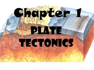
Important Ideas • Lithosphere. The lithosphere is made up of the Earth’s crust and solid upper mantle. It is broken up into tectonic plates which through their movement shape the Earth’s surface. As the plates move apart new crust is made as they collide mountains are formed. Often found along plate boundaries are volcanoes and the occurrence of Earthquakes. Weathering and erosion tear down Earth’s surface. From these particles of rock along with decayed plant and animal life the Earth’s soil is formed. • Hydrosphere. Oceans cover over 70% of our planet’s surface area. Currents, caused by winds and differences in water density, move the ocean’s waters around the planet. Water is also moved between the atmosphere, oceans, and land surfaces through the water cycle.
Important Ideas Con’t • Atmosphere. The spinning of Earth, the unequal heating of air by the sun, the evaporation of water, and the effect of various landforms on the air result in weather or differences in temperature, wind, and precipitation. Climate is an area’s average weather. Earth’s tilt as it orbits the sun causes our seasons. • Biosphere. Differences in climate give rise to biomes – geographic regions that support different kinds of life – forests, grasslands, deserts and tundra.
Lithosphere • Below the crust is the mantle, a region of hot, dense rock. About 100 km below the surface, rock is near its melting point and becomes semi-solid or plastic. Scientists are investigating how to use the Earth’s heat as a source of usable, clean, geothermal energy. • The lithosphere consists of Earth’s crust and the top section of solid mantle. This brittle uppermost shell of the Earth is broken into a number of tectonic plates.
Plate Tectonic Motion • Many scientists believe that several or even all of the present continents of the world once fit together into a single, giant continent. Scientists refer to these ideas as plate tectonic theory. Earth’s lithosphere is divided into large slabs of rock known as tectonic plates. • Scientists believe that these plates move as solid chunks floating on top of the more “plastic” part of the mantle. The plates move only a few centimeters each year. Despite such slow movement, over hundreds of millions of years these plates can move thousands of kilometers.
How Tectonic Plates Move • Scientists believe heat and gravity may be responsible for the movement of tectonic plates. • Convection is the spread of heat through the movement of a fluid substance. Inside the mantle, semi-solid rock is heated. As it is heated, it expands and becomes less dense. The lighter rock rises as gravity pulls down cooler, denser rock in its place. After the hotter rock rises, it begins to cool down. Once cooled, it sinks, creating a circular motion or current. This circular motion pushes the plates above.
How Tectonic Plates Move • Gravity also contributes to plate movement. When oceanic and land plates collide, the dense oceanic plate is pulled by gravity under the lighter land plate. At one end of the oceanic plate sinks, it pulls on the rest of the plate as well.
Effects Tectonic Movement • Mountain Building occurs when two land plates, known as continental plates, slowly push into one another, they often fold upwards, creating mountain chains. The Indian plate, for example, pushes northward against the Eurasian plate creating the Himalayan Mountains. • The Earth’s crust under the ocean’s is thinner but denser than the continental crust. When oceanic crust collides into continental crust, the oceanic curst sinks downwards and slides under the continental crust, lifting it up. This can also build mountains, like the Andes Mountains.
Seafloor Spreading & Rift Valleys • Some tectonic plates move apart. Scientists have discovered that in the middle of the Atlantic Ocean, the separation of plates is actually causing the seafloor to spread. As the plates move apart, magma rises up through the cracks in the ocean floor, creating a ridge of mountains. • The separation of tectonic plates has created rift valleys – long valleys between parallel ridges of mountains.
Earthquakes & Tsunamis • Plate movements can cause a break in Earth’s crust, known as a fault. Plate movements can also cause vibrations known as earthquakes. As plates move, they create tremendous stress at plate boundaries. Eventually, parts of rocky crust will break, creating a fault and sending vibrations known as seismic waves. Scientists measure the waves sent by an earthquake with a seismograph. When an earthquake occurs under or near the ocean, it creates immense ocean waves of destructive force known as tsunamis.
Volcanoes • In places where tectonic plates diverge or where one plate dives under another, pressure in Earth’s mantle is reduced and some of the hot, solid rock turns to liquid. • This magma may break through weaknesses in Earth’s crust. Magma, ashes and gases erupt and form a volcano. Once the magma reaches Earth’s surface, it becomes known as lava.
Ring of Fire • The “Ring of Fire” around the Pacific Ocean – a zone of volcanoes and frequent earthquakes – coincides with the boundaries of the Pacific tectonic plate. Many mountains and even islands have been formed by volcanoes. The Hawaiian islands are actually the tops of volcanoes in the Pacific Ocean.
Weathering • The wearing down of rocks at the Earth’s surface by the actions of wind, water, ice and living things is referred to as weathering. Water, for example, expands when it freezes. Water may seep into cracks or pores in rocks and expand these cracks if the temperature drops and the water freezes. Rain, running water, chemicals, and organisms will also break down rock into smaller particles.
Erosion • The processes by which rock, sand, and soil are broken down and carried away are known as erosion. By erosion, a river can cut a canyon, like Grand Canyon, through solid rock. An icy glacier can carve and wear away a region, leaving behind valleys and lakes, such as the Great Lakes.
Deposition • The same forces that erode one place can deposit particles and sediment in another, building it up. Rivers carry sediment downstream and deposit this sediment where they meet the ocean. The action of ocean waves can bring sand to a beach.
Soil: Building Processes • Weathering breaks down rocks on Earth’s surface. The material left from the rocks mixes with decaying plants and animals to make soil. Soil is therefore a mixture of several materials, including sand, clay, rocks, water, fungi, bacteria, and decayed plants and animal material.
Soil Quality • The type of soil found in an area greatly affects the types of plant life that can grow there. The sands of the Sahara or Arabian Desert, for example, will not support many forms of life. The Amazon basin of South America and the rainforests of central Africa have tropical soils with few minerals or nutrients. Rain quickly washes these nutrients and animals that are still decomposing. Soils found in grassland areas – the Great Plains, pampas, and Russian steppes – have the organic matter and are among the best soils for farming.
Earth’s Landforms • All these processes acting on Earth’s lithosphere create typical landforms. These landforms include mountains, hills, plateaus, plains, valleys, canyons, deserts, and beaches.
Mountains • Mountains, often formed by the collision of tectonic plates, can be thousands of feet high in elevation. Andes Mountains Himalayas
Plateau • A plateau is a flat highland, whose sides drop suddenly because of erosion. Edwards Plateau Colorado Plateau
Valleys • Valleys are long, low areas between ranges of mountains, hills, or uplands. They are often created by erosion, and may have a river or stream running along the bottom.
Canyons • A canyon is a deep gorge or ravine between cliffs, often carved from the landscape by a river.
The Hydrosphere • More than 70 percent of Earth’s surface is covered by water. Scientists refer to this as the hydrosphere. About 97 percent of this water is in the ocean; most of the rest of it is frozen in the polar ice caps; less than one percent is found in the atmosphere, groundwater, or in freshwater lakes and rivers.
The Water Cycle • During the water cycle, solar energy heats the surface of oceans, seas, and lakes. This causes some of the surface water to evaporate into the atmosphere. The water vapor rises until it becomes cooler. The water vapor then condenses into tiny droplets small enough to float in the atmosphere as clouds.
The Water Cycle (cont.) • When the droplets grow larger and heavier, they fall back to Earth’s surface as precipitation – rain, snow, hail. Some precipitation returns to the ocean, but some falls on land where it is absorbed by the ground or forms lakes, streams and rivers.
Ocean Currents • Ocean currents are movements of the ocean’s waters. Surface currents are mainly caused by the spinning of Earth and winds. At the equator, the spinning of Earth and winds push surface water towards the west. Water heated by the sun moves away from the equator, carrying heat energy towards the polar regions. • Below the ocean’s surface, its waters actually separate into different layers based on their density. Cold, salty water is more dense than warm, less salty water. At the poles, cold, salty water sinks. It then slowly moves towards the equator, pushing warmer water away.
Ocean Currents (cont.) • For example, the Gulf Stream carries warm water towards Great Britain, making that country warmer than it would otherwise be. This transfer of energy helps maintain a balance – carrying warm water from the tropics to colder regions, and cold water from the polar regions towards the tropics.
Tides • Each day, the surface level of the oceans rises and falls during high and low tide. Tides are caused by the gravitational pull of the moon on Earth’s ocean waters. Ocean waters directly facing the moon bulge towards the moon, creating high tide, a time when sea levels are at their highest.
Tides (cont.) • On the opposite side of Earth is another hide tide, caused by the force of Earth’s spin where the moon’s pull is weakest. • Sea levels become highest when the moon and sun are both lined up on the same side of Earth, and lowest when they are on opposite sides.
The Atmosphere &Climate • Around Earth is an envelope of gases known as the atmosphere. It consists mainly of nitrogen (78%) and oxygen (21%). The atmosphere absorbs solar radiation, moderates temperatures, and distributes water. Weather refers to conditions in the atmosphere closest to Earth, including humidity, winds, and precipitation (rain snow, or hail). Different processes in the atmosphere lead to differences in climate, the average weather conditions of a place over a long period of time.
The Geography of Weather • Weather is affected by latitude, elevation (height above sea level), wind patterns, ocean currents, and mountain barriers. For example, temperatures are generally warmer the closer an area is to the equator. Temperatures tend to decrease as you move away from the equator to higher latitudes. Temperatures are also cooler at higher elevations, such as on mountains or high plateaus. Geographers refer to different climates at different altitudes in the same area as vertical climates.
The Geography of Weather • Winds are influenced by Earth’s spin. Depending on the location of a place, winds may bring moist air and rain, such as the monsoons; or they may leave an area dry. Distance from major bodies of water also affects climate. Because air cools as it rises over a mountain barrier, the ocean side of a mountain often has heavy rainfall. The air loses moisture and is drier when it reaches the other side of the mountain.
The Geography of Weather • Tropical hurricanes occur in tropical regions in late summer and early fall when the ocean water is very warm. The warm ocean water evaporates so quickly that it creates an area of low pressure. Air around a rising air column begins to spiral at high speeds. The hot air rises until it cools and condenses – releasing energy and causing heavy rains, strong winds, and dangerous lightning strikes.
Earth’s Seasons • The Earth tilts on its axis as it revolves around the sun. Because of this tilt, the sun’s rays hit the Northern Hemisphere longer and more directly in summer than in winter. The sun appears to rise higher in the sky, temperatures are warmer, and the days are longer. • When it is summer in the Northern Hemisphere, it is winter in the Southern Hemisphere. This is because the Southern Hemisphere is tilting away from the sun and receives less direct solar rays.
Earth’s Seasons • Because seasons are caused by Earth’s tilt, seasonal differences are greatest at the poles and least at the equator. Area near the equator are always warm because they receive the sun’s direct rays. The two poles are very different. In the summer, each pole has 24 hours of sunlight, while in the winter, the sun never rises in areas around the North or South pole.
Distribution of Climate Regions • Climate zones are most affected by latitude and elevation.
Distribution of Climate Regions (cont.) • High-Latitude Climates. The North and South Poles have similar “polar climates” with very cold winter temperatures. • Mid-Latitude Climates. Places in the middle latitudes with low elevations generally have warm summers and cool winters. These are also known as “moist mid-latitude climates,” with either mild or cold winters, or as “temperate climates.” • Low-Latitude Climates. Central Africa, Central America, Northern South America, South Asia and Southeast Asia have warm and humid climates. These are sometimes called “tropical moist climates.” North Africa, the Middle East, Western Australia, and Asia have warm and dry climates. In these areas, the evaporation of water can be greater than precipitation.
The Biosphere • The biosphere refers to all life on Earth. Weather patterns and climate influence what kinds of plants and animals can successfully live in a particular geographic location. Based on the interaction of climate, landforms, bodies of water, and soils, scientists have identified several different biomes, or distinct geographic regions with their own particular types of plant and animal life.
Temperate Deciduous Forest • Temperate deciduous forests develop in mid-latitude regions where there is ample rain and moderate temperatures with cool winters. Trees change colors in fall and lose their leaves in winter. There is a wide range of plant and animal life.
Tropical Rain Forests • Tropical rainforests develop in tropical areas near the equator where there is ample rainfall and warm temperatures year-round. Large trees cover the area with their leaves, forming a canopy. Despite the rapid growth of trees, the topsoil is actually very thin. Tropical rainforests are marked by a great abundance of animal and plant life, displaying greater biological diversity than any other biome.
Grasslands, Savanna, or Steppes • Grassland areas exist where the climate is drier and there is not enough rainfall to support large amounts of trees. Instead, grasses dominate these areas with large grazing animals, like cattle, antelope or bison. Savannas are grasslands with some trees.
Deserts • Deserts are regions that receive less than 10 inches of rainfall annually. Deserts in the tropical latitudes, such as the Sahara desert, have their own special forms of plant and animal life, which have adapted to the lack of water and extremes of temperature. Cacti, for example, store water in their stems.
Tundra • Tundra is found closer to the polar regions. The soil of the tundra is so cold that trees cannot grow. Much of the ground is frozen part of the year. Tundras constitute a distinct biome, with their own plant and animal life, including grasses, small shrubs, large mammals and birds that migrate to these regions in the warmer spring and summer months.