Download
1 / 19
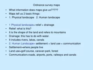
Scale (ordnance survey maps)
200 likes | 364 Vues
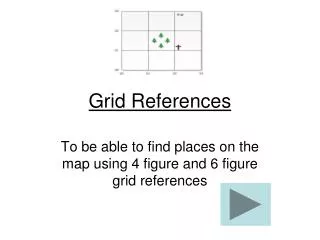
Scale (ordnance survey maps). Chapter 25. Grid References. Each map we will study will have a large letter in blue (sometimes more!). These letters show us where in Ireland the map is of. What letters above will be on maps of Wexford. . eastings. northings. O. L E N.
Télécharger la présentation 
Scale (ordnance survey maps)
An Image/Link below is provided (as is) to download presentation
Download Policy: Content on the Website is provided to you AS IS for your information and personal use and may not be sold / licensed / shared on other websites without getting consent from its author.
Content is provided to you AS IS for your information and personal use only.
Download presentation by click this link.
While downloading, if for some reason you are not able to download a presentation, the publisher may have deleted the file from their server.
During download, if you can't get a presentation, the file might be deleted by the publisher.
E N D
Presentation Transcript
Scale (ordnance survey maps) Chapter 25
Each map we will study will have a large letter in blue (sometimes more!). These letters show us where in Ireland the map is of. What letters above will be on maps of Wexford.
eastings northings
O L E N
Height of land in colour Land above 600 metres Land above 400 metres 200-400 metres Land below 200 metres High water mark Low water mark Beach / Sandy areas


More Related